Bergen, Queensland

Last updated

Map all coordinates using: OpenStreetMap
Bergen
Queensland
Bergen Djuan cemetery, 2006.jpg
Bergen Djuan cemetery, 2006
Australia Queensland location map.svg
Red pog.svg
Bergen
Coordinates 27°14′24″S151°55′15″E / 27.24°S 151.9208°E / -27.24; 151.9208 (Bergen (centre of locality))
Population68 (2016 census) [1]
 • Density3.37/km2 (8.72/sq mi)
Postcode(s) 4353
Area20.2 km2 (7.8 sq mi)
Time zone AEST (UTC+10:00)
Location
LGA(s) Toowoomba Region
State electorate(s) Condamine
Federal division(s)
Suburbs around Bergen:
Haden Djuan Upper Pinelands
Goombungee Bergen Plainby
Goombungee Douglas Plainby

Bergen is a rural locality in the Toowoomba Region, Queensland, Australia. [2] In the 2016 census, Bergen had a population of 68 people. [1]

Contents

Neuve is a neighbourhood in the south-west of the locality. [3]

Geography

Neuve is a neighbourhood ( 27°16′00″S151°53′00″E / 27.2666°S 151.8833°E / -27.2666; 151.8833 (Neuve) ) within the south-west of locality. It takes its name from a former railway station. [3] [4]

History

The Haden railway line from Kingsthorpe to Goobungee and Haden opened in 1910 with Bergen being served by a station called Bergenside ( 27°15′39″S151°53′26″E / 27.2608°S 151.8906°E / -27.2608; 151.8906 (Neuve (Bergenside) railway station (site)) ). [4]

In 1914 a cemetery was established, operated by a group of trustees. The cemetery had separate sections for a number of religious denominations (Anglican, Roman Catholic, Lutheran, Presbyterian, Methodist and Baptist) and a general section. In 1982 responsibility for the cemetery was given to the Crows Nest Shire Council, and became the responsibility of the Toowoomba Regional Council following the local government amalgamations in 2008. [5]

During World War I, due to anti-German sentiment, the Rosalie Shire Council (headquartered at Goombungee) requested that the Bergenside railway station be renamed. On 14 August 1916 the Queensland Railways Department renamed it Neuve after Neuve Chapelle in France where the Battle of Neuve Chapelle had taken place in March 1915. [3]

Bergen Provisional School opened on 3 August 1896. On 20 January 1902 it became Bergen State School. It closed on 31 December 1969. [6] It was on Gomoran Bergen Road (approx 27°15′24″S151°54′22″E / 27.2567°S 151.9062°E / -27.2567; 151.9062 (Bergen State School (site)) ). [4]

The Haden railway line closed in 1964.

In the 2016 census, Bergen had a population of 68 people. [1]

Education

There are no schools in Bergen. The nearest primary schools are Haden State School in neighbouring Haden to the north-west and Goobungee State School in neighbouring Goombungee to the south-west. For secondary education, the nearest schools are Crows Nest State School (to Year 10) in Crows Nest to the east and Highfields State College (to Year 12) in Highfields to the south. [7]

Amenities

The Bergen Djuan Cemetery is on Bergen Road (corner Menkins Road, 27°14′06″S151°55′21″E / 27.2350°S 151.9226°E / -27.2350; 151.9226 (Bergen Djuan cemetery) ). It is operated by the Toowoomba Regional Council. [5]

Related Research Articles

<span class="mw-page-title-main">Shire of Crows Nest</span> Local government area in Queensland, Australia

The Shire of Crows Nest was a local government area in the Darling Downs region of Queensland, Australia, immediately northeast of the regional city of Toowoomba. The shire, administered from the town of Crows Nest, covered an area of 1,629.9 square kilometres (629.3 sq mi), and existed as a local government entity from 1913 until 2008, when it amalgamated with several other councils in the Toowoomba area to form the Toowoomba Region. Its growth in later years has been fuelled by the expansion of Toowoomba, particularly the suburbs of Highfields and Blue Mountain Heights which, with a combined population of 7,333 in 2006, were home to over half the shire's population.

<span class="mw-page-title-main">Shire of Rosalie</span> Local government area in Queensland, Australia

The Shire of Rosalie was a local government area in the Darling Downs region of Queensland, Australia, immediately northwest of the regional city of Toowoomba. The shire, administered from the town of Goombungee, covered an area of 2,200.7 square kilometres (849.7 sq mi), and existed as a local government entity from 1879 until 2008. In 2008, it amalgamated with several other councils in the Toowoomba area to form the Toowoomba Region.

<span class="mw-page-title-main">Bell, Queensland</span> Town in Queensland, Australia

Bell is a rural town and locality in the Western Downs Region, Queensland, Australia. In the 2016 census, the locality of Bell had a population of 502 people.

<span class="mw-page-title-main">Crows Nest, Queensland</span> Town in Queensland, Australia

Crows Nest is a rural town and locality in the Toowoomba Region, Queensland, Australia. The town is located in the Darling Downs on the New England Highway, 158 kilometres (98 mi) from the state capital, Brisbane and 43 kilometres (27 mi) from the nearby city of Toowoomba. In the 2016 census, Crows Nest had a population of 2160 people.

<span class="mw-page-title-main">Kingsthorpe, Queensland</span> Town in Queensland, Australia

Kingsthorpe is a rural town and locality in the Toowoomba Region, Queensland, Australia. In the 2021 census, the locality of Kingsthorpe had a population of 2,159 people.

<span class="mw-page-title-main">Cabarlah, Queensland</span> Town in Queensland, Australia

Cabarlah is a rural town and locality in the Toowoomba Region, Queensland, Australia. In the 2016 census the locality of Cabarlah had a population of 1,075 people.

<span class="mw-page-title-main">Goombungee, Queensland</span> Town in Queensland, Australia

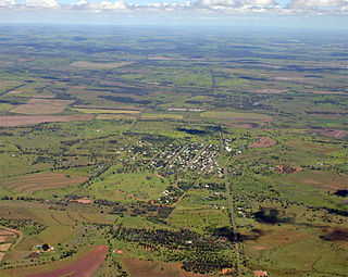
Goombungee is a rural town and locality in the Toowoomba Region, Queensland, Australia. In the 2016 census the locality of Goombungee had a population of 1,026 people.

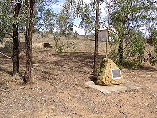
Haden Branch Railway was a branch railway line from Kingsthorpe to Goombungee and Haden in the Darling Downs, Queensland, Australia.

<span class="mw-page-title-main">Vale View, Queensland</span> Suburb of Toowoomba, Queensland, Australia

Vale View is a rural locality in the Toowoomba Region, Queensland, Australia. In the 2016 census, Vale View had a population of 472 people.

Haden is a rural town and locality in the Toowoomba Region, Queensland, Australia. In the 2016 census, the locality of Haden had a population of 195 people.

<span class="mw-page-title-main">Boodua, Queensland</span> Suburb of Toowoomba Region, Queensland, Australia

Boodua is a rural locality in the Toowoomba Region, Queensland, Australia. In the 2016 census Boodua had a population of 93 people.

<span class="mw-page-title-main">Meringandan West, Queensland</span> Suburb of Toowoomba Region, Queensland, Australia

Meringandan West is a rural locality in the Toowoomba Region, Queensland, Australia. In the 2016 census, Meringandan West had a population of 2211 people.

Bybera is a rural locality in the Goondiwindi Region, Queensland, Australia. In the 2016 census, Bybera had a population of 3 people.

<span class="mw-page-title-main">Douglas, Queensland (Toowoomba Region)</span> Suburb of Toowoomba Region, Queensland, Australia

Douglas is a rural locality in the Toowoomba Region, Queensland, Australia. In the 2016 census, Douglas had a population of 112 people.

Cutella is a rural locality in the Toowoomba Region, Queensland, Australia. In the 2021 census, Cutella had a population of 45 people.

Doctor Creek is a rural locality in the Toowoomba Region, Queensland, Australia. In the 2016 census, Doctor Creek had a population of 37 people.

Mount Darry is a rural locality in the Toowoomba Region, Queensland, Australia. In the 2016 census Mount Darry had a population of 35 people.

Glenaven is a rural locality in the Toowoomba Region, Queensland, Australia. In the 2016 census, Glenaven had a population of 79 people.

Upper Pinelands is a rural locality in the Toowoomba Region, Queensland, Australia. In the 2016 census, Upper Pinelands had a population of 33 people.

The roads that join the towns of Dalby, Toowoomba and Cooyar form a triangle that encloses some of the most fertile land on the Darling Downs in Queensland, Australia. These roads are the Warrego Highway, New England Highway and Dalby–Cooyar Road. Pechey–Maclagan Road forms a large part of a group of roads that bisect the triangle from east to west, and is also part of one of the groups of roads that bisect from south to north.

References

  1. 1 2 3 Australian Bureau of Statistics (27 June 2017). "Bergen (SSC)". 2016 Census QuickStats. Retrieved 20 October 2018. OOjs UI icon edit-ltr-progressive.svg
  2. "Bergen – locality in Toowoomba Region (entry 49255)". Queensland Place Names. Queensland Government . Retrieved 19 September 2020.
  3. 1 2 3 "Neuve – locality unbounded in Toowoomba Regional (entry 24092)". Queensland Place Names. Queensland Government . Retrieved 19 September 2020.
  4. 1 2 3 "Jondaryan" (Map). Queensland Government. 1943. Archived from the original on 27 September 2020. Retrieved 28 September 2020.
  5. 1 2 "Location, open hours and interment options for all Toowoomba Regional Council cemeteries". Toowoomba Regional Council . Archived from the original on 28 September 2020. Retrieved 28 September 2020.
  6. Queensland Family History Society (2010), Queensland schools past and present (Version 1.01 ed.), Queensland Family History Society, ISBN   978-1-921171-26-0
  7. "Queensland Globe". State of Queensland . Retrieved 27 September 2020.