
Gowrie Junction is a rural locality in the Toowoomba Region, Queensland, Australia. It is north-west of Toowoomba. In the 2016 census, Gowrie Junction had a population of 2,120 people. The town of Gowrie is in the eastern part of the locality.

Leyburn is a rural town in the Southern Downs Region and a locality split between the South Downs Region and the Toowoomba Region in Queensland, Australia. In the 2016 census, Leyburn had a population of 476 people.

Pilton is a town and a locality in the Toowoomba Region, Queensland, Australia. It is south of the city of Toowoomba. In the 2016 census, Pilton had a population of 88 people.

Vale View is a rural locality in the Toowoomba Region, Queensland, Australia. In the 2016 census, Vale View had a population of 472 people.
Hodgson Vale is a rural locality in the Toowoomba Region, Queensland, Australia. In the 2016 census, Hodgson Vale had a population of 1,379 people.

Ballandean is a small town and locality in the Granite Belt Region of the Southern Downs, Queensland, Australia. It is on the Queensland border with New South Wales. At the 2016 census the town recorded a population of 338. The town has a number of nearby vineyards which attracted tourists to the area.
Kulpi is a rural town and locality in the Toowoomba Region, Queensland, Australia. In the 2016 census, Kulpi had a population of 77 people.

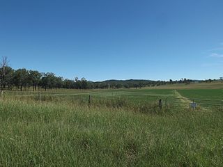
Mount Irving is a rural locality in the Toowoomba Region, Queensland, Australia. In the 2016 census, Mount Irving had a population of 15 people.

Gowrie Little Plain is a rural locality in the Toowoomba Region, Queensland, Australia. In the 2016 census, Gowrie Little Plain had a population of 65 people.
Mount Walker West is a locality split between the Scenic Rim Region and City of Ipswich local government areas of Queensland, Australia. In the 2016 census, Mount Walker West had a population of 19 people.
Captains Mountain is a locality in the Toowoomba Region, Queensland, Australia. In the 2016 census, Captains Mountain had a population of 77 people.
Ramsay is a rural locality in the Toowoomba Region, Queensland, Australia. In the 2016 census Ramsay had a population of 348 people.
North Branch is a locality in the Toowoomba Region, Queensland, Australia. In the 2016 census, North Branch had a population of 39 people.
St Ruth is a locality split between the Western Downs Region and the Toowoomba Region in Queensland, Australia.
Aranbanga is a rural locality in the North Burnett Region, Queensland, Australia. In the 2016 census, Aranbanga had a population of 10 people.
Irvingdale is a locality split between the Toowoomba Region and the Western Downs Region, both in Queensland, Australia. In the 2016 census, Irvingdale had a population of 194 people.

Western Creek is a locality in the Toowoomba Region, Queensland, Australia. In the 2016 census, Western Creek had a population of 15 people.
Felton South is a rural locality in the Toowoomba Region, Queensland, Australia. In the 2016 census, Felton South had a population of 65 people.
Rosalie Plains is a rural locality in the Toowoomba Region, Queensland, Australia. In the 2016 census, Rosalie Plains had a population of 44 people.
Kings Siding is a rural locality in the Toowoomba Region, Queensland, Australia. In the 2016 census Kings Siding had a population of 16 people.
