Middle Ridge, Queensland

Last updated

Map all coordinates using: OpenStreetMap
Middle Ridge
Toowoomba,  Queensland
Gabbinbar (1997).jpg
Gabbinbar Homestead, 1997
Australia Queensland location map.svg
Red pog.svg
Middle Ridge
Coordinates 27°36′28″S151°58′08″E / 27.6077°S 151.9688°E / -27.6077; 151.9688 (Middle Ridge (centre of locality))
Population7,595 (SAL 2021) [1]
Postcode(s) 4350
Elevation420–670 m (1,378–2,198 ft)
Area8.7 km2 (3.4 sq mi)
Time zone AEST (UTC+10:00)
Location
LGA(s) Toowoomba Region
State electorate(s) Toowoomba South
Federal division(s) Groom
Suburbs around Middle Ridge:
Kearneys Spring Centenary Heights Rangeville
Kearneys Spring Middle Ridge Silver Ridge
Kearneys Spring Preston Upper Flagstone

Middle Ridge is a residential locality of Toowoomba in the Toowoomba Region, Queensland, Australia. [2] In the 2021 census, Middle Ridge had a population of 7,595 people. [3]

Contents

Geography

Middle Ridge is located 6 kilometres (4 mi) from the Toowoomba city centre.

The Great Dividing Range passes through Middle Ridge from the north-west to the south-east. The area west of the range is on the Darling Downs at 660 to 670 metres (2,170 to 2,200 ft) above sea level and is a residential area. The area east of the range falls rapidly to as low as 420 metres (1,380 ft) above sea level. [4]

History

Carl Ludwig Heuschele and his wife Anna Catherina (nee Berghofer) with family at Middle Ridge, circa 1890 StateLibQld 1 180135 Heuschele Family.jpg
Carl Ludwig Heuschele and his wife Anna Catherina (nee Berghofer) with family at Middle Ridge, circa 1890

Middle Ridge was named in the 1860s, as the area between East and West Creeks where the teamsters who camped at Toowoomba turned their teams loose to graze. [2]

The Shire of Middle Ridge, a local government area, existed from 1880 to 1917. [5] [6] The shire's centre was at the intersection of Stenner and Hume Streets ( 27°35′36″S151°57′08″E / 27.5934°S 151.9521°E / -27.5934; 151.9521 (Intersection of Hume Street and Stenner Street, Middle Ridge (centre of the historical Shire of Middle Ridge)) ) now the north-western corner of the locality of Middle Ridge where there was the shire hall, the school and a church. [7]

Middle Ridge State School opened on 27 May 1884. [8]

Between 1958 and 1961 three motor racing events took place at Middle Ridge, to coincide with the Carnival of Flowers in September. [9] A rectangular circuit using Stenner Street-Mackenzie Street-Alderley Street-Rowbotham Street was run in an anti-clockwise direction. [10] There have been several reasons given why racing stopped after 1961 - local farmers claimed that the races stopped their chickens laying eggs; the carnival organisers believed that loud racing engines were incompatible with flowers; or that the races were pulling spectators away from other Carnival events. [9]

Demographics

In the 2016 census, Middle Ridge had a population of 7,141 people. [11]

In the 2021 census, Middle Ridge had a population of 7,595 people. [3]

Education

Middle Ridge State School, 2023 Middle Ridge State School, 2023 01.jpg
Middle Ridge State School, 2023

Middle Ridge State School is a government primary (Prep-6) school for boys and girls at 203 Spring Street ( 27°36′06″S151°57′23″E / 27.6017°S 151.9564°E / -27.6017; 151.9564 (Middle Ridge State School) ). [12] [13] In 2017, the school had an enrolment of 827 students with 65 teachers (53 full-time equivalent) and 33 non-teaching staff (20 full-time equivalent). [14] It includes a special education program. [12]

One School Global (formerly the Agnew Schoo) has a campus at 40 Gerrard Street. Middle Ridge ( 27°35′55″S151°57′22″E / 27.5987°S 151.9562°E / -27.5987; 151.9562 (combined primary secondary) ). It is a combined primary secondary school operated by the Plymouth Brethren Christian Church. [15] [16]

There are no government secondary schools in Middle Ridge. The nearest government secondary school is Centenary Heights State High School in neighbouring Centenary Heights to the north. [4]

Heritage listings

Entrance building to Gabbinbar homestead, 2014 Gabbinbar Homestead side.jpg
Entrance building to Gabbinbar homestead, 2014

Middle Ridge is home to the heritage-listed Gabbinbar homestead 344-376 Ramsay Street ( 27°36′41″S151°57′35″E / 27.6115°S 151.9597°E / -27.6115; 151.9597 (Gabbinbar Homestead) ). [17]

Amenities

The Toowoomba Golf Club is at 245 Rowbotham Street ( 27°36′08″S151°58′36″E / 27.6022°S 151.9767°E / -27.6022; 151.9767 (Toowoomba Golf Club) ). [18] It has an 18-hole golf course. [19]

Other sporting facilities at Middle Ridge include: the Echo Valley Motor Sport Complex (home to the Toowoomba Auto Club and Toowoomba Motocross Club) and the Valleys rugby league club. [20]

The Middle Ridge branch of the Queensland Country Women's Association meets at 95 Preston-Boundary Road, Preston. [21]

Related Research Articles

<span class="mw-page-title-main">Toowoomba</span> City in Queensland, Australia

Toowoomba is a city in the Toowoomba Region of the Darling Downs, Queensland, Australia. It is 125 km (78 mi) west of Queensland's capital city Brisbane by road. The urban population of Toowoomba as of the 2021 census was 142,163, having grown at an average annual rate of 1.45% over the previous two decades. Toowoomba is the second-most-populous inland city in the country after the nation's capital of Canberra, and hence the largest city on the Darling Downs. It is the third largest regional centre in Queensland, often referred to as the capital of the Darling Downs.

<span class="mw-page-title-main">Yarraman, Queensland</span> Town in Queensland, Australia

Yarraman is a rural town and locality in the Toowoomba Region, Queensland, Australia. In the 2021 census, the locality of Yarraman had a population of 1,127 people.

<span class="mw-page-title-main">Drayton, Queensland</span> Suburb of Toowoomba Region, Queensland, Australia

Drayton is a rural locality in the Toowoomba Region, Queensland, Australia. In the 2016 census, Drayton had a population of 1,710 people.

<span class="mw-page-title-main">Leyburn, Queensland</span> Town in Queensland, Australia

Leyburn is a rural town in the Southern Downs Region and a locality split between the South Downs Region and the Toowoomba Region in Queensland, Australia. In the 2016 census, Leyburn had a population of 476 people.

<span class="mw-page-title-main">Kingsthorpe, Queensland</span> Town in Queensland, Australia

Kingsthorpe is a rural town and locality in the Toowoomba Region, Queensland, Australia. In the 2021 census, the locality of Kingsthorpe had a population of 2,159 people.

<span class="mw-page-title-main">Goombungee, Queensland</span> Town in Queensland, Australia

Goombungee is a rural town and locality in the Toowoomba Region, Queensland, Australia. In the 2016 census the locality of Goombungee had a population of 1,026 people.

Centenary Heights is a residential locality of Toowoomba in the Toowoomba Region, Queensland, Australia. In the 2016 census, Centenary Heights had a population of 6,063 people.

Cotswold Hills is a rural-residential locality within Toowoomba in the Toowoomba Region, Queensland, Australia. In the 2021 census, Cotswold Hills had a population of 1,620 people.

<span class="mw-page-title-main">Vale View, Queensland</span> Suburb of Toowoomba, Queensland, Australia

Vale View is a rural locality in the Toowoomba Region, Queensland, Australia. In the 2016 census, Vale View had a population of 472 people.

Wilsonton is an urban locality in the Toowoomba Region, Queensland, Australia. In the 2021 census, Wilsonton had a population of 5,891 people.

<span class="mw-page-title-main">Harristown, Queensland</span> Suburb of Toowoomba, Queensland, Australia

Harristown is a residential locality in Toowoomba in the Toowoomba Region, Queensland, Australia. In the 2021 census, Harristown had a population of 9,081 people.

Kearneys Spring is a residential locality in Toowoomba in the Toowoomba Region, Queensland, Australia. In the 2021 census, Kearneys Spring had a population of 9,419 people.

Preston is a rural locality split between the Toowoomba Region and the Lockyer Valley Region in Queensland, Australia. In the 2016 census Preston had a population of 614 people.

<span class="mw-page-title-main">Mount Kynoch, Queensland</span> Suburb of Toowoomba, Queensland, Australia

Mount Kynoch is a rural locality in the Toowoomba Region, Queensland, Australia. In the 2016 census, Mount Kynoch had a population of 237 people.

<span class="mw-page-title-main">Redwood, Queensland</span> Suburb of Toowoomba, Queensland, Australia

Redwood is a rural locality on the outskirts of Toowoomba in the Toowoomba Region, Queensland, Australia. In the 2016 census, Redwood had a population of 170 people.

<span class="mw-page-title-main">Rangeville, Queensland</span> Suburb of Toowoomba, Queensland, Australia

Rangeville is a residential locality in Toowoomba in the Toowoomba Region, Queensland, Australia. In the 2016 census, Rangeville had a population of 8,312 people.

<span class="mw-page-title-main">South Toowoomba, Queensland</span> Suburb of Toowoomba, Queensland, Australia

South Toowoomba is an urban locality in Toowoomba in the Toowoomba Region, Queensland, Australia. In the 2016 census, South Toowoomba had a population of 5,224 people.

The Shire of Middle Ridge was a local government area in the Darling Downs region of Queensland, Australia, south of Toowoomba, Queensland, centred on Middle Ridge. It existed from 1880 to 1917.

<span class="mw-page-title-main">Shire of Drayton</span>

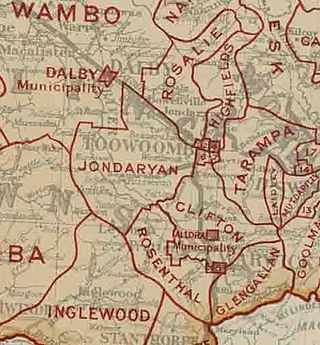
The Shire of Drayton was a local government area in the Darling Downs region of Queensland, Australia, west of Toowoomba. It existed between 1887 and 1949.

<span class="mw-page-title-main">Toowoomba Golf Club Middle Ridge</span>

The Toowoomba Golf Club Middle Ridge is one of two golf clubs in Toowoomba, Queensland, Australia; the other being City Golf Club Toowoomba. Toowoomba Golf Club is situated in the suburb of Middle Ridge, and its address is 235–323 Rowbotham Street.

References

  1. Australian Bureau of Statistics (28 June 2022). "Middle Ridge (Suburb and Locality)". Australian Census 2021 QuickStats. Retrieved 28 June 2022.  OOjs UI icon edit-ltr-progressive.svg
  2. 1 2 "Middle Ridge – locality in Toowoomba Region (entry 48000)". Queensland Place Names. Queensland Government . Retrieved 1 December 2019.
  3. 1 2 Australian Bureau of Statistics (28 June 2022). "Middle Ridge (SAL)". 2021 Census QuickStats. Retrieved 28 February 2023. OOjs UI icon edit-ltr-progressive.svg
  4. 1 2 "Queensland Globe". State of Queensland . Retrieved 10 August 2023.
  5. "Shire of Middle Ridge". Queensland Government Gazette . 22 May 1880. p. 26:1143.
  6. "Official Notifications". The Queenslander . Brisbane: National Library of Australia. 29 May 1880. p. 679. Retrieved 10 September 2013.
  7. "Middle Ridge". Queensland Places. Centre for the Government of Queensland, University of Queensland. Archived from the original on 9 January 2014. Retrieved 9 January 2014.
  8. Queensland Family History Society (2010), Queensland schools past and present (Version 1.01 ed.), Queensland Family History Society, ISBN   978-1-921171-26-0
  9. 1 2 Walker, Terry (1995). Fast Tracks - Australia's Motor Racing Circuits 1904-1995. Sydney: Turton & Armstrong. p. 98. ISBN   0908031556.
  10. Galpin, Darren. "Middle Ridge". GEL Motorsport Information Page. Archived from the original on 9 February 2008. Retrieved 10 June 2017.
  11. Australian Bureau of Statistics (27 June 2017). "Middle Ridge (SSC)". 2016 Census QuickStats. Retrieved 20 October 2018. OOjs UI icon edit-ltr-progressive.svg
  12. 1 2 "State and non-state school details". Queensland Government. 9 July 2018. Archived from the original on 21 November 2018. Retrieved 21 November 2018.
  13. "Middle Ridge State School". Middle Ridge State School. 5 September 2022. Archived from the original on 1 March 2023. Retrieved 11 August 2023.
  14. "ACARA School Profile 2017". Archived from the original on 22 November 2018. Retrieved 22 November 2018.
  15. "Toowoomba - OneSchool Global". 27 March 2019. Archived from the original on 3 June 2023. Retrieved 11 August 2023.
  16. "About Us - OneSchool Global". 15 March 2019. Archived from the original on 3 July 2023. Retrieved 11 August 2023.
  17. "Gabbinbar (entry 600840)". Queensland Heritage Register . Queensland Heritage Council. Retrieved 1 August 2014.
  18. "Golf at Toowoomba Golf Club". Golf at Toowoomba Golf Club. Archived from the original on 23 January 2023. Retrieved 11 August 2023.
  19. "Golf at Toowoomba GC". Golf at Toowoomba Golf Club. Archived from the original on 6 March 2019. Retrieved 11 August 2023.
  20. Brisway Publishing (2008). Brisway: Greater Brisbane, Sunshine Coast, Gold Coast and Toowoomba. p. Map T261. ISBN   978-0-909439-30-9.
  21. "Branch Locations". Queensland Country Women's Association. Archived from the original on 26 December 2018. Retrieved 26 December 2018.

Further reading