Mount Lofty, Queensland

Last updated

Map all coordinates using: OpenStreetMap
Mount Lofty
Toowoomba,  Queensland
Curzon Street, Mount Lofty.jpg
Curzon Street, Mount Lofty
Australia Queensland location map.svg
Red pog.svg
Mount Lofty
Coordinates 27°32′13″S151°59′02″E / 27.5369°S 151.9838°E / -27.5369; 151.9838 (Mount Lofty (centre of locality))
Population3,775 (2016 census) [1]
 • Density393.2/km2 (1,018/sq mi)
Postcode(s) 4350
Area9.6 km2 (3.7 sq mi)
Time zone AEST (UTC+10:00)
Location
LGA(s) Toowoomba Region
State electorate(s) Toowoomba North
Federal division(s) Groom
Suburbs around Mount Lofty:
Ballard Ballard Withcott
Harlaxton Mount Lofty Withcott
North Toowoomba East Toowoomba Prince Henry Heights

Mount Lofty is a residential locality on the north-eastern edge of the suburban area of Toowoomba, in the Toowoomba Region, Queensland, Australia. [2] In the 2016 census, Mount Lofty had a population of 3,775 people. [1]

Contents

Geography

Jubilee Park, a large parkland and bushland area with numerous riding trails, forms the eastern part of the suburb. At the end of North Street is the peak of Mount Lofty, which features a garden and rainforest, a lookout, and the transmission tower for WIN Television. Nearby is Toowoomba State High School (Mount Lofty Campus) and a rifle range used by Toowoomba Rifle Club, that is no longer in use. [3]

History

Mount Lofty was formerly known as Tick Hill. [2]

There was a two-storey house called Longview on its crest, which was relocated from the Toowoomba CBD by Charles Cocks. The house was built for Cocks in the 1860s on the corner of Ruthven Street and Bridge Street. In 1904, Cocks had the house dismantled and rebuilt on the eastern end of North Street on a 40-acre (16 ha) site, where it overlooked Toowoomba. After Cocks's death in 1916, [4] the house was occupied by his daughter Eleanor Sophia (Polly) Cocks who operated it as a boarding house (advertising it as having the health benefit of "flu cured two days"). After her death in 1956, the house was demolished. A reservoir occupies the site today at 13 North Street ( 27°32′39″S151°58′19″E / 27.5441°S 151.9719°E / -27.5441; 151.9719 (Longview (former house)) ). [2] [5] [6] [7] [8] [9]

Toowoomba State High School and Technical College opened on 12 May 1919, after the Department of Public Instruction took over the Toowoomba Technical College. In January 1962, it became Toowoomba State High School. [10]

On Saturday 14 August 1926, the Reverend William Goyen officially opened a Presbyterian Sunday School hall in Geoffrey Street, as an outreach of St Stephen's Presbyterian Church in Neil Street in the Toowoomba CBD. [11] [12] By 1927, it was being used for church services on a monthly basis and was known as the Geoffrey Street Presbyterian Church. [13] In 1939, the hall was moved to a block on the south-east corner of Mary Street and Alford Street. On 12 November 1949, the foundation stone for the current church was laid by the Right Reverend William Frederick Mackenzie, the Moderator of the Presbyterian Church of Queensland. [14] On Saturday 26 July 1952, the new church was officially opened as St David's Presbyterian Church by the Moderator of the Presbyterian Church of Queensland, the Right Reverend Malcolm McDermant. The old church remains on the site and is used as a hall. [15] [16]

In the 2016 census, Mount Lofty had a population of 3,775 people. [1]

Heritage listings

Boyce gardens - entrance and driveway. Boyce gardens - entrance and driveway.jpg
Boyce gardens - entrance and driveway.

Mount Lofty has one heritage-listed site:

Education

Toowoomba State High School is a government secondary (7-12) school for boys and girls at Stuart Street ( 27°32′43″S151°57′53″E / 27.5452°S 151.9648°E / -27.5452; 151.9648 (Toowoomba State High School) ). [18] [19] In 2018, the school had an enrolment of 832 students with 76 teachers (69 full-time equivalent) and 37 non-teaching staff (29 full-time equivalent). [20] It includes a special education program. [18]

There is no primary school in Mount Lofty. The nearest government primary schools are Toowoomba East State School in neighbouring East Toowoomba to the south and Harlaxton State School in neighbouring Harlaxton to the west. [21]

Amenities

St David's Presbyterian Church is at 46 Mary Street (corner Alford Street, 27°33′02″S151°58′07″E / 27.5505°S 151.9685°E / -27.5505; 151.9685 (St David's Presbyterian Church) ). [22] [23] [24] It is part of the Presbyterian Church of Queensland. [25]

There are a number of parks in the area:

Attractions

Mount Lofty Lookout is at the eastern end of North Street near the reservoir where Longview House once stood ( 27°32′41″S151°58′19″E / 27.5446°S 151.9719°E / -27.5446; 151.9719 (Mount Lofty Lookout) ). [27]

Related Research Articles

<span class="mw-page-title-main">Oakey, Queensland</span> Town in Queensland, Australia

Oakey is a rural town and locality in the Toowoomba Region, Queensland, Australia. The Museum of Army Aviation is located at Oakey Airport.

<span class="mw-page-title-main">Nobby, Queensland</span> Town in Queensland, Australia

Nobby is a rural town and locality on the Darling Downs in the Toowoomba Region, Queensland, Australia. It is located halfway between Toowoomba and Warwick. It is known for its association with Steele Rudd (author) and Sister Elizabeth Kenny.

<span class="mw-page-title-main">Drayton, Queensland</span> Suburb of Toowoomba Region, Queensland, Australia

Drayton is a rural locality in the Toowoomba Region, Queensland, Australia. In the 2016 census, Drayton had a population of 1,710 people.

<span class="mw-page-title-main">Clifton, Queensland</span> Town in Queensland, Australia

Clifton is a rural town and locality in the Toowoomba Region, Queensland, Australia. In the 2016 census, Clifton had a population of 1,456 people.

<span class="mw-page-title-main">Allora, Queensland</span> Town in Queensland, Australia

Allora is a rural town and locality in the Southern Downs Region, Queensland, Australia. In the 2016 census, the locality of Allora had a population of 1,223 people.

<span class="mw-page-title-main">Greenmount, Queensland (Toowoomba Region)</span> Town in Queensland, Australia

Greenmount is a rural town and locality in the Toowoomba Region, Queensland, Australia. In the 2016 census, the locality of Greenmount had a population of 699 people.

<span class="mw-page-title-main">Millmerran, Queensland</span> Town in Queensland, Australia

Millmerran, known as Domville between 1 June 1889 and 16 November 1894, is a town and a locality in the Toowoomba Region, Queensland, Australia. In the 2016 census, the locality of Millmerran had a population of 1,563 people.

<span class="mw-page-title-main">Cecil Plains, Queensland</span> Town in Queensland, Australia

Cecil Plains is a rural town and locality in the Toowoomba Region, Queensland, Australia. In the 2016 census, the locality of Cecil Plains had a population of 429 people.

<span class="mw-page-title-main">Cambooya, Queensland</span> Town in Queensland, Australia

Cambooya is a rural town and locality in the Toowoomba Region, Queensland, Australia. In the 2016 census the locality of Cambooya had a population of 1,584 people.

<span class="mw-page-title-main">Kingsthorpe, Queensland</span> Town in Queensland, Australia

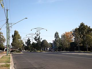
Kingsthorpe is a rural town and locality in the Toowoomba Region, Queensland, Australia. In the 2021 census, the locality of Kingsthorpe had a population of 2,159 people.

<span class="mw-page-title-main">Bowenville, Queensland</span> Town in Queensland, Australia

Bowenville is a rural town and locality in the Toowoomba Region, Queensland, Australia. The town's economy rested on the rail industry and with the winding down of the railways the population declined. In the 2016 census, the locality of Bowenville had a population of 250 people.

<span class="mw-page-title-main">Goombungee, Queensland</span> Town in Queensland, Australia

Goombungee is a rural town and locality in the Toowoomba Region, Queensland, Australia. In the 2016 census the locality of Goombungee had a population of 1,026 people.

<span class="mw-page-title-main">Toowoomba City, Queensland</span> Suburb of Toowoomba, Queensland, Australia

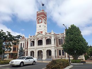
Toowoomba City is an urban locality in the Toowoomba Region, Queensland, Australia. It is the central suburb of Toowoomba, containing its central business district and informally known as the Toowoomba CBD. In the 2021 census, Toowoomba City had a population of 2,321 people.

<span class="mw-page-title-main">East Toowoomba, Queensland</span> Suburb of Toowoomba, Queensland, Australia

East Toowoomba is a residential locality in Toowoomba in the Toowoomba Region, Queensland, Australia. In the 2016 census, East Toowoomba had a population of 5,244 people.

<span class="mw-page-title-main">Newtown, Queensland (Toowoomba)</span> Suburb of Toowoomba, Queensland, Australia

Newtown is a residential locality in Toowoomba in the Toowoomba Region, Queensland, Australia. In the 2021 census, Newtown had a population of 10,039 people.

<span class="mw-page-title-main">North Toowoomba, Queensland</span> Suburb of Toowoomba, Queensland, Australia

North Toowoomba is a suburban locality in Toowoomba in the Toowoomba Region, Queensland, Australia. In the 2021 census, North Toowoomba had a population of 3,332 people.

<span class="mw-page-title-main">Rangeville, Queensland</span> Suburb of Toowoomba, Queensland, Australia

Rangeville is a residential locality in Toowoomba in the Toowoomba Region, Queensland, Australia. In the 2021 census, Rangeville had a population of 8,668 people.

<span class="mw-page-title-main">Geham</span> Suburb of Toowoomba Region, Queensland, Australia

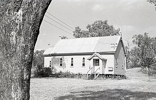
Geham is a rural locality in the Toowoomba Region, Queensland, Australia. In the 2021 census, Geham had a population of 470 people.

<span class="mw-page-title-main">Westbrook, Queensland</span> Suburb of Toowoomba Region, Queensland, Australia

Westbrook is a rural town and locality in the Toowoomba Region, Queensland, Australia. In the 2016 census, the locality of Westbrook had a population of 3,885 people.

<span class="mw-page-title-main">Mount Tyson, Queensland</span> Town in Queensland, Australia

Mount Tyson is a rural town and locality in the Toowoomba Region, Queensland, Australia. In the 2016 census, the locality of Mount Tyson had a population of 285 people.

References

  1. 1 2 3 Australian Bureau of Statistics (27 June 2017). "Mount Lofty (SSC)". 2016 Census QuickStats. Retrieved 20 October 2018. OOjs UI icon edit-ltr-progressive.svg
  2. 1 2 3 "Mount Lofty – locality in Toowoomba Region (entry 50199)". Queensland Place Names. Queensland Government . Retrieved 29 December 2020.
  3. Brisway Publishing (2008). Brisway: Greater Brisbane, Sunshine Coast, Gold Coast and Toowoomba. p. Map T221. ISBN   978-0-909439-30-9.
  4. "MR. CHARLES COCKS". Darling Downs Gazette . No. 7927. Queensland, Australia. 2 June 1916. p. 4. Archived from the original on 14 January 2022. Retrieved 14 January 2022 via National Library of Australia.
  5. "Historic Homes Toowoomba - Longview | Toowoomba Darling Downs". 4 October 2021. Archived from the original on 14 January 2022. Retrieved 14 January 2022.
  6. "Charitable Bequests". The Brisbane Courier . No. 18, 260. Queensland, Australia. 26 July 1916. p. 6. Archived from the original on 14 January 2022. Retrieved 14 January 2022 via National Library of Australia.
  7. "Advertising". The Brisbane Courier . No. 19, 407. Queensland, Australia. 1 April 1920. p. 10. Archived from the original on 14 January 2022. Retrieved 14 January 2022 via National Library of Australia.
  8. "Advertising". The Brisbane Courier . No. 21, 395. Queensland, Australia. 21 August 1926. p. 16. Archived from the original on 14 January 2022. Retrieved 14 January 2022 via National Library of Australia.
  9. "Advertising". The Brisbane Courier . No. 22, 693. Queensland, Australia. 22 October 1930. p. 9. Archived from the original on 14 January 2022. Retrieved 14 January 2022 via National Library of Australia.
  10. Queensland Family History Society (2010), Queensland schools past and present (Version 1.01 ed.), Queensland Family History Society, ISBN   978-1-921171-26-0
  11. "PRESBYTERIAN CHURCH". Toowoomba Chronicle and Darling Downs Gazette . Vol. LXV, no. 195. Queensland, Australia. 16 August 1926. p. 4. Retrieved 14 January 2022 via National Library of Australia.
  12. "The Churches". Daily Mail . No. 7625. Queensland, Australia. 7 August 1926. p. 11. Retrieved 14 January 2022 via National Library of Australia.
  13. "GEOFFREY-STREET PRESBYTERIAN". Toowoomba Chronicle and Darling Downs Gazette . Vol. LXXI, no. 223. Queensland, Australia. 19 September 1932. p. 10. Retrieved 14 January 2022 via National Library of Australia.
  14. "The churches". The Courier-mail . No. 4045. Queensland, Australia. 12 November 1949. p. 5. Retrieved 14 January 2022 via National Library of Australia.
  15. "History". St David's Presbyterian Church. Retrieved 14 January 2022.
  16. "THREE DEDICATIONS IN JULY". Brisbane Telegraph . Queensland, Australia. 5 July 1952. p. 18. Retrieved 14 January 2022 via National Library of Australia.
  17. "Boyce Gardens (entry 601311)". Queensland Heritage Register . Queensland Heritage Council. Retrieved 15 July 2013.
  18. 1 2 "State and non-state school details". Queensland Government. 9 July 2018. Archived from the original on 21 November 2018. Retrieved 21 November 2018.
  19. "Toowoomba State High School". Toowoomba State High School. 27 March 2019. Archived from the original on 8 June 2021. Retrieved 14 January 2022.
  20. "ACARA School Profile 2018". Australian Curriculum, Assessment and Reporting Authority. Archived from the original on 27 August 2020. Retrieved 28 January 2020.
  21. "Queensland Globe". State of Queensland . Retrieved 14 January 2022.
  22. "St David's Presbyterian Church" . Retrieved 14 January 2022.
  23. "St David's Presbyterian Church". Churches Australia. Retrieved 14 January 2022.
  24. Blake, Thom. "St David's Presbyterian Church". Queensland religious places database. Retrieved 14 January 2022.
  25. "The Presbyterian Church of Queensland". St David's Presbyterian Church. Retrieved 14 January 2022.
  26. 1 2 3 4 5 6 "Land for public recreation - Queensland". Queensland Open Data. Queensland Government. 20 November 2020. Archived from the original on 22 November 2020. Retrieved 22 November 2020.
  27. "Tourist points - Queensland". Queensland Open Data. Queensland Government. 18 November 2020. Archived from the original on 24 November 2020. Retrieved 24 November 2020.

Commons-logo.svg Media related to Mount Lofty, Queensland at Wikimedia Commons