Cecil Plains is a rural town and locality in the Toowoomba Region, Queensland, Australia. In the 2016 census, Cecil Plains had a population of 429 people.
Lemontree is a rural locality in the Toowoomba Region, Queensland, Australia. In the 2016 census, Lemontree had a population of 45 people.
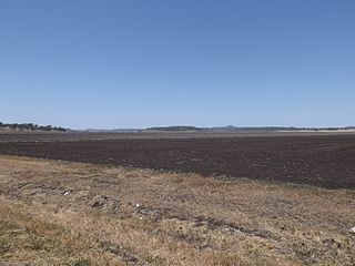
Yandilla is a rural locality in the Toowoomba Region, Queensland, Australia. In the 2016 census Yandilla had a population of 46 people.
Mount Tyson is a rural town and locality in the Toowoomba Region, Queensland, Australia. In the 2016 census, Mount Tyson had a population of 285 people.

Aubigny is a rural town and locality in the Toowoomba Region, Queensland, Australia. In the 2016 census, Aubigny had a population of 254 people.
Kulpi is a rural town and locality in the Toowoomba Region, Queensland, Australia. In the 2016 census, Kulpi had a population of 77 people.

Felton is a rural locality in the Toowoomba Region, Queensland, Australia. In the 2016 census, Felton had a population of 276 people.

Linthorpe is a rural locality in the Toowoomba Region, Queensland, Australia. In the 2016 census, Linthorpe had a population of 440 people.

Mount Irving is a rural locality in the Toowoomba Region, Queensland, Australia. In the 2016 census, Mount Irving had a population of 15 people.

Gowrie Little Plain is a rural locality in the Toowoomba Region, Queensland, Australia. In the 2016 census, Gowrie Little Plain had a population of 65 people.
Nangwee is a rural town and locality in the Toowoomba Region, Queensland, Australia. In the 2016 census the locality of Nangwee had a population of 52 people.
North Branch is a locality in the Toowoomba Region, Queensland, Australia. In the 2016 census, North Branch had a population of 39 people.
West Prairie is a rural locality in the Toowoomba Region, Queensland, Australia. In the 2016 census West Prairie had a population of 79 people.
Turallin is a town and a locality in the Toowoomba Region, Queensland, Australia. In the 2016 census, Turallin had a population of 65 people.
Kurrowah is a rural locality in the Toowoomba Region, Queensland, Australia. In the 2016 census, Kurrowah had a population of 25 people.
Rosalie Plains is a rural locality in the Toowoomba Region, Queensland, Australia. In the 2016 census, Rosalie Plains had a population of 44 people.
Chinchilla–Wondai Road is a continuous 151.6 kilometres (94.2 mi) road route in the Western Downs and South Burnett regions of Queensland, Australia. Part of the route is signed as State Route 82. It is a state-controlled part regional and part district road. It provides an alternate route between the Warrego Highway and the South Burnett, bypassing Dalby, Oakey and Toowoomba.
Toowoomba–Cecil Plains Road is a continuous 78.6 kilometres (48.8 mi) road route in the Toowoomba region of Queensland, Australia. Most of the road is not signed with any route number, but a short section near Cecil Plains is part of State Route 82. Toowoomba–Cecil Plains Road is a state-controlled district road, part of which is rated as a local road of regional significance (LRRS).
Dalby–Jandowae Road is a continuous 47.3 kilometres (29.4 mi) road route in the Western Downs region of Queensland, Australia. The road is signed as State Route 82. Dalby–Jandowae Road is a state-controlled regional road.
Dalby–Cecil Plains Road is a continuous 39.1 kilometres (24.3 mi) road route in the Western Downs and Toowoomba regions of Queensland, Australia. The road is signed as State Route 82. Dalby–Cecil Plains Road is a state-controlled regional road.
