The Gums is a rural town and locality in the Western Downs Region, Queensland, Australia. In the 2021 census, the locality of The Gums had a population of 165 people.
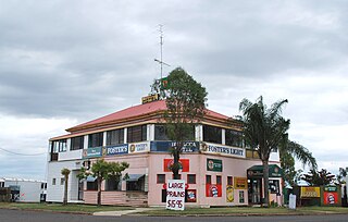
Dulacca is a rural town and locality in the Western Downs Region, Queensland, Australia. In the 2021 census, the locality of Dulacca had a population of 131 people.

Hirstglen is a rural locality in the Toowoomba Region on the Darling Downs, Queensland, Australia. In the 2021 census, Hirstglen had a population of 77 people.

Ascot is a rural locality in the Toowoomba Region, Queensland, Australia. In the 2021 census, Ascot had a population of 106 people.
Kumbarilla is a town and rural locality in the Western Downs Region, Queensland, Australia. In the 2021 census, the locality of Kumbarilla had a population of 223 people.
Ducklo is a locality in the Western Downs Region, Queensland, Australia. In the 2021 census, Ducklo had a population of 306 people.
North Branch is a locality in the Toowoomba Region, Queensland, Australia. In the 2021 census, North Branch had a population of 48 people.
Yulabilla is a rural locality in the Western Downs Region, Queensland, Australia. In the 2021 census, Yulabilla had a population of 41 people.
Leslie is a rural locality in the Southern Downs Region, Queensland, Australia. In the 2021 census, Leslie had a population of 12 people.
Mount Tabor is a rural locality in the Southern Downs Region, Queensland, Australia. In the 2021 census, Mount Tabor had a population of 19 people.
Roche Creek is a rural locality in the Western Downs Region, Queensland, Australia. In the 2021 census, Roche Creek had a population of 53 people.
Hookswood is a locality in the Western Downs Region, Queensland, Australia. In the 2021 census, Hookswood had a population of 58 people.
Coomrith is a locality in the Western Downs Region, Queensland, Australia. In the 2021 census, Coomrith had a population of 52 people.

Nandi is a rural locality in the Western Downs Region, Queensland, Australia. In the 2021 census, Nandi had a population of 105 people.
Crossroads is a rural locality in the Western Downs Region, Queensland, Australia. In the 2021 census, Crossroads had a population of 127 people.
Condamine Plains is a rural locality in the Toowoomba Region, Queensland, Australia. In the 2021 census, Condamine Plains had a population of 101 people.
Kurrowah is a rural locality in the Toowoomba Region, Queensland, Australia. In the 2021 census, Kurrowah had a population of 10 people.
Jackson South is a rural locality in the Maranoa Region, Queensland, Australia. In the 2021 census, Jackson South had "no people or a very low population".
Wallumbilla South is a rural locality in the Maranoa Region, Queensland, Australia. In the 2021 census, Wallumbilla South had a population of 80 people.

Noorindoo is a rural locality in the Maranoa Region, Queensland, Australia. In the 2021 census, Noorindoo had a population of 71 people.
