Diamondy, Queensland

Last updated

Map all coordinates using: OpenStreetMap  
Download coordinates as: KML  ·  GPX
Diamondy
Queensland
Australia Queensland location map.svg
Red pog.svg
Diamondy
Coordinates 26°37′58″S151°17′03″E / 26.6327°S 151.2841°E / -26.6327; 151.2841 (Diamondy (centre of locality))
Population47 (2016 census) [1]
 • Density0.1335/km2 (0.346/sq mi)
Postcode(s) 4410
Area352.1 km2 (135.9 sq mi)
Time zone AEST (UTC+10:00)
Location
LGA(s) Western Downs Region
State electorate(s) Callide
Federal Division(s) Maranoa
Suburbs around Diamondy:
Darr Creek Chahpingah Ironpot
Jinghi Diamondy Ironpot
Jandowae Cooranga Boyneside

Diamondy is a rural locality in the Western Downs Region, Queensland, Australia. [2] In the 2016 census, Diamondy had a population of 47 people. [1]

Contents

Geography

The locality is bounded to the east by the ridge of the Craig Range, part of the Great Dividing Range. [3]

Glenmorriston is a neighbourhood in the south-west of the locality ( 26°40′00″S151°15′00″E / 26.6666°S 151.25°E / -26.6666; 151.25 (Glenmorriston) ). [4]

Norjinghi is a neighbourhood in the south-west of the locality ( 26°40′00″S151°14′00″E / 26.6666°S 151.2333°E / -26.6666; 151.2333 (Norjinghi) ). [5]

The Diamondy State Forest is in the north-east of the locality, extending into neighbouring Darr Creek, Chahpingah and Ironpot. Apart from this, the land use is a mix of crops and grazing on native vegetation. [3]

History

In the 2016 census, Diamondy had a population of 47 people. [1]

Education

There are no schools in Diamondy. The nearest primary school is Jandowae State School in neighbouring Jandowae to the south-west. The nearest secondary schools are Jandowae State School (to Year 10) in Jandowae, Kingaroy State High School (to Year 12) in Kingaroy to the north-east, and Dalby State High School in Dalby to the south. [3]

Related Research Articles

Jandowae Town in Queensland, Australia

Jandowae is a rural town and locality in the Western Downs Region, Queensland, Australia. In the 2016 census the locality of Jandowae had a population of 1,047 people.

Ascot, Queensland (Toowoomba Region) Suburb of Toowoomba Region, Queensland, Australia

Ascot is a rural locality in the Toowoomba Region, Queensland, Australia. In the 2016 census, Ascot had a population of 31 people.

Alexandra, Queensland Suburb of Mackay, Queensland, Australia

Alexandra is a suburb of Mackay in the Mackay Region, Queensland, Australia. In the 2016 census, Alexandra had a population of 193 people.

Beebo, Queensland Suburb of Goondiwindi Region, Queensland, Australia

Beebo is a rural locality in the Goondiwindi Region, Queensland, Australia. It is on the border between Queensland and New South Wales. In the 2016 census, Beebo had a population of 84 people.
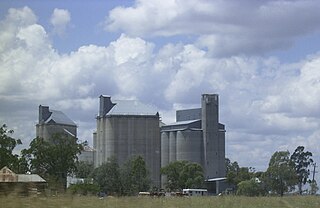
Brookstead, Queensland Town in Queensland, Australia

Brookstead is a rural town and locality in the Toowoomba Region, Queensland, Australia. In the 2016 census, Brookstead had a population of 217 people.
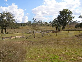
Bergen, Queensland Suburb of Toowoomba Region, Queensland, Australia

Bergen is a rural locality in the Toowoomba Region, Queensland, Australia. In the 2016 census, Bergen had a population of 68 people.

Cooranga, Queensland Suburb of Western Downs Region, Queensland, Australia

Cooranga is a locality in the Western Downs Region, Queensland, Australia. In the 2016 census, Cooranga had a population of 133 people.

Darr Creek, Queensland Suburb of Western Downs Region, Queensland, Australia

Darr Creek is a rural locality in the Western Downs Region, Queensland, Australia. In the 2016 census Darr Creek had a population of 18 people.

Ducklo, Queensland Suburb of Western Downs Region, Queensland, Australia

Ducklo is a locality in the Western Downs Region, Queensland, Australia. In the 2016 census, Ducklo had a population of 333 people.

Euthulla, Queensland Suburb of Maranoa Region, Queensland, Australia

Euthulla is a rural locality in the Maranoa Region, Queensland, Australia. In the 2016 census, Euthulla had a population of 370 people.

Formartin, Queensland Suburb of Toowoomba Region, Queensland, Australia

Formartin is a rural locality in the Toowoomba Region, Queensland, Australia. In the 2016 census Formartin had a population of 95 people.

Alice Creek, Queensland Suburb of South Burnett Region, Queensland, Australia

Alice Creek is a rural locality in the South Burnett Region, Queensland, Australia. In the 2016 census, Alice Creek had a population of 60 people.

Langlands, Queensland Suburb of Western Downs Region, Queensland, Australia

Langlands is a rural locality in the Western Downs Region, Queensland, Australia. In the 2016 census Langlands had a population of 7 people.

Jinghi, Queensland Suburb of Western Downs Region, Queensland, Australia

Jinghi is a rural locality in the Western Downs Region, Queensland, Australia. In the 2016 census Jinghi had a population of 74 people.

Pine Creek, Queensland Suburb of Bundaberg Region, Queensland, Australia

Pine Creek is a rural locality in the Bundaberg Region, Queensland, Australia. In the 2016 census Pine Creek had a population of 254 people.

Gilla, Queensland Suburb of Toowoomba Region, Queensland, Australia

Gilla is a rural locality in the Toowoomba Region, Queensland, Australia. In the 2016 census Gilla had a population of 32 people.

Jimbour West, Queensland Suburb of Western Downs Region, Queensland, Australia

Jimbour West is a rural locality in the Western Downs Region, Queensland, Australia. In the 2016 census Jimbour West had a population of 56 people.

Crossroads, Queensland Suburb of Western Downs Region, Queensland, Australia

Crossroads is a rural locality in the Western Downs Region, Queensland, Australia. In the 2016 census, Crossroads had a population of 130 people.

Halliford, Queensland Suburb of Western Downs Region, Queensland, Australia

Halliford is a rural locality in the Western Downs Region, Queensland, Australia. In the 2016 census, Halliford had a population of 0 people.

Mount Darry, Queensland Suburb of Toowoomba Region, Queensland, Australia

Mount Darry is a rural locality in the Toowoomba Region, Queensland, Australia. In the 2016 census Mount Darry had a population of 35 people.

References

  1. 1 2 3 Australian Bureau of Statistics (27 June 2017). "Diamondy (SSC)". 2016 Census QuickStats. Retrieved 20 October 2018. OOjs UI icon edit-ltr-progressive.svg
  2. "Diamondy – locality in Western Downs Region (entry 47691)". Queensland Place Names. Queensland Government . Retrieved 19 September 2020.
  3. 1 2 3 "Queensland Globe". State of Queensland . Retrieved 27 October 2020.
  4. "Glenmorriston – locality unbounded in Western Downs Regional (entry 14012)". Queensland Place Names. Queensland Government . Retrieved 19 September 2020.
  5. "Norjinghi – locality unbounded in Western Downs Regional (entry 24526)". Queensland Place Names. Queensland Government . Retrieved 19 September 2020.