Yulabilla, Queensland

Last updated

Yulabilla
Queensland
Australia Queensland location map.svg
Red pog.svg
Yulabilla
Coordinates 27°01′35″S149°46′42″E / 27.0263°S 149.7783°E / -27.0263; 149.7783 (Yulabilla (centre of locality))
Population41 (SAL 2021) [1]
Postcode(s) 4416
Area351.3 km2 (135.6 sq mi)
Time zone AEST (UTC+10:00)
Location
  • 44.5 km (28 mi) SW of Condamine
  • 75.6 km (47 mi) SW of Miles
  • 158 km (98 mi) ESE of Roma
  • 169 km (105 mi) W of Dalby
  • 379 km (235 mi) WNW of Brisbane
LGA(s) Western Downs Region
State electorate(s) Warrego
Federal division(s) Maranoa
Suburbs around Yulabilla:
Moraby Moraby Pine Hills
Warkon Yulabilla Condamine
Glenmorgan Glenmorgan Meandarra

Yulabilla is a rural locality in the Western Downs Region, Queensland, Australia. [2] In the 2021 census, Yulabilla had a population of 41 people. [3]

Contents

Geography

The locality is bounded to the south by the Condamine River and from the north to the south-west by Dogwood Creek. Their confluence at the south-west of the locality is the start of the Balonne River. [4]

The land use is predominantly crop growing with some grazing on native vegetation. [5]

History

The locality was officially named and bounded on 25 February 2000. The locality name derives from the parish name, which in turn is believed to be the name of an early settlement or pastoral station which first appears on the 1883 Darling Downs Run Map. [2] [6]

Demographics

In the 2016 census, Yulabilla had a population of 44 people. [7]

In the 2021 census, Yulabilla had a population of 41 people. [3]

Education

There are no schools in Yulabilla. The nearest government primary schools are Condamine State School in neighbouring Condamine to the east and Glenmorgan State School in neighbouring Glenmorgan to the south. There are no nearby secondary schools; the options are distance education and boarding school. [8]

Related Research Articles

Weyba Downs is a rural locality in the Sunshine Coast Region, Queensland, Australia. In the 2021 census, Weyba Downs had a population of 352 people.

The Gums is a rural town and locality in the Western Downs Region, Queensland, Australia. In the 2016 census, The Gums had a population of 159 people.

<span class="mw-page-title-main">Hirstglen, Queensland</span> Suburb of Toowoomba Region, Queensland, Australia

Hirstglen is a rural locality in the Toowoomba Region on the Darling Downs, Queensland, Australia. In the 2021 census, Hirstglen had a population of 77 people.

<span class="mw-page-title-main">Mount Irving, Queensland</span> Suburb of Toowoomba Region, Queensland, Australia

Mount Irving is a rural locality in the Toowoomba Region, Queensland, Australia. In the 2021 census, Mount Irving had a population of 34 people.

<span class="mw-page-title-main">Whichello, Queensland</span> Suburb of Toowoomba Region, Queensland, Australia

Whichello is a rural locality in the Toowoomba Region, Queensland, Australia. In the 2021 census, Whichello had a population of 31 people.

<span class="mw-page-title-main">Domville, Queensland</span> Suburb of Toowoomba Region, Queensland, Australia

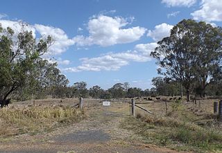
Domville is a rural locality in the Toowoomba Region, Queensland, Australia. In the 2021 census, Domville had "no people or a very low population".

Ducklo is a locality in the Western Downs Region, Queensland, Australia. In the 2021 census, Ducklo had a population of 306 people.

<span class="mw-page-title-main">North Branch, Queensland (Toowoomba Region)</span> Suburb of Toowoomba Region, Queensland, Australia

North Branch is a locality in the Toowoomba Region, Queensland, Australia. In the 2021 census, North Branch had a population of 48 people.

Moraby is a locality in the Western Downs Region, Queensland, Australia. In the 2021 census, Moraby had a population of 43 people.

Womina is a rural locality in the Southern Downs Region, Queensland, Australia. In the 2021 census, Womina had a population of 207 people.

Leslie is a rural locality in the Southern Downs Region, Queensland, Australia. In the 2021 census, Leslie had a population of 12 people.

<span class="mw-page-title-main">Massie, Queensland</span> Suburb of Southern Downs Region, Queensland, Australia

Massie is a rural locality in the Southern Downs Region, Queensland, Australia. In the 2021 census, Massie had a population of 113 people.

<span class="mw-page-title-main">Coomrith, Queensland</span> Suburb of Western Downs Region, Queensland, Australia

Coomrith is a locality in the Western Downs Region, Queensland, Australia. In the 2021 census, Coomrith had a population of 52 people.

<span class="mw-page-title-main">Nandi, Queensland</span> Suburb of Western Downs Region, Queensland, Australia

Nandi is a rural locality in the Western Downs Region, Queensland, Australia. In the 2021 census, Nandi had a population of 105 people.

<span class="mw-page-title-main">Western Creek, Queensland</span> Suburb of Toowoomba Region, Queensland, Australia

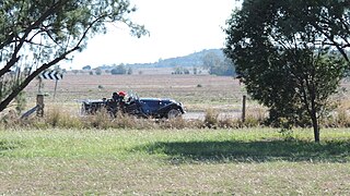
Western Creek is a locality in the Toowoomba Region, Queensland, Australia. In the 2021 census, Western Creek had "no people or a very low population".

The Head is a rural locality in the Southern Downs Region, Queensland, Australia. It borders New South Wales. In the 2021 census, The Head had a population of 12 people.

Kings Creek is a rural locality in the Toowoomba Region, Queensland, Australia. In the 2021 census, Kings Creek had a population of 55 people.

Condamine Plains is a rural locality in the Toowoomba Region, Queensland, Australia. In the 2021 census, Condamine Plains had a population of 101 people.

Wallumbilla South is a rural locality in the Maranoa Region, Queensland, Australia. In the 2021 census, Wallumbilla South had a population of 80 people.

<span class="mw-page-title-main">Noorindoo, Queensland</span> Suburb of Maranoa Region, Queensland, Australia

Noorindoo is a rural locality in the Maranoa Region, Queensland, Australia. In the 2021 census, Noorindoo had a population of 71 people.

References

  1. Australian Bureau of Statistics (28 June 2022). "Yulabilla (suburb and locality)". Australian Census 2021 QuickStats. Retrieved 28 June 2022.  OOjs UI icon edit-ltr-progressive.svg
  2. 1 2 "Yulabilla – locality in Western Downs Region (entry 47762)". Queensland Place Names. Queensland Government . Retrieved 16 November 2018.
  3. 1 2 Australian Bureau of Statistics (28 June 2022). "Yulabilla (SAL)". 2021 Census QuickStats. Retrieved 28 February 2023. OOjs UI icon edit-ltr-progressive.svg
  4. "Layers: Locality; Mountains and ranges; Contours; Watercourses". Queensland Globe. Queensland Government. Archived from the original on 19 December 2017. Retrieved 8 April 2024.
  5. "Layers: Locality; Protected areas and forests; Land use". Queensland Globe. Queensland Government. Archived from the original on 19 December 2017. Retrieved 8 April 2024.
  6. "Queensland Run Maps Darling Downs Sketch Map shewing the surveyed and unsurveyed runs" (Map). Queensland Government. 1883. Archived from the original on 9 April 2024. Retrieved 8 April 2024.
  7. Australian Bureau of Statistics (27 June 2017). "Yulabilla (SSC)". 2016 Census QuickStats. Retrieved 20 October 2018. OOjs UI icon edit-ltr-progressive.svg
  8. "Layers: Locality; Schools and school catchments". Queensland Globe. Queensland Government. Archived from the original on 19 December 2017. Retrieved 9 April 2024.