
Motley is a rural locality in the Toowoomba Region, Queensland, Australia. In the 2021 census, Motley had a population of 10 people.
Goombi is a rural locality in the Western Downs Region, Queensland, Australia. In the 2021 census, Goombi had a population of 56 people.
Southwood is a rural town and locality in the Western Downs Region, Queensland, Australia. In the 2021 census, the locality of Southwood had a population of 57 people.
Canaga is a rural locality in the Western Downs Region, Queensland, Australia. In the 2021 census, Canaga had a population of 85 people.
Fairyland is a rural locality in the Western Downs Region, Queensland, Australia. In the 2021 census, Fairyland had a population of 90 people.
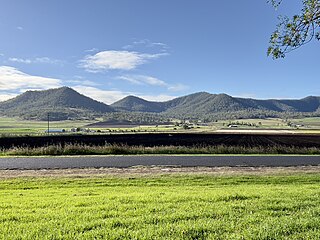
Gladfield is a rural locality in the Southern Downs Region, Queensland, Australia. In the 2021 census, Gladfield had a population of 71 people.
Rywung is a locality in the Western Downs Region, Queensland, Australia. Rywung's postcode is 4413.
Moraby is a locality in the Western Downs Region, Queensland, Australia. In the 2021 census, Moraby had a population of 43 people.
Bungaban is a rural locality in the Western Downs Region, Queensland, Australia. In the 2021 census, Bungaban had a population of 60 people.
Hookswood is a locality in the Western Downs Region, Queensland, Australia. In the 2021 census, Hookswood had a population of 58 people.
Bogandilla is a rural locality in the Western Downs Region, Queensland, Australia. In the 2021 census, Bogandilla had a population of 37 people.
Barramornie is a locality in the Western Downs Region, Queensland, Australia. In the 2021 census, Barramornie had a population of 15 people.
Inglestone is a locality in the Western Downs Region, Queensland, Australia. In the 2021 census, Inglestone had a population of 63 people.
Coomrith is a locality in the Western Downs Region, Queensland, Australia. In the 2021 census, Coomrith had a population of 52 people.

Nandi is a rural locality in the Western Downs Region, Queensland, Australia. In the 2021 census, Nandi had a population of 105 people.
Pine Hills is a rural locality in the Western Downs Region, Queensland, Australia. In the 2021 census, Pine Hills had "no people or a very low population".
Myall Park is a rural locality, north of Miles, in the Western Downs Region, Queensland, Australia. In the 2021 census, Myall Park had a population of 17 people.
Epsom is a rural locality in the Isaac Region, Queensland, Australia. In the 2021 census, Epsom had a population of 21 people.
Durham Downs is a rural locality in the Maranoa Region, Queensland, Australia. In the 2021 census, Durham Downs had a population of 63 people.
Minnie Downs is a rural locality in the Blackall-Tambo Region, Queensland, Australia. In the 2021 census, Minnie Downs had a population of 12 people.
