
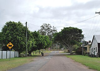
Brigalow is a rural town and locality in the Western Downs Region, Queensland, Australia. In the 2021 census, the locality of Brigalow had a population of 181 people.
Gundiah is a rural town and locality in the Fraser Coast Region, Queensland, Australia. In the 2021 census, the locality of Gundiah had a population of 89 people.

Pampas is a rural locality in the Toowoomba Region, Queensland, Australia. In the 2021 census, Pampas had a population of 78 people.

Colinton is a rural locality in the Somerset Region, Queensland, Australia. In the 2021 census, Colinton had a population of 60 people.
Machine Creek is a rural locality in the Gladstone Region, Queensland, Australia. In the 2021 census, Machine Creek had a population of 131 people.
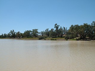
Durham is a rural locality in the Shire of Bulloo, Queensland, Australia. It is on the Queensland border with South Australia. In the 2021 census, Durham had a population of 31 people.
Waverley is an outback locality in the Shire of Boulia, Queensland, Australia. In the 2021 census, Waverley had a population of 6 people.
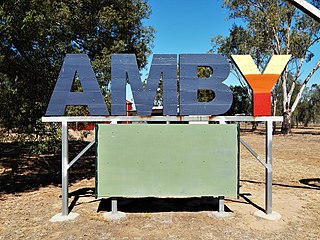
Amby is a rural town and locality in the Maranoa Region, Queensland, Australia. In the 2021 census, the locality of Amby had a population of 49 people.

Cooladdi is a rural town and locality in the Shire of Murweh, Queensland, Australia. The town is 88.9 kilometres (55.2 mi) south-west of Charleville.

Tanbar is an outback locality in the Shire of Barcoo, Queensland, Australia. It is on the corner of Queensland's southern and western border with South Australia. In the 2021 census, Tanbar had "no people or a very low population".
Kogan is a rural town and locality in the Western Downs Region, Queensland, Australia. In the 2021 census, the locality of Kogan had a population of 211 people.
Kragra is a rural locality in the Western Downs Region, Queensland, Australia. In the 2021 census, Kragra had a population of 26 people.
Langlands is a rural locality in the Western Downs Region, Queensland, Australia. In the 2021 census, Langlands had a population of 30 people.
Rywung is a locality in the Western Downs Region, Queensland, Australia. Rywung's postcode is 4413.
Hawkwood is a rural locality in the North Burnett Region, Queensland, Australia. In the 2021 census, Hawkwood had a population of 34 people.
Strathmore is a locality split between the Shire of Mareeba and the Shire of Etheridge, in Queensland, Australia. In the 2021 census, Strathmore had "no people or a very low population".
Jinghi is a rural locality in the Western Downs Region, Queensland, Australia. In the 2021 census, Jinghi had a population of 70 people.
Desailly is a rural locality in the Shire of Mareeba, Queensland, Australia. In the 2021 census, Desailly had "no people or a very low population".
Maramie is a locality in the Shire of Carpentaria, Queensland, Australia. In the 2021 census, Maramie had a population of 28 people.
Kilmorey Falls is a rural locality in the Maranoa Region, Queensland, Australia. In the 2021 census, Kilmorey Falls had a population of 23 people.
