Auburn River National Park is a protected area in the North Burnett Region, Queensland, Australia. It is in the north-east of the locality of Hawkwood extending into southern Dykehead.

Eidsvold is a rural town and locality in the North Burnett Region, Queensland, Australia. The town is the self-proclaimed Beef Capital of the Burnett and is a hub for the regional cattle industry. In the 2016 census, the locality of Eidsvold had a population of 574 people.

The County of Newcastle is a county in the Wide Bay–Burnett region of Queensland, Australia. On 7 March 1901, the Governor issued a proclamation legally dividing Queensland into counties under the Land Act 1897. Its schedule described Newcastle thus:
Bounded on the east by the counties of Mackenzie and Boondooma; on the south by the Main Dividing Range; on the west by the eastern watershed of the Dawson River; on the north by the northern boundaries of the leased parts of Auburn and Hawkwood Runs and the Auburn River from the confluence of Narayen Creek downwards to its junction with the Burnett River.
Ramsay is a rural locality in the Toowoomba Region, Queensland, Australia. In the 2016 census Ramsay had a population of 348 people.
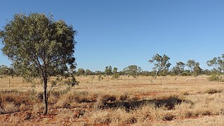
Waverley is an outback locality in the Shire of Boulia, Queensland, Australia. In the 2021 census, Waverley had a population of 6 people.

Ironpot is a rural locality in the South Burnett Region, Queensland, Australia. In the 2016 census Ironpot had a population of 45 people.

Didcot is a rural locality in the North Burnett Region, Queensland, Australia. In the 2021 census, Didcot had a population of 85 people.
Gordonbrook is a rural locality in the South Burnett Region, Queensland, Australia. In the 2021 census, Gordonbrook had a population of 184 people.
Kragra is a rural locality in the Western Downs Region, Queensland, Australia. In the 2021 census, Kragra had a population of 26 people.
Spring Creek is a rural locality in the Shire of Banana, Queensland, Australia. In the 2016 census Spring Creek had a population of 15 people.
Harrami is a rural locality in the North Burnett Region, Queensland, Australia. In the 2021 census, Harrami had a population of 22 people.
Lakeside is a rural locality in the North Burnett Region, Queensland, Australia. In the 2021 census, Lakeside had a population of 69 people.
Mount Steadman is a rural locality in the North Burnett Region, Queensland, Australia. In the 2016 census Mount Steadman had a population of 8 people.

Stonelands is a rural locality in the South Burnett Region, Queensland, Australia. In the 2016 census, Stonelands had a population of 51 people.
Dykehead is a rural locality in the North Burnett Region, Queensland, Australia. In the 2021 census, Dykehead had a population of 13 people.
Sujeewong is a rural locality in the Western Downs Region, Queensland, Australia. In the 2021 census, Sujeewong had a population of 6 people.

Rawbelle is a locality in the North Burnett Region, Queensland, Australia. In the 2021 census, Rawbelle had a population of 51 people.

Coominglah is a rural locality in the North Burnett Region, Queensland, Australia. The land use is grazing on native vegetation.

Mount Alma is a rural locality in the Gladstone Region, Queensland, Australia. In the 2016 census, Mount Alma had a population of 47 people.
Kunwarara is a rural locality in the Livingstone Shire, Queensland, Australia. In the 2021 census, Kunwarara had a population of 69 people.
