
The Burnett River is a river located in the Wide Bay–Burnett and Central Queensland regions of Queensland, Australia.

Biggenden is a rural town and locality in the North Burnett Region, Queensland, Australia. In the 2016 census, Biggenden had a population of 845 people.

Wondai is a rural town and locality in the South Burnett Region, Queensland, Australia. In the 2016 census, Wondai had a population of 1,973 people.
Proston is a rural town and locality in the South Burnett Region, Queensland, Australia. In the 2016 census, Proston had a population of 379 people.

Dundas is a rural locality in the Somerset Region, Queensland, Australia.

Coalstoun Lakes is a rural town and locality in the North Burnett Region, Queensland, Australia. In the 2016 census the locality of Coalstoun Lakes had a population of 114 people.

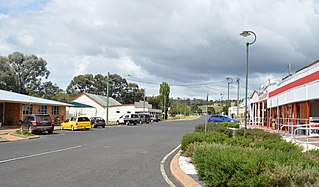
Abercorn is a rural town and locality in the North Burnett Region, Queensland, Australia. In the 2016 census the locality of Abercorn had a population of 46 people.
Wetheron is a rural town and locality in the North Burnett Region, Queensland, Australia. In the 2016 census, Wetheron had a population of 46 people.
Gordonbrook is a locality located in the South Burnett Region, Queensland, Australia.
Boondooma is a rural locality in the South Burnett Region, Queensland, Australia. In the 2016 census, Boondooma had a population of 76 people.
Okeden is a rural locality in the South Burnett Region, Queensland, Australia. In the 2016 census Okeden had a population of 26 people.
Cynthia is a rural town and locality in the North Burnett Region, Queensland, Australia. In the 2016 census, Cynthia had a population of 31 people.

Moffatdale is a rural locality in the South Burnett Region, Queensland, Australia. In the 2016 census Moffatdale had a population of 179 people.
Brigooda is a rural locality in the South Burnett Region, Queensland, Australia. In the 2016 census Brigooda had a population of 36 people.
Coringa is a locality in the North Burnett Region, Queensland, Australia. In the 2016 census, Coringa had a population of 77 people.
Moonford is a town and locality in the North Burnett Region, Queensland, Australia.
Mundowran is a rural locality in the North Burnett Region, Queensland, Australia. In the 2016 census Mundowran had a population of 122 people.
Aranbanga is a rural locality in the North Burnett Region, Queensland, Australia. In the 2016 census, Aranbanga had a population of 10 people.
Cania is a locality in the North Burnett Region, Queensland, Australia. In the 2016 census, Cania had a population of 28 people. The locality includes Cania Gorge National Park and Cania Dam.
Leslie Dam is a locality in the Southern Downs Region, Queensland, Australia. In the 2016 census, Leslie Dam had a population of 163 people.
