Mulgildie

Last updated

Mulgildie
Queensland
Mulgildie Burnett Highway.JPG
The Burnett Highway passing through Mulgildie, 2017
Australia Queensland location map.svg
Red pog.svg
Mulgildie
Coordinates 24°57′51″S151°08′01″E / 24.9641°S 151.1336°E / -24.9641; 151.1336 (Mulgildie (town centre))
Population147 (2021 census) [1]
 • Density2.386/km2 (6.181/sq mi)
Postcode(s) 4630
Area61.6 km2 (23.8 sq mi)
Time zone AEST (UTC+10:00)
Location
LGA(s) North Burnett Region
State electorate(s) Callide
Federal division(s) Flynn
Localities around Mulgildie:
Coominglah Forest Three Moon Splinter Creek
Coominglah Forest Mulgildie Splinter Creek
Selene Selene Tellebang

Mulgildie /ˈmʌlɡɪldi/ (formerly Mulgeldie) is a rural town and locality in the North Burnett Region, Queensland, Australia. [2] [3] In the 2021 census, the locality of Mulgildie had a population of 147 people. [1]

Contents

Geography

The town is located 463 kilometres (288 mi) by road from the state capital, Brisbane. [4] The town is situated within the north of the locality. The Burnett Highway enters the locality from the south-east (Tellebang), passes through the town along Wattle Street and Monal Street, and exits to the north (Three Moon). [5]

Mulgildie railway station is an abandoned railway station on the abandoned Mungar Junction to Monto railway line ( 24°57′46″S151°07′57″E / 24.9627°S 151.1326°E / -24.9627; 151.1326 (Mulgildie railway station (former)) ). [6]

The land use is predominantly grazing on native vegetation with some crop growing. [5]

History

The town was named Mulgeldie in 1925, and is believed to be derived from the Aboriginal name bulgeldee referring to a deep waterhole on Three Moon Creek. The spelling was changed to Mulgildie on 15 March 1945. [2]

A postal receiving office opened in 1902 and closed in 1905. Mulgildie Post Office opened on 6 January 1925, was renamed Mulgeldie in September of that year, reverted to Mulgildie in 1945 and closed in 1991. [7]

The railway line from Mungar Junction to Monto opened to Mulgeldie in 1927. In order to build the extension to Monto, the workers' camp was relocated to Mulgeldie, including the tent school for the children of the workers, becoming Mulgildie Provisional School on 26 September 1927. In 1928, it was decided to establish a permanent school. Land was reserved for the school and a 21-by-18-foot (6.4 by 5.5 m) school building was erected to accommodate 40 students at a cost of £645. The new school building opened on 7 October 1929. On 1 January 1930, it became Mulgeldie State School. [8] [9]

Euruga State School opened on 7 June 1932, but was renamed on 13 June 1932 to Aberfeldie State School. It closed on 26 September 1937. The school building was relocated to Glen Leigh. [8]

Splinter Creek Bridge State School opened on 3 April 1934. It closed on 6 October 1958. [8]

The Mulgildie Hall (also known as the School of Arts) opened on 30 April 1938. [10] [11]

Mulgildie Presbyterian Church was built in 1950. It was at 6 Monal St ( 24°57′49″S151°07′58″E / 24.9636°S 151.1329°E / -24.9636; 151.1329 (Mulgildie Presbyterian Church (former)) ). It is now closed and used as a house. [12]

Mulgildie Anglican Church, 2019 (after closure) Mulgildie Anglican Church 001.JPG
Mulgildie Anglican Church, 2019 (after closure)

St Mark's Anglican Church was dedicated on 10 May 1959 by Venerable Harold John Richards. The timber church was designed by Helmut Breckwoldt, who designed a similar church at Eidsvold. It was noted for its war memorial. Its closure circa 5 September 2009 was approved by Archbishop Phillip Aspinall. It was at 7 Brigalow Street ( 24°57′50″S151°08′03″E / 24.9639°S 151.1341°E / -24.9639; 151.1341 (St Mark's Anglican Church (former)) ). [13]

Demographics

In the 2006 census, the locality of Mulgildie had a population of 114 people. [14]

In the 2016 census, the locality of Mulgildie had a population of 174 people. [15]

In the 2021 census, the locality of Mulgildie had a population of 147 people. [1]

Heritage listings

Mulgildie has a number of heritage-listed sites, including:

Education

Mulgildie State School, 2019 Mulgildie State School 001.JPG
Mulgildie State School, 2019

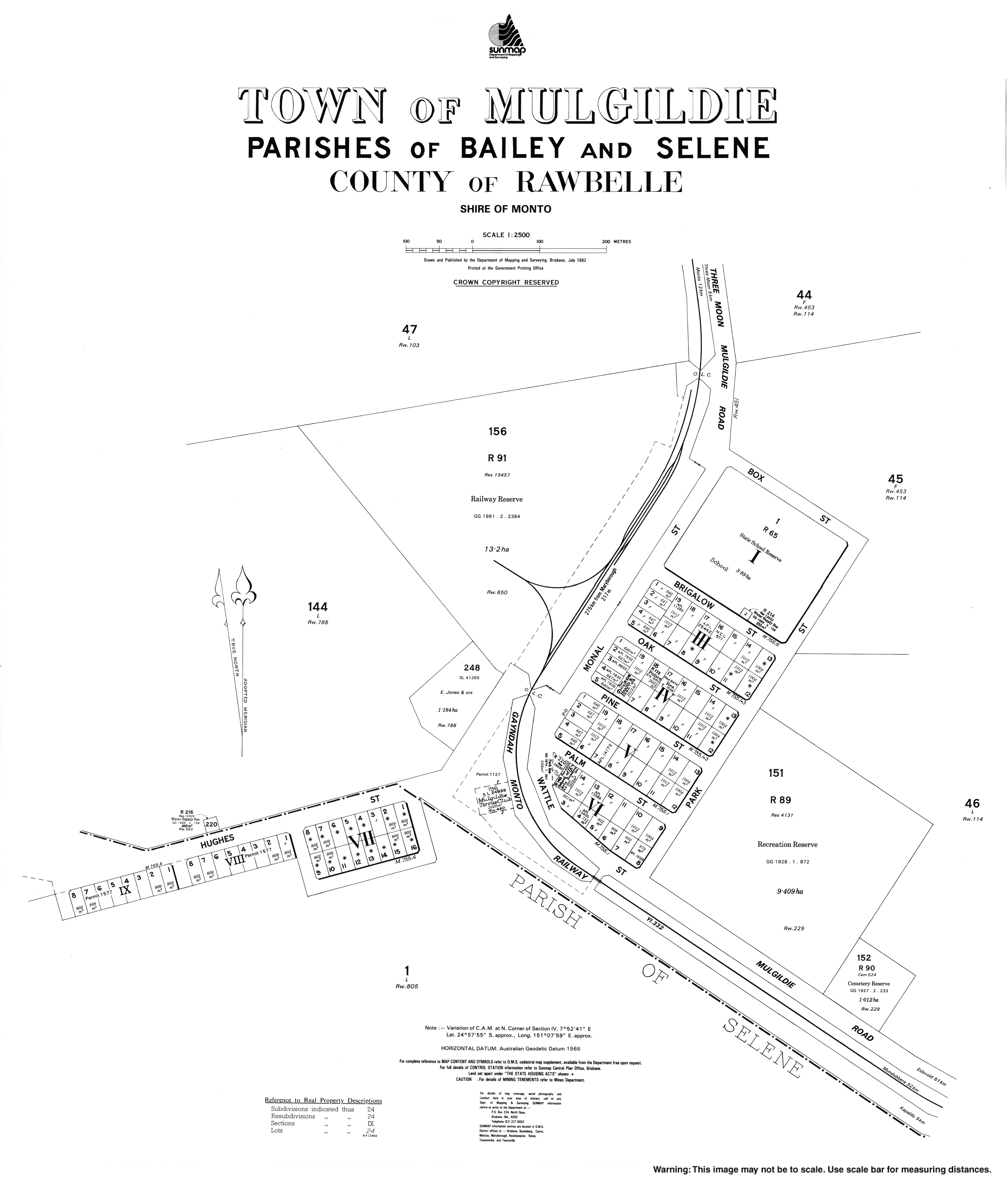
Mulgildie State School is a government primary (Prep-6) school for boys and girls at Brigalow Street ( 24°57′48″S151°08′02″E / 24.9634°S 151.1340°E / -24.9634; 151.1340 (Mulgildie State School) ). [16] [17] In 2017, the school had an enrolment of 25 students with 4 teachers (2 full-time equivalent) and 6 non-teaching staff (3 full-time equivalent). [18] In 2018, the school had an enrolment of 19 students with 2 teachers and 5 non-teaching staff (2 full-time equivalent). [19]

There is no secondary school in Mulgildie. The nearest secondary school is Monto State High School in Monto to the north. [5]

Amenities

Mulgildie Cemetery, 2014 Mulgildie Cemetery, Burnett Highway, 2014 02.jpg
Mulgildie Cemetery, 2014

The Mulgildie branch of the Queensland Country Women's Association meets at the QCWA Rooms at 14 Pine Street ( 24°57′52″S151°07′57″E / 24.9645°S 151.1325°E / -24.9645; 151.1325 (CWA Hall) ). [20] [21]

Mulgildie Cemetery is at 29952 Burnett Highway ( 24°58′08″S151°08′08″E / 24.9689°S 151.1356°E / -24.9689; 151.1356 (Mulgildie Cemetery) ). [22]

The Mulgildie Hall is used for movies, dances, functions and meetings. It is at 13 Palm Street ( 24°57′56″S151°07′53″E / 24.9656°S 151.1315°E / -24.9656; 151.1315 (Mulgildie Hall) ). [10]

Attractions

Bunyip statue, 2014 Bunyip statue.jpg
Bunyip statue, 2014

The sculpture of the Mulgildie Bunyip is on the roadside in Wattle Street (opposite Palm Street, 24°57′54″S151°07′52″E / 24.96495°S 151.13109°E / -24.96495; 151.13109 (Bunyip statue) ). [23] Tourists are encouraged to visit the Bunyip's watering hole approximately 10 minutes drive from Mulgildie, a place renowned for strange bubbling and churning waters and the subsequent disappearance of livestock. [24]

Related Research Articles

<span class="mw-page-title-main">Eidsvold, Queensland</span> Town in Queensland, Australia

Eidsvold is a rural town and locality in the North Burnett Region, Queensland, Australia. The town is the self-proclaimed Beef Capital of the Burnett and is a hub for the regional cattle industry. In the 2021 census, the locality of Eidsvold had a population of 538 people.

<span class="mw-page-title-main">Monto, Queensland</span> Town in Queensland, Australia

Monto is a rural town and locality in the North Burnett Region, Queensland, Australia. In the 2021 census, the locality of Monto had a population of 1,156 people.

<span class="mw-page-title-main">Boyne Valley, Queensland</span> Suburb of Gladstone Region, Queensland, Australia

The Boyne Valley is a rural locality in Gladstone Region, Queensland, Australia. The locality contains four small towns: Nagoorin, Ubobo, Builyan, and Many Peaks. In the 2021 census, Boyne Valley had a population of 301 people.

<span class="mw-page-title-main">Degilbo</span> Town in Queensland, Australia

Degilbo is a rural town and locality in the North Burnett Region, Queensland, Australia. In the 2021 census, the locality of Degilbo had a population of 182 people.

<span class="mw-page-title-main">Ideraway</span> Town in Queensland, Australia

Ideraway is a rural town and locality in the North Burnett Region, Queensland, Australia. In the 2021 census, the locality of Ideraway had a population of 31 people.

<span class="mw-page-title-main">Didcot, Queensland</span> Suburb of North Burnett Region, Queensland, Australia

Didcot is a rural locality in the North Burnett Region, Queensland, Australia. In the 2021 census, Didcot had a population of 85 people.

Wetheron is a rural town and locality in the North Burnett Region, Queensland, Australia. In the 2021 census, the locality of Wetheron had a population of 40 people.

Cynthia is a rural town and locality in the North Burnett Region, Queensland, Australia. In the 2021 census, the locality of Cynthia had a population of 13 people.

Coolabunia is a rural locality in the South Burnett Region, Queensland, Australia.

<span class="mw-page-title-main">Kalpowar</span> Town in Queensland, Australia

Kalpowar is a town in the North Burnett Region and a locality split between the North Burnett Region and the Bundaberg Region, in Queensland, Australia. In the 2021 census, the locality of Kalpowar had a population of 53 people.

<span class="mw-page-title-main">Bancroft, Queensland</span> Suburb of North Burnett Region, Queensland, Australia

Bancroft is a rural locality in the North Burnett Region, Queensland, Australia. In the 2021 census, Bancroft had a population of 98 people.

Cannindah is a rural locality in the North Burnett Region, Queensland, Australia. In the 2021 census, Cannindah had a population of 35 people.

Kapaldo is a rural town and locality in the North Burnett Region, Queensland, Australia. In the 2021 census, the locality of Kapaldo had a population of 41 people.

Moonford is a rural town and locality in the North Burnett Region, Queensland, Australia. In the 2021 census, the locality of Moonford had a population of 162 people.

Riverleigh is a rural locality in the North Burnett Region, Queensland, Australia. In the 2021 census, Riverleigh had a population of 95 people.

<span class="mw-page-title-main">Mungungo</span> Town in Queensland, Australia

Mungungo is a rural town and locality in the North Burnett Region, Queensland, Australia. In the 2021 census, the locality of Mungungo had a population of 84 people.

Grosvenor is a locality in the North Burnett Region, Queensland, Australia. In the 2021 census, Grosvenor had a population of 29 people.

Monal is a locality in the North Burnett Region, Queensland, Australia. In the 2021 census, Monal had a population of 34 people.

Selene is a rural locality in the North Burnett Region, Queensland, Australia. In the 2021 census, Selene had a population of 27 people.

Yarrol is a rural locality in the North Burnett Region, Queensland, Australia. In the 2021 census, Yarrol had a population of 15 people.

References

  1. 1 2 3 Australian Bureau of Statistics (28 June 2022). "Mulgildie (SAL)". 2021 Census QuickStats. Retrieved 28 February 2023. OOjs UI icon edit-ltr-progressive.svg
  2. 1 2 "Mulgildie – town in North Burnett Region (entry 23350)". Queensland Place Names. Queensland Government . Retrieved 2 August 2019.
  3. "Mulgildie – locality in North Burnett Region (entry 47370)". Queensland Place Names. Queensland Government . Retrieved 2 August 2019.
  4. Google (14 November 2022). "Brisbane to Mulgildie via M1 and Burnett Hwy/A3" (Map). Google Maps . Google. Retrieved 14 November 2022.
  5. 1 2 3 "Queensland Globe". State of Queensland . Retrieved 14 November 2022.
  6. "Railway stations and sidings - Queensland". Queensland Open Data. Queensland Government. 2 October 2020. Archived from the original on 5 October 2020. Retrieved 5 October 2020.
  7. Premier Postal History. "Post Office List". Premier Postal Auctions. Retrieved 10 May 2014.
  8. 1 2 3 Queensland Family History Society (2010), Queensland schools past and present (Version 1.01 ed.), Queensland Family History Society, ISBN   978-1-921171-26-0
  9. "History". Mulgildie State School. 13 August 2019. Retrieved 5 April 2024.
  10. 1 2 3 4 5 "North Burnett Local Heritage Register" (PDF). North Burnett Regional Council. Archived (PDF) from the original on 16 August 2019. Retrieved 16 August 2019.
  11. Colahan, Mackenzie (7 April 2018). "Mulgildie landmark celebrates 80 years". The Courier-Mail . Archived from the original on 14 November 2022. Retrieved 14 November 2022.
  12. Blake, Thom. "Mulgildie Presbyterian Church". Queensland religious places database. Retrieved 22 September 2022.
  13. Anglican Church of Southern Queensland. "Closed Churches". Archived from the original on 3 April 2019. Retrieved 3 July 2020.
  14. Australian Bureau of Statistics (25 October 2007). "Mulgildie (Monto Shire) (State Suburb)". 2006 Census QuickStats. Retrieved 25 October 2007.
  15. Australian Bureau of Statistics (27 June 2017). "Mulgildie (SSC)". 2016 Census QuickStats. Retrieved 20 October 2018. OOjs UI icon edit-ltr-progressive.svg
  16. "State and non-state school details". Queensland Government. 9 July 2018. Archived from the original on 21 November 2018. Retrieved 21 November 2018.
  17. "Mulgildie State School". Mulgildie State School. 8 August 2019. Retrieved 14 November 2022.
  18. "ACARA School Profile 2017". Archived from the original on 22 November 2018. Retrieved 22 November 2018.
  19. "ACARA School Profile 2018". Australian Curriculum, Assessment and Reporting Authority . Retrieved 28 January 2020.
  20. "Branch Locations". Queensland Country Women's Association . Retrieved 26 December 2018.
  21. "QCWA Mulgildie Branch" . Retrieved 14 November 2022.
  22. "Cemetery Areas - Queensland". Queensland Open Data. Queensland Government. 12 November 2020. Archived from the original on 15 November 2020. Retrieved 12 November 2020.
  23. "Mulgildie Bunyip Statue - Monto Magic". 1 April 2017. Retrieved 14 November 2022.
  24. "The Bunyip Legend of Mulgildie - Monto Magic". 26 March 2017. Retrieved 14 November 2022.

Further reading

Commons-logo.svg Media related to Mulgildie at Wikimedia Commons