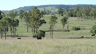
North Maclagan is a rural locality in the Toowoomba Region, Queensland, Australia. In the 2021 census, North Maclagan had "no people or a very low population".
Brovinia is a rural locality in the North Burnett Region, Queensland, Australia. In the 2021 census, Brovinia had "no people or a very low population".

Mundowran is a rural locality in the North Burnett Region, Queensland, Australia. In the 2021 census, Mundowran had a population of 119 people.
Oakdale is a rural locality in the South Burnett Region, Queensland, Australia. In the 2021 census, Oakdale had a population of 49 people.
Dykehead is a rural locality in the North Burnett Region, Queensland, Australia. In the 2021 census, Dykehead had "no people or a very low population".
Blairmore is a locality in the North Burnett Region, Queensland, Australia. In the 2021 census, Blairmore had "no people or a very low population".
Campbell Creek is a locality in the North Burnett Region, Queensland, Australia. In the 2021 census, Campbell Creek had "no people or a very low population".
Barlyne is a locality in the North Burnett Region, Queensland, Australia. In the 2021 census, Barlyne had "no people or a very low population".
Penwhaupell is a locality in the North Burnett Region, Queensland, Australia. In the 2021 census, Penwhaupell had "no people or a very low population".
Pile Gully is a rural locality in the North Burnett Region, Queensland, Australia. In the 2021 census, Pile Gully had "no people or a very low population".
Harriet is a rural locality in the North Burnett Region, Queensland, Australia. In the 2021 census, Harriet had "no people or a very low population".
Coominglah Forest is a rural locality in the North Burnett Region, Queensland, Australia. In the 2021 census, Coominglah Forest had "no people or a very low population".
Mungy is a rural locality in the North Burnett Region, Queensland, Australia. In the 2021 census, Mungy had "no people or a very low population".
Stockhaven is a rural locality in the North Burnett Region, Queensland, Australia. In the 2021 census, Stockhaven had "no people or a very low population".
Wahoon is a rural locality in the North Burnett Region, Queensland, Australia. In the 2021 census, Wahoon had "no people or a very low population".
Wateranga is a rural locality in the North Burnett Region, Queensland, Australia. In the 2021 census, Wateranga had "no people or a very low population".
Toondahra is a rural locality in the North Burnett Region, Queensland, Australia. In the 2021 census, Toondahra had "no people or a very low population".
Cobbs Hill is a rural locality in the South Burnett Region, Queensland, Australia. In the 2021 census, Cobbs Hill had "no people or a very low population".
Halliford is a rural locality in the Western Downs Region, Queensland, Australia. In the 2021 census, Halliford had a population of 4 people.
Fletcher Creek is a rural locality in the Rockhampton Region, Queensland, Australia. In the 2021 census, Fletcher Creek had "no people or a very low population".

