Wilson Valley, Queensland

Last updated

Wilson Valley
Queensland
Australia Queensland location map.svg
Red pog.svg
Wilson Valley
Coordinates 25°33′09″S151°51′14″E / 25.5525°S 151.8538°E / -25.5525; 151.8538 (Wilson Valley (centre of locality))
Population20 (SAL 2021) [1]
Postcode(s) 4625
Area38.1 km2 (14.7 sq mi)
Time zone AEST (UTC+10:00)
Location
LGA(s) North Burnett Region
State electorate(s) Callide
Federal division(s) Flynn
Suburbs around Wilson Valley:
Gooroolba Didcot Didcot
Gooroolba Wilson Valley Didcot
Ginoondan Coalstoun Lakes Coalstoun Lakes

Wilson Valley is a rural locality in the North Burnett Region, Queensland, Australia. [2] In the 2021 census, Wilson Valley had a population of 20 people. [3]

Contents

Geography

The locality is loosely bounded from the north to the south-east by the Bin Bin Range. [4]

The terrain varies from 150 to 360 metres (490 to 1,180 ft) above sea level with the higher elevations near the Bin Bin Range and the lower elevations in the south-west of the locality. The land use is grazing on native vegetation. [5]

History

The locality takes its name from its school, which was named Wilson Valley after Sam Wilson, described as the "founder of the valley" and who was then enlisted for military service in World War I. [6]

Although approval to establish the school was refused in July 1916 due to some of the students leaving the district resulting in too few students for the 18 required to establish a school, [7] Mr J. Stines offered to building a provisional school building at his own expanse on his own land, an offer accepted by the government. [8] Wilson Valley Provisional School opened on 4 October 1916 under teacher Mrs W. Brown junior. [9] [10] In June 1818, the government agreed to erect a state school building. [11] On 1 October 1918, it became Wilson Valley State School. [12] [13] The school closed on 14 May 1944. [14] [15] It was on Fowlers Road ( 25°33′02″S151°50′19″E / 25.55058°S 151.83853°E / -25.55058; 151.83853 (Wilson Valley State School (former)) ). [16] [17] [18]

Demographics

In the 2016 census, Wilson Valley had a population of 14 people. [19]

In the 2021 census, Wilson Valley had a population of 20 people. [3]

Education

There are no schools in Wilson Valley. The nearest government primary school is Coalstoun Lakes State School in neighbouring Coalstoun Lakes to the south-east. The nearest government secondary schools are Biggenden State School (to Year 10) in Biggenden to the east and Burnett State College (to Year 12) in Gayndah to the south-west. [20]

Related Research Articles

<span class="mw-page-title-main">Biggenden</span> Town in Queensland, Australia

Biggenden is a rural town and locality in the North Burnett Region, Queensland, Australia. In the 2021 census, the locality of Biggenden had a population of 788 people.

<span class="mw-page-title-main">Shire of Woocoo</span> Local government area in Queensland, Australia

The Shire of Woocoo was a local government area located in the Wide Bay–Burnett region of Queensland, Australia, containing the rural residential area to the west of the town of Maryborough, and surrounding countryside. The shire covered an area of 2,007.9 square kilometres (775.3 sq mi), and existed as a local government entity from 1914 until 2008, when it was amalgamated with the City of Maryborough, City of Hervey Bay and the 1st and 2nd divisions of the Shire of Tiaro to form the Fraser Coast Region.

<span class="mw-page-title-main">Brooweena, Queensland</span> Town in Queensland, Australia

Brooweena is a rural town and locality in the Fraser Coast Region, Queensland, Australia. In the 2021 census, the locality of Brooweena had a population of 91 people.

<span class="mw-page-title-main">Tinana, Queensland</span> Town in Queensland, Australia

Tinana is a rural town and locality in the Fraser Coast Region, Queensland, Australia. In the 2021 census, the locality of Tinana had a population of 5,872 people.

<span class="mw-page-title-main">Coalstoun Lakes, Queensland</span> Town in Queensland, Australia

Coalstoun Lakes is a rural town and locality in the North Burnett Region, Queensland, Australia. In the 2016 census, the locality of Coalstoun Lakes had a population of 114 people.

<span class="mw-page-title-main">Didcot, Queensland</span> Suburb of North Burnett Region, Queensland, Australia

Didcot is a rural locality in the North Burnett Region, Queensland, Australia. In the 2016 census Didcot had a population of 60 people.

Wetheron is a rural town and locality in the North Burnett Region, Queensland, Australia. In the 2016 census, Wetheron had a population of 46 people.

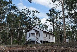
Dallarnil is a rural town and locality in the North Burnett Region, Queensland, Australia. In the 2016 census, Dallarnil had a population of 230 people.

Granville is a rural locality in the Fraser Coast Region, Queensland, Australia. It is a suburb of Maryborough. In the 2016 census Granville had a population of 2,716 people.

Tinana South is a rural locality in the Fraser Coast Region, Queensland, Australia. In the 2021 census, Tinana South had a population of 545 people.

Aramara is a rural town and locality in the Fraser Coast Region, Queensland, Australia. In the 2016 census, the locality of Aramara had a population of 57 people.

Boompa is a rural locality in the Fraser Coast Region, Queensland, Australia. In the 2021 census, Boompa had a population of 89 people.

Mount Steadman is a rural locality in the North Burnett Region, Queensland, Australia. In the 2016 census Mount Steadman had a population of 8 people.

Riverleigh is a rural locality in the North Burnett Region, Queensland, Australia. In the 2016 census, Riverleigh had a population of 80 people.

Stalworth is a rural locality in the South Burnett Region, Queensland, Australia. In the 2021 census, Stalworth had a population of 37 people.

<span class="mw-page-title-main">Teebar, Queensland</span> Suburb of Fraser Coast Region, Queensland, Australia

Teebar is a rural locality in the Fraser Coast Region, Queensland, Australia. In the 2021 census, Teebar had a population of 59 people.

Teddington is a rural locality in the Fraser Coast Region, Queensland, Australia. In the 2021 census, Teddington had a population of 236 people.

Island Plantation is a rural locality in the Fraser Coast Region, Queensland, Australia. In the 2021 census, Island Plantation had a population of 155 people.

Gungaloon is a locality in the Fraser Coast Region, Queensland, Australia. In the 2016 census, Gungaloon had a population of 33 people.

Mount Lawless is a rural locality in the North Burnett Region, Queensland, Australia. In the 2021 census, Mount Lawless had a population of 9 people.

References

  1. Australian Bureau of Statistics (28 June 2022). "Wilson Valley (suburb and locality)". Australian Census 2021 QuickStats. Retrieved 28 June 2022.  OOjs UI icon edit-ltr-progressive.svg
  2. "Wilson Valley – locality in North Burnett Region (entry 45425)". Queensland Place Names. Queensland Government . Retrieved 2 August 2019.
  3. 1 2 Australian Bureau of Statistics (28 June 2022). "Wilson Valley (SAL)". 2021 Census QuickStats. Retrieved 28 February 2023. OOjs UI icon edit-ltr-progressive.svg
  4. "Layers: Locality; Mountains and ranges; Contours; Watercourses". Queensland Globe. Queensland Government. Archived from the original on 19 December 2017. Retrieved 16 March 2024.
  5. "Layers: Locality; Protected areas and forests; Land use". Queensland Globe. Queensland Government. Archived from the original on 19 December 2017. Retrieved 16 March 2024.
  6. "GOOROOLBA". Maryborough Chronicle, Wide Bay And Burnett Advertiser . No. 13, 248. Queensland, Australia. 10 November 1915. p. 3. Retrieved 16 March 2024 via National Library of Australia.
  7. "GOOROOLBA". Maryborough Chronicle, Wide Bay And Burnett Advertiser . No. 13, 462. Queensland, Australia. 20 July 1916. p. 8. Retrieved 16 March 2024 via National Library of Australia.
  8. "GOOROOLBA". Maryborough Chronicle, Wide Bay And Burnett Advertiser . No. 13, 522. Queensland, Australia. 27 September 1916. p. 8. Retrieved 16 March 2024 via National Library of Australia.
  9. "GOOROOLBA". Maryborough Chronicle, Wide Bay And Burnett Advertiser . No. 13, 434. Queensland, Australia. 17 June 1916. p. 6. Archived from the original on 16 March 2024. Retrieved 16 March 2024 via National Library of Australia.
  10. "GOOROOLBA". Maryborough Chronicle, Wide Bay And Burnett Advertiser . No. 13, 530. Queensland, Australia. 6 October 1916. p. 6. Archived from the original on 16 March 2024. Retrieved 16 March 2024 via National Library of Australia.
  11. "SCHOOL FOR WILSON VALLEY". Maryborough Chronicle, Wide Bay And Burnett Advertiser . No. 14, 066. Queensland, Australia. 22 June 1918. p. 7. Archived from the original on 16 March 2024. Retrieved 16 March 2024 via National Library of Australia.
  12. "GOOROOLBA". Maryborough Chronicle, Wide Bay And Burnett Advertiser . No. 14, 215. Queensland, Australia. 13 December 1918. p. 4. Archived from the original on 16 March 2024. Retrieved 16 March 2024 via National Library of Australia.
  13. "WILSON VALLEY STATE SCHOOL". Maryborough Chronicle, Wide Bay And Burnett Advertiser . No. 14, 228. Queensland, Australia. 1 January 1919. p. 6. Archived from the original on 16 March 2024. Retrieved 16 March 2024 via National Library of Australia.
  14. Queensland Family History Society (2010), Queensland schools past and present (Version 1.01 ed.), Queensland Family History Society, ISBN   978-1-921171-26-0
  15. "Agency ID 9277, Wilson Valley State School". Queensland State Archives . Retrieved 16 March 2024.
  16. "Queensland Two Mile series sheet 2m115" (Map). Queensland Government. 1933. Archived from the original on 24 December 2023. Retrieved 16 March 2024.
  17. "Gayndah" (Map). Queensland Government. 1944. Archived from the original on 24 December 2023. Retrieved 16 March 2024.
  18. "Layers: Locality; Road and rail; Watercourse; Land parcel". Queensland Globe. Queensland Government. Archived from the original on 19 December 2017. Retrieved 16 March 2024.
  19. Australian Bureau of Statistics (27 June 2017). "Wilson Valley (SSC)". 2016 Census QuickStats. Retrieved 20 October 2018. OOjs UI icon edit-ltr-progressive.svg
  20. "Layers: Locality; Schools and school catchments". Queensland Globe. Queensland Government. Archived from the original on 19 December 2017. Retrieved 16 March 2024.