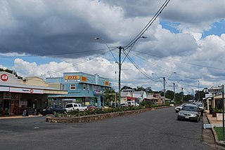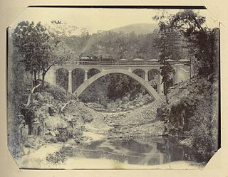
Biggenden is a rural town and locality in the North Burnett Region, Queensland, Australia. In the 2021 census, the locality of Biggenden had a population of 788 people.

Mount Perry is a rural town and locality in the North Burnett Region, Queensland, Australia. In the 2021 census, the locality of Mount Perry had a population of 487 people.

The Shire of Biggenden was a local government area located in the northern catchment of the Burnett River, Queensland, Australia, 100 kilometres (62 mi) south-southwest of the regional city of Bundaberg. The shire covered an area of 1,314.5 square kilometres (507.5 sq mi), and existed as a local government area from 1905 until 2008, when it amalgamated with several other shires to become the North Burnett Region.

Brooweena is a rural town and locality in the Fraser Coast Region, Queensland, Australia. In the 2021 census, the locality of Brooweena had a population of 91 people.

The Mungar Junction to Monto railway line is a 267-kilometre (166 mi) railway in Queensland, Australia. Progressively opened in eleven stages between 1889 and 1928 the line branched from the North Coast line at Mungar Junction a short distance west of Maryborough and followed a westerly route towards Biggenden and Gayndah before turning north via Mundubbera and Eidsvold to Monto. It is also known as the Gayndah Monto Branch Railway. In 2012, the line was officially closed.

Degilbo is a rural town and locality in the North Burnett Region, Queensland, Australia. In the 2021 census, the locality of Degilbo had a population of 182 people.

Oakwood is a rural locality in the Bundaberg Region, Queensland, Australia. In the 2021 census, Oakwood had a population of 364 people.
Sharon is a rural locality in the Bundaberg Region, Queensland, Australia. In the 2021 census, Sharon had a population of 1,209 people.

Didcot is a rural locality in the North Burnett Region, Queensland, Australia. In the 2021 census, Didcot had a population of 85 people.
Owanyilla is a rural town and locality in the Fraser Coast Region, Queensland, Australia. In the 2021 census, the locality of Owanyilla had a population of 245 people.

Dallarnil is a rural town and locality in the North Burnett Region, Queensland, Australia. In the 2021 census, the locality of Dallarnil had a population of 245 people.
Coringa is a rural locality in the North Burnett Region, Queensland, Australia. In the 2021 census, Coringa had a population of 86 people.
Lakeside is a rural locality in the North Burnett Region, Queensland, Australia. In the 2021 census, Lakeside had a population of 69 people.
White Mountain is a rural locality in the Lockyer Valley Region, Queensland, Australia. In the 2021 census, White Mountain had a population of 16 people.
Ban Ban is a rural locality in the North Burnett Region, Queensland, Australia. In the 2021 census, Ban Ban had a population of 25 people.
Dirnbir is a rural locality in the North Burnett Region, Queensland, Australia. In the 2021 census, Dirnbir had a population of 59 people.
Golden Fleece is a locality in the North Burnett Region, Queensland, Australia. In the 2021 census, Golden Fleece had a population of 45 people.

Teebar is a rural locality in the Fraser Coast Region, Queensland, Australia. In the 2021 census, Teebar had a population of 59 people.
Gungaloon is a locality in the Fraser Coast Region, Queensland, Australia. In the 2021 census, Gungaloon had a population of 27 people.
Dunmora is a rural locality in the Fraser Coast Region, Queensland, Australia. In the 2021 census, Dunmora had a population of 281 people.


