Cania, Queensland

Last updated

Cania
Queensland
Dragon Cave, Cania Gorge National Park, Monto.jpg
Dragon Cave, Cania Gorge National Park
Australia Queensland location map.svg
Red pog.svg
Cania
Coordinates 24°34′54″S150°59′39″E / 24.5816°S 150.9941°E / -24.5816; 150.9941 (Cania (centre of locality))
Population27 (2021 census) [1]
 • Density0.0573/km2 (0.1484/sq mi)
Postcode(s) 4630
Area471.1 km2 (181.9 sq mi)
Time zone AEST (UTC+10:00)
Location
LGA(s) North Burnett Region
State electorate(s) Callide
Federal division(s) Flynn
Suburbs around Cania:
Valentine Plains Tablelands Boyne Valley
Lawgi Dawes Cania Monal
Coominglah Coominglah Forest Moonford

Cania is a locality in the North Burnett Region, Queensland, Australia. [2] In the 2021 census, Cania had a population of 27 people. [1]

Contents

Geography

Cania Dam, 2021 Cania Dam 2021.jpg
Cania Dam, 2021

Three Moon Creek rises in the north of the locality ( 24°23′54″S151°02′44″E / 24.39831°S 151.04558°E / -24.39831; 151.04558 (Three Moon Creek (source)) ) and flows south through the locality into Lake Cania, created by the Cania Dam in the south of the locality ( 24°39′00″S150°59′09″E / 24.65004°S 150.98592°E / -24.65004; 150.98592 (Cania Dam) ). [3]

There are a number of protected areas in Cania: [4]

History

Thomas Archer was the first European to explore the headwaters of the Burnett River in the 1840s. [5]

Cania pastoral station was established in the 1850s raising sheep until 1883, after which beef and dairy cattle were added. [6]

Gold was discovered in the Cania Gorge in 1870. [7] The gold mining town of Cania was established near Three Moon Creek and gold mining continued there until the early 1920s. [6]

Cania Provisional School opened in 1890. It became Cania State School on 1 January 1909. Due to low attendance numbers, it closed in 1930. [8]

The construction of the Cania Dam across Three Moon Creek in 1982 flooded the former town of Cania. However, headstones from the town's cemetery were relocated to the dam lookout. [9] At low water levels, the tops of some of the town's buildings become visible, which last occurred in 2010. [6]

Demographics

In the 2016 census, Cania had a population of 28 people. [10]

In the 2021 census, Cania had a population of 27 people. [1]

Education

There are no schools in Cania. The nearest government primary school is Monto State School in Monto to the south-east. The nearest government secondary school is Monto State High School, also in Monto. However, some parts of Cania are too far from Monto for a daily commute, so distance education and boarding school are other options. [4]

Amenities

There is boat ramp into the Cania Dam ( 24°38′52″S150°58′55″E / 24.6477°S 150.9820°E / -24.6477; 150.9820 (Cania Dam boat ramp) ). It is managed by the North Burnett Regional Council. [11]

Attractions

There are numerous lookouts in Cania:

Related Research Articles

<span class="mw-page-title-main">Cania Gorge National Park</span> Protected area in Queensland, Australia

Cania Gorge is a national park in the North Burnett Region, Queensland, Australia, in the locality of Cania.

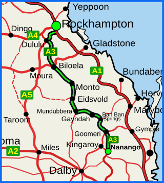
<span class="mw-page-title-main">Burnett Highway</span> Highway in Queensland, Australia

The Burnett Highway is an inland rural highway located in Queensland, Australia. The highway runs from its junction with the Bruce Highway at Gracemere, just south of Rockhampton, to the D'Aguilar Highway in Nanango. Its length is approximately 542 kilometres. The highway takes its name from the Burnett River, which it crosses in Gayndah. The Burnett Highway provides the most direct link between the northern end of the New England Highway and Rockhampton. It is designated as a State Strategic Road by the Queensland Government.

<span class="mw-page-title-main">Monto, Queensland</span> Town in Queensland, Australia

Monto is a rural town and locality in the North Burnett Region, Queensland, Australia. In the 2021 census, the locality of Monto had a population of 1,156 people.

<span class="mw-page-title-main">Mulgildie</span> Town in Queensland, Australia

Mulgildie is a rural town and locality in the North Burnett Region, Queensland, Australia. In the 2021 census, the locality of Mulgildie had a population of 147 people.

<span class="mw-page-title-main">Boyne Valley, Queensland</span> Suburb of Gladstone Region, Queensland, Australia

The Boyne Valley is a rural locality in Gladstone Region, Queensland, Australia. The locality contains four small towns: Nagoorin, Ubobo, Builyan, and Many Peaks. In the 2021 census, Boyne Valley had a population of 301 people.

<span class="mw-page-title-main">Builyan, Queensland</span> Town in Queensland, Australia

Builyan is a town in Gladstone Region, Central Queensland, Australia. It is one of four small townships within the locality of Boyne Valley along with Nagoorin, Ubobo, and Many Peaks.

Cania Dam is a dam in central Queensland, Australia, 37 kilometres (23 mi) north west of Monto, in the locality of Cania. The dam is situated on Three Moon Creek, a tributary of the Burnett River. The dam wall is an earth and rock-fill embankment type. It has a surface area of 7.6 square kilometres, an average depth of 12 metres (39 ft) and a capacity of 88,580 ML. The dam is named after the abandoned gold mining town of Cania, which was inundated by the lake as it filled.

Humphery is a rural locality in the North Burnett Region, Queensland, Australia. In the 2021 census, Humphery had a population of 24 people.

Cynthia is a rural town and locality in the North Burnett Region, Queensland, Australia. In the 2021 census, the locality of Cynthia had a population of 13 people.

<span class="mw-page-title-main">Moffatdale, Queensland</span> Suburb of South Burnett Region, Queensland, Australia

Moffatdale is a rural locality in the South Burnett Region, Queensland, Australia. In the 2021 census, Moffatdale had a population of 257 people.
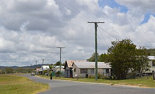
<span class="mw-page-title-main">Kalpowar</span> Town in Queensland, Australia

Kalpowar is a town in the North Burnett Region and a locality split between the North Burnett Region and the Bundaberg Region, in Queensland, Australia. In the 2021 census, the locality of Kalpowar had a population of 53 people.

<span class="mw-page-title-main">Bancroft, Queensland</span> Suburb of North Burnett Region, Queensland, Australia

Bancroft is a rural locality in the North Burnett Region, Queensland, Australia. In the 2021 census, Bancroft had a population of 98 people.

Harrami is a rural locality in the North Burnett Region, Queensland, Australia. In the 2021 census, Harrami had a population of 22 people.

Kapaldo is a rural town and locality in the North Burnett Region, Queensland, Australia. In the 2021 census, the locality of Kapaldo had a population of 41 people.

Moonford is a rural town and locality in the North Burnett Region, Queensland, Australia. In the 2021 census, the locality of Moonford had a population of 162 people.

<span class="mw-page-title-main">Mungungo</span> Town in Queensland, Australia

Mungungo is a rural town and locality in the North Burnett Region, Queensland, Australia. In the 2021 census, the locality of Mungungo had a population of 84 people.

<span class="mw-page-title-main">Valentine Plains</span> Suburb of Shire of Banana, Queensland, Australia

Valentine Plains is a rural locality in the Shire of Banana, Queensland, Australia. In the 2021 census, Valentine Plains had a population of 373 people.

<span class="mw-page-title-main">Lawgi Dawes</span> Suburb of Shire of Banana, Queensland, Australia

Lawgi Dawes is a rural locality in the Shire of Banana, Queensland, Australia. It contains the neighbourhood of Lawgi, a former town.

Monal is a locality in the North Burnett Region, Queensland, Australia. In the 2021 census, Monal had a population of 34 people.

<span class="mw-page-title-main">Coominglah, Queensland</span> Suburb of North Burnett Region, Queensland, Australia

Coominglah is a rural locality in the North Burnett Region, Queensland, Australia. The land use is grazing on native vegetation.

References

  1. 1 2 3 Australian Bureau of Statistics (28 June 2022). "Cania (SAL)". 2021 Census QuickStats. Retrieved 28 February 2023. OOjs UI icon edit-ltr-progressive.svg
  2. "Cania – locality in North Burnett Region (entry 45327)". Queensland Place Names. Queensland Government . Retrieved 30 March 2019.
  3. Google (29 July 2019). "Cania, Queensland" (Map). Google Maps . Google. Retrieved 29 July 2019.
  4. 1 2 "Queensland Globe". State of Queensland . Retrieved 27 August 2023.
  5. Mennell, Philip (1892). "Archer, Thomas"  . The Dictionary of Australasian Biography. London: Hutchinson & Co via Wikisource.
  6. 1 2 3 "Cania Gorge & National Park - Monto Magic". 8 March 2017. Archived from the original on 24 March 2023. Retrieved 27 August 2023.
  7. "MINING". Maryborough Chronicle, Wide Bay And Burnett Advertiser . No. 895. Queensland, Australia. 30 April 1870. p. 3. Archived from the original on 27 August 2023. Retrieved 28 August 2023 via National Library of Australia.
  8. Queensland Family History Society (2010), Queensland schools past and present (Version 1.01 ed.), Queensland Family History Society, ISBN   978-1-921171-26-0
  9. 1 2 "Cania Dam". Sunwater. Archived from the original on 20 March 2023. Retrieved 27 August 2023.
  10. Australian Bureau of Statistics (27 June 2017). "Cania (SSC)". 2016 Census QuickStats. Retrieved 20 October 2018. OOjs UI icon edit-ltr-progressive.svg
  11. "Recreational Boating Facilities Queensland". Queensland Open Data. Queensland Government. 12 November 2020. Archived from the original on 22 November 2020. Retrieved 22 November 2020.
  12. 1 2 3 4 5 6 7 8 9 "Tourist points - Queensland". Queensland Open Data. Queensland Government. 18 November 2020. Archived from the original on 24 November 2020. Retrieved 24 November 2020.

Further reading