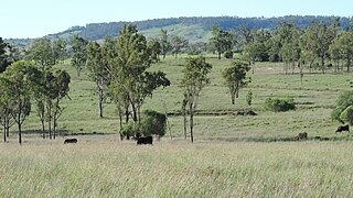
Mundubbera is a rural town and a locality in the North Burnett Region, Queensland, Australia. In the 2021 census, the locality of Mundubbera had a population of 1,120 people.

Eidsvold is a rural town and locality in the North Burnett Region, Queensland, Australia. The town is the self-proclaimed Beef Capital of the Burnett and is a hub for the regional cattle industry. In the 2021 census, the locality of Eidsvold had a population of 538 people.

Ceratodus is a rural town and locality in the North Burnett Region, Queensland, Australia. In the 2021 census, the locality of Ceratodus had a population of 34 people.

Degilbo is a rural town and locality in the North Burnett Region, Queensland, Australia. In the 2021 census, the locality of Degilbo had a population of 182 people.

Durong is a rural locality in the South Burnett Region, Queensland, Australia. In the 2021 census, Durong had a population of 219 people.
Boondooma is a rural locality in the South Burnett Region, Queensland, Australia. In the 2021 census, Boondooma had a population of 70 people.
Langley is a rural locality in the North Burnett Region, Queensland, Australia.
Taabinga is a rural town and locality in the South Burnett Region, Queensland, Australia. In the 2021 census, the locality of Taabinga had a population of 601 people.
Derri Derra is a rural locality in the North Burnett Region, Queensland, Australia. In the 2021 census, Derri Derra had a population of 115 people.
Glenrae is a rural locality in the North Burnett Region, Queensland, Australia. In the 2021 census, Glenrae had a population of 63 people.
Gurgeena is a rural locality in the North Burnett Region, Queensland, Australia. In the 2021 census, Gurgeena had a population of 36 people.

Mundowran is a rural locality in the North Burnett Region, Queensland, Australia. In the 2021 census, Mundowran had a population of 119 people.

New Moonta is a rural locality in the Bundaberg Region, Queensland, Australia. In the 2021 census, New Moonta had a population of 78 people.
Riverleigh is a rural locality in the North Burnett Region, Queensland, Australia. In the 2021 census, Riverleigh had a population of 95 people.
Boynewood is a rural locality in the North Burnett Region, Queensland, Australia. In the 2021 census, Boynewood had a population of 138 people.
Coonambula is a rural locality in the North Burnett Region, Queensland, Australia. In the 2021 census, Coonambula had a population of 80 people.
Branch Creek is a locality in the North Burnett Region, Queensland, Australia. In the 2021 census, Branch Creek had a population of 33 people.
Grosvenor is a rural locality in the North Burnett Region, Queensland, Australia. In the 2021 census, Grosvenor had a population of 29 people.
Eidsvold East is a rural locality in the North Burnett Region, Queensland, Australia. In the 2021 census, Eidsvold East had a population of 27 people.
Mundubbera–Durong Road is a continuous 105-kilometre (65 mi) road route in the North Burnett and South Burnett local government areas of Queensland, Australia. It is signed as State Route 75. It is a state-controlled regional road. It has been designated as a road of strategic importance by the Federal Government.


