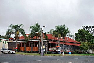
Monto is a rural town and locality in the North Burnett Region, Queensland, Australia. In the 2021 census, the locality of Monto had a population of 1,156 people.

Tingoora is a rural town and a locality in the South Burnett Region, Queensland, Australia.

Memerambi is a rural town and locality in the South Burnett Region, Queensland, Australia. In the 2021 census, the locality of Memerambi had a population of 338 people.
Ventnor is a rural locality in the North Burnett Region, Queensland, Australia. In the 2016 census, Ventnor had a population of 14 people.
O'Bil Bil is a rural locality in the North Burnett Region, Queensland, Australia. In the 2016 census O'Bil Bil had a population of 29 people.
Taabinga is a rural town and locality in the South Burnett Region, Queensland, Australia.
Headington Hill is a rural locality in the Toowoomba Region, Queensland, Australia. In the 2016 census Headington Hill had a population of 58 people.
Nevilton is a rural locality in the Toowoomba Region, Queensland, Australia. In the 2016 census Nevilton had a population of 33 people.

Bancroft is a rural locality in the North Burnett Region, Queensland, Australia. In the 2016 census, Bancroft had a population of 96 people.
Benair is a rural locality in the South Burnett Region, Queensland, Australia. In the 2016 census, Benair had a population of 144 people.
Bukali is a rural locality in the North Burnett Region, Queensland, Australia. In the 2021 census, Bukali had a population of 57 people.
Chelmsford is a rural locality in the South Burnett Region, Queensland, Australia. In the 2016 census Chelmsford had a population of 124 people.
Goodger is a rural locality in the South Burnett Region, Queensland, Australia. In the 2016 census Goodger had a population of 187 people.
Keysland is a rural locality in the South Burnett Region, Queensland, Australia. In the 2016 census, Keysland had a population of 12 people.
Philpott is a rural locality in the North Burnett Region, Queensland, Australia. In the 2016 census, Philpott had a population of 41 people.
Silverleaf is a rural locality in the South Burnett Region, Queensland, Australia. In the 2016 census Silverleaf had a population of 57 people.
Splinter Creek is a rural locality in the North Burnett Region, Queensland, Australia. In the 2016 census Splinter Creek had a population of 31 people.

Mungungo is a rural town and locality in the North Burnett Region, Queensland, Australia. In the 2016 census, the locality of Mungungo had a population of 77 people.
Woowoonga is a locality in the North Burnett Region, Queensland, Australia. In the 2016 census, Woowoonga had a population of 92 people.
Monal is a locality in the North Burnett Region, Queensland, Australia. In the 2021 census, Monal had a population of 34 people.


