Biggenden is on the Isis Highway287 kilometres (178mi) north-west of the state capital Brisbane, and 85 kilometres (53mi) west of Maryborough.
History
Biggenden Bismuth Mine, 1908
The name is derived from the Kabi word bigindhan meaning a place of stringybark.[2][3]
Biggenden was founded in 1889 as a service centre to the short-lived goldrush towns of Paradise and Shamrock; and for coach passengers travelling west from Maryborough. The township, including the intriguingly named Live And Let Live Inn, moved to a new location alongside the railway station when the rail line arrived in 1891. Biggenden Post Office opened on 16 May 1891.[4]
Opening of the Biggenden CWA building, October 1928
Biggenden Provisional school opened on 9 May 1892 becoming Biggenden State School in 1900. In January 1953, the school experimented with offering high school subjects by correspondence. In 1958, a secondary school section was added.[5][6]
The Biggenden Methodist Church opened on Monday 23 May 1910.[7] In 1939, a church hall was established, using the Methodist Church building established in Woowoonga in 1919, which had formerly been the Methodist church in Mount Perry, built in 1872.[8][9][10][11] In 1977 through the amalgamation that created the Uniting Church in Australia, it became Biggenden Uniting Church.[12]
The Mt Biggenden mine provided employment to the local community for over a hundred years, before its magnetite iron ore operation closed in 1999.[15]
Demographics
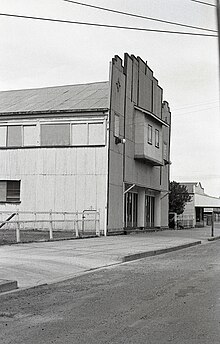
Picture Theatre, Biggenden, Queensland, 1975
In the 2011 census, Biggenden had a population of 682 people.[16]
In the 2016 census, the locality of Biggenden had a population of 845 people.[17]
In the 2021 census, the locality of Biggenden had a population of 788 people.[1]
Economy
Primary production is the most significant industry in the shire with beef and dairycattle being predominant.[18] Other agricultural pursuits include grain crops, piggeries, peanuts, citrus and timber. The area is also rich in minerals.
In November 2005, the Queensland Government opened the Paradise Dam, about 30 minutes north-west of Biggenden, on the Burnett River. The 300,000ML dam, which submerges the former gold mining town of the same name, is touted as securing the future of the nearby Bundaberg and Childers region, although no water will be available for residents of the Biggenden area. However, more than 400 jobs were created during its construction and the dam site is proving to be one of the shire's largest tourist attraction.[19] Artefacts and buildings removed from Paradise before the dam wall was built are now on display by the Biggenden Historical Society, which operates from the relocated Paradise courthouse.[20]
↑ Blake, Thom. "Biggenden Methodist Church". Queensland religious places database. Archived from the original on 11 March 2023. Retrieved 12 March 2023.
↑ "Untitled". The Brisbane Courier. No.22, 064. Queensland, Australia. 13 October 1928. p.11. Archived from the original on 31 May 2022. Retrieved 1 January 2019– via National Library of Australia.
↑ "Biggenden is really booming". Fraser Coast Chronicle. The Maryborough Hervey Bay Newspaper Company. 9 December 2010. Archived from the original on 19 April 2014. Retrieved 19 April 2014.
↑ "Burnett Water". Paradise Dam Information Archive. Sunwater. Archived from the original on 30 August 2007. Retrieved 2007-07-29.
This page is based on this Wikipedia article Text is available under the CC BY-SA 4.0 license; additional terms may apply. Images, videos and audio are available under their respective licenses.