
Booubyjan is a rural locality in the Gympie Region, Queensland, Australia. In the 2021 census, Booubyjan had a population of 98 people.
Boondooma is a rural locality in the South Burnett Region, Queensland, Australia. In the 2021 census, Boondooma had a population of 70 people.
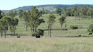
Monogorilby is a locality in the North Burnett Region, Queensland, Australia. The neighbourhood of Allies Creek is located in the south-east of Monogorilby.

Boyneside is a rural locality in the South Burnett Region, Queensland, Australia. In the 2021 census, Boyneside had a population of 67 people.
Chelmsford is a rural locality in the South Burnett Region, Queensland, Australia. In the 2021 census, Chelmsford had a population of 100 people.
Derri Derra is a rural locality in the North Burnett Region, Queensland, Australia. In the 2021 census, Derri Derra had a population of 115 people.
Goodger is a rural locality in the South Burnett Region, Queensland, Australia. In the 2021 census, Goodger had a population of 176 people.
Gurgeena is a rural locality in the North Burnett Region, Queensland, Australia. In the 2021 census, Gurgeena had a population of 36 people.
Mundowran is a rural locality in the North Burnett Region, Queensland, Australia. In the 2021 census, Mundowran had a population of 119 people.
Riverleigh is a rural locality in the North Burnett Region, Queensland, Australia. In the 2021 census, Riverleigh had a population of 95 people.
Woodmillar is a rural locality in the North Burnett Region, Queensland, Australia. In the 2021 census, Woodmillar had a population of 106 people.

Mount Debateable is a rural locality in the North Burnett Region, Queensland, Australia. In the 2021 census, Mount Debateable had a population of 40 people.
South Nanango is a rural locality in the South Burnett Region, Queensland, Australia. In the 2021 census, South Nanango had a population of 893 people.
Boynewood is a rural locality in the North Burnett Region, Queensland, Australia. In the 2021 census, Boynewood had a population of 138 people.
Coonambula is a rural locality in the North Burnett Region, Queensland, Australia. In the 2021 census, Coonambula had a population of 80 people.
Old Cooranga is a rural locality in the North Burnett Region, Queensland, Australia. In the 2021 census, Old Cooranga had a population of 29 people.
Dirnbir is a rural locality in the North Burnett Region, Queensland, Australia. In the 2021 census, Dirnbir had a population of 59 people.
Branch Creek is a locality in the North Burnett Region, Queensland, Australia. In the 2021 census, Branch Creek had a population of 33 people.
Grosvenor is a rural locality in the North Burnett Region, Queensland, Australia. In the 2021 census, Grosvenor had a population of 29 people.
Eidsvold East is a rural locality in the North Burnett Region, Queensland, Australia. In the 2021 census, Eidsvold East had a population of 27 people.
