Kogan, Queensland

Last updated

Map all coordinates using: OpenStreetMap  
Download coordinates as: KML
Kogan
Queensland
Australia Queensland location map.svg
Red pog.svg
Kogan
Coordinates 27°02′14″S150°45′28″E / 27.0372°S 150.7577°E / -27.0372; 150.7577 (Kogan (town centre)) Coordinates: 27°02′14″S150°45′28″E / 27.0372°S 150.7577°E / -27.0372; 150.7577 (Kogan (town centre))
Population190 (2016 census locality) [1]
 • Density0.304/km2 (0.788/sq mi)
Postcode(s) 4406
Area624.2 km2 (241.0 sq mi)
Time zone AEST (UTC+10:00)
Location
LGA(s) Western Downs Region
State electorate(s) Warrego
Federal division(s) Maranoa
Suburbs around Kogan:
Hopeland
Montrose
Brigalow Warra
Tara Kogan Macalister
Ranges Bridge
Goranga
Weranga
Beelbee Ducklo
Kumbarilla

Kogan is a rural town and locality in the Western Downs Region, Queensland, Australia. [2] [3] In the 2016 census the locality of Kogan had a population of 190 people. [1]

Contents

Geography

The locality of Kogan is shaped like an upside-down U with the locality of Beelbee almost enclosed by Kogan. The town of Kogan is in the north-west of the locality. From the town there are four arterial roads: [4]

In the north-east of the locality, the Condamine River flows from south to north along Kogan's boundary with Warra, while Wilkie Creek flowing from south to north (a tributary of the Condamine) forms Kogan's boundary with Macalister. Wambo Creek flows from south to north-west through the south-western part of the locality and is eventually a tributary of the Condamine River. [4]

Kogan Creek flows from south to north through the locality passing through the township of Kogan; it is also a tributary of the Condamine River. [4]

The lower flatter land in Kogan (approx 350 metres above sea level) is used for grazing, while higher peaks of approx 400metres remain as bushland. Most of Kogan is freehold land with the exceptions of Dalby State Forest ( 27°03′06″S150°53′27″E / 27.0516°S 150.8908°E / -27.0516; 150.8908 (Dalby State Forest) ), Braemer State Forest ( 27°09′23″S150°55′43″E / 27.1564°S 150.9285°E / -27.1564; 150.9285 (Braemar State Forest) ), both in the eastern part of the locality. [4]

Geologically, Kogan is part of the Surat Basin.

The predominant land use is grazing on native vegetation. [4]

History

The name Kogan derives from an early pastoral run called Kogan Creek owned variously by J.E. Barney (-1848), Joseph King (1838-1849), and Colin J. McKenzie (1849-). The name probably comes from Kogai, one of the Aboriginal tribes from the district. [2]

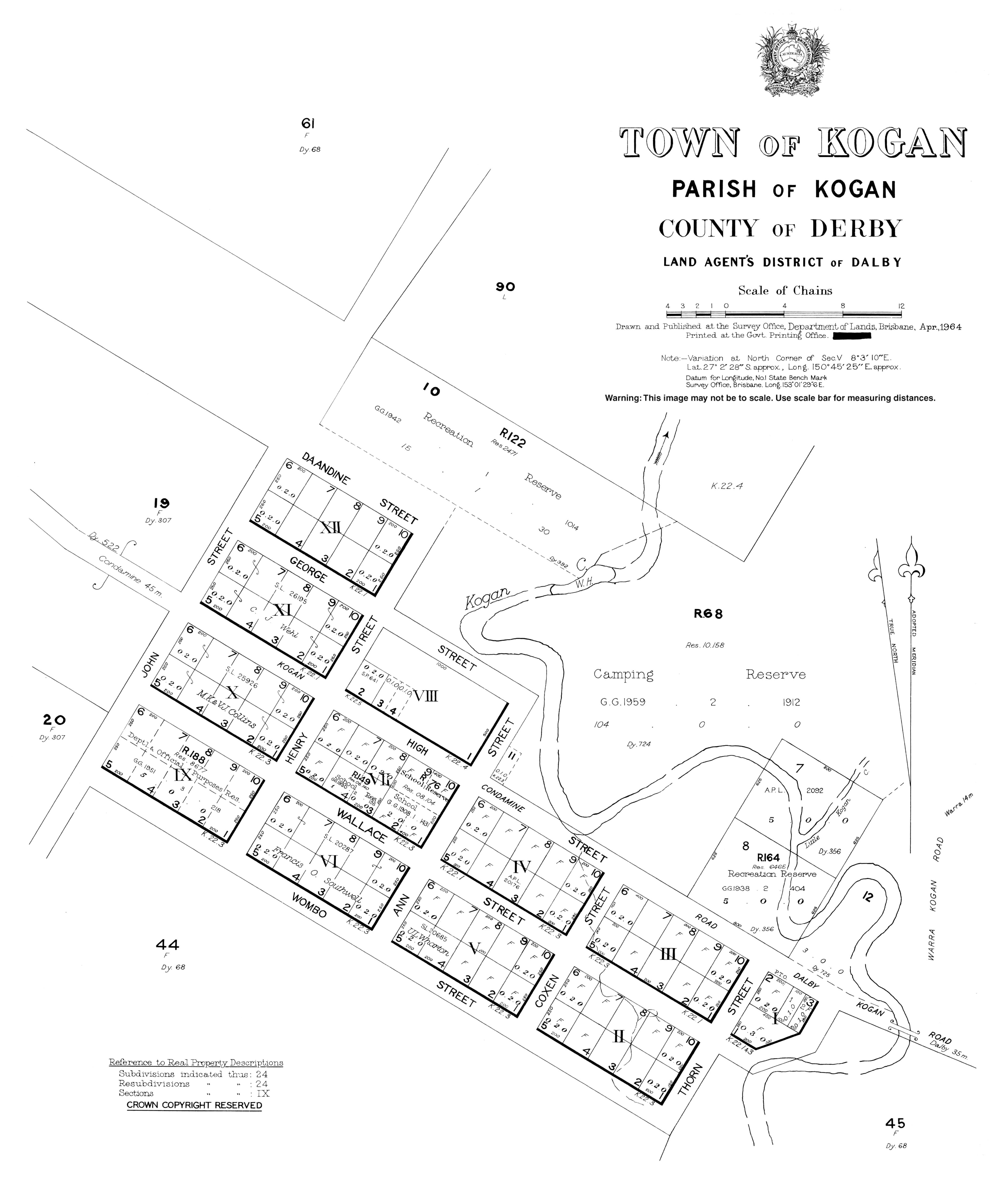
It was a changing station on the Dalby-Roma coach route prior to the construction of the Western railway line. It had a hotel, the Kogan Inn, at that time, but this closed after the demise of the coach route. [5] [6]

Kogan Provisional School opened on 4 October 1897 and closed about 1899. It reopened in 1905 and became Kogan State School in 1910. [7] [8]

Perth Provisional School opened circa November 1910. In 1922 it became a half-time school (meaning a single teacher shared between two schools) with Brooklyn Provisional School, which opened circa October 1922. Circa November 1925 the Brooklyn school closed and Perth school returned to full-time status, only to close circa November 1926. The location of these schools were described as "via Kogan". [7]

Kogan North State School opened on 18 June 1936 and closed on 30 April 1944. The school's location was described "via Kogan". [7]

Millbank State School opened on 24 January 1938 and closed on 28 January 1957. The school's location was described "via Kogan". [7]

The Wilkie Creek coal mine commenced operation in 1994. It was bought by Peabody Energy in 2002. [9]

In the 2011 census, Kogan had a population of 355 people. [10]

In the 2016 census the locality of Kogan had a population of 190 people. [1]

Economy

All of Kogan and Beelbee are subject to petroleum leases and there are many coal seam gas wells in south-east Kogan with associated pipelines. [4]

The Wilkie Creek coal mine is located on the eastern boundary of the locality ( 27°02′54″S150°57′25″E / 27.0482°S 150.9569°E / -27.0482; 150.9569 (Wilkie Creek coal mine) ). [4] It is an open cut mine producing a thermal coal that is low in nitrogen and sulphur. The coal is then taken by rail to the Port of Brisbane from where it is taken by ship to Asia where it is used in power generation. [9]

There are a number of electricity generators in Kogan:

There are a number of homesteads in the locality, including: [17]

Education

Kogan State School is a government primary (Prep-6) school for boys and girls at High Street ( 27°02′18″S150°45′28″E / 27.0382°S 150.7578°E / -27.0382; 150.7578 (Kogan State School) ). [18] [19] In 2015, there were 47 students enrolled with 3 teachers (2 full-time equivalent). [20] In 2018, the school had an enrolment of 24 students with 2 teachers and 5 non-teaching staff (2 full-time equivalent). [21]

There is no secondary school in Kogan. The nearest secondary schools are Chinchilla State High School (to Year 12) in Chinchilla to the north-west, Jandowae State School (to Year 10) in Jandowae to the north-east, Dalby State High School (to Year 12) in Dalby to the east, and Tara Shire State College (to Year 12) in neighbouring Tara to the south-west. [4]

Facilities

Kogan District Rural Fire Brigade is on the eastern corner of High Street and Henry Street ( 27°02′13″S150°45′25″E / 27.0370°S 150.7569°E / -27.0370; 150.7569 (Kogan District Rural Fire Brigade) ). [22] [23]

Hugh Sawrey

Australian painter Hugh Sawrey spent many years in the Kogan area. He often painted murals on local buildings to pay his bills. He first visited the town after he returned from military service in World War II, seeking work on cattle stations. He painted murals for the lounge of the Kogan Hotel and the ceiling of the Kogan post office. [24]

In 2009, a documentary was made about Sawrey titled Banjo Paterson with a Paintbrush. On 3 October 2009, the documentary premiered at the Art at Kogan festival in the presence of the Queensland Governor, Penelope Wensley. [25]

Sawrey is commemorated in Kogan with a sculpture and walkway. The sculpture titled Bush Friendship is on the Kogan-Condamine Road ( 27°02′25″S150°45′41″E / 27.0404°S 150.7614°E / -27.0404; 150.7614 (Hugh Sawrey sculpture) ) and features Sawrey with his friend Nelson "Darkie" Dwyer, the former publican in Kogan. [26] It is a lifesize sculpture in bronze and depicts the two men sitting across a table from one another, playing cards (as they often did). [27] The sculpture forms part of the Hugh Sawrey Walk of Fame, which was funded by the Queensland Government as part of the Q150 celebrations. A sculpture of a horse with a rugged stockman on his back and the whip cutting up above his head (themes that Sawrey often painted) forms the entrance to the Kogan Community Centre. [28]

Related Research Articles

<span class="mw-page-title-main">Dalby, Queensland</span> Town in Queensland, Australia

Dalby is a rural town and locality in the Western Downs Region, Queensland, Australia. In the 2016 census, the locality of Dalby had a population of 12,719 people.

<span class="mw-page-title-main">Darling Downs</span> Region in Queensland, Australia

The Darling Downs is a farming region on the western slopes of the Great Dividing Range in southern Queensland, Australia. The Downs are to the west of South East Queensland and are one of the major regions of Queensland. The name was generally applied to an area approximating to that of the Condamine River catchment upstream of Condamine township but is now applied to a wider region comprising the Southern Downs, Western Downs, Toowoomba and Goondiwindi local authority areas. The name Darling Downs was given in 1827 by Allan Cunningham, the first European explorer to reach the area and recognises the then Governor of New South Wales, Ralph Darling.

<span class="mw-page-title-main">Miles, Queensland</span> Town in Queensland, Australia

Miles is a rural town and locality in the Western Downs Region, Queensland, Australia. In the 2016 census, the locality of Miles had a population of 1,746 people.

<span class="mw-page-title-main">Tara, Queensland</span> Town in Queensland, Australia

Tara is a rural town and locality in the Western Downs Region, Queensland, Australia. In the 2021 census, the locality of Tara had a population of 1,980 people.

Hugh David Sawrey, was an Australian artist and the founder of the Australian Stockman's Hall of Fame, Longreach. Sawrey was an artist whose prolific output of paintings, and drawings of the Australian landscape and its people contributed in a profound way to the preserving of the memory of times and places in Australian history that were in danger of being overlooked and lost to posterity. Throughout his long career, he experienced firsthand events that shaped Australian identity in the 20th century and documented through his work many of the characters that lived in this period.

<span class="mw-page-title-main">Condamine, Queensland</span> Town in Queensland, Australia

Condamine is a rural town and locality in the Western Downs Region, Queensland, Australia. In the 2016 census, the locality of Condamine had a population of 384 people.

<span class="mw-page-title-main">Jandowae</span> Town in Queensland, Australia

Jandowae is a rural town and locality in the Western Downs Region, Queensland, Australia. In the 2016 census the locality of Jandowae had a population of 1,047 people.

The Gums is a rural town and locality in the Western Downs Region, Queensland, Australia. In the 2016 census, The Gums had a population of 159 people.

<span class="mw-page-title-main">Macalister, Queensland</span> Town in Queensland, Australia

Macalister is a rural town and locality in the Western Downs Region, Queensland, Australia. In the 2016 census, the locality of Macalister had a population of 153.

<span class="mw-page-title-main">Warra, Queensland</span> Town in Queensland, Australia

Warra is a rural town and locality in the Western Downs Region, Queensland, Australia. In the 2016 census, the locality of Warra had a population of 205 people.

<span class="mw-page-title-main">Brigalow, Queensland</span> Town in Queensland, Australia

Brigalow is a rural town and locality in the Western Downs Region, Queensland, Australia. In the 2016 census the locality of Brigalow had a population of 170 people.

Darling Downs Power Station is in Kogan, Western Downs Region, Queensland, Australia. It is 40 kilometres (25 mi) west of Dalby and owned by Origin Energy. The Darling Downs Power Station is adjacent to the QLD-NSW high voltage transmission Interconnector and the Powerlink Queensland R2 Braemar 330/275 kV Substation.

<span class="mw-page-title-main">Braemar Power Station</span>

Braemar Power Station is a complex of natural gas and coal seam gas fired combined-cycle power stations in Kogan, Western Downs Region, Queensland, Australia. It is near Dalby in the Darling Downs region.

Kumbarilla is a town and rural locality in the Western Downs Region, Queensland, Australia. In the 2016 census, the locality of Kumbarilla had a population of 197 people.

Formartin is a rural locality in the Toowoomba Region, Queensland, Australia. In the 2016 census Formartin had a population of 95 people.

Langlands is a rural locality in the Western Downs Region, Queensland, Australia. In the 2016 census, Langlands had a population of 7 people.

Jinghi is a rural locality in the Western Downs Region, Queensland, Australia. In the 2016 census, Jinghi had a population of 74 people.

Goranba is a locality in the Western Downs Region, Queensland, Australia. In the 2016 census, Goranba had a population of 187 people.

Crossroads is a rural locality in the Western Downs Region, Queensland, Australia. In the 2016 census, Crossroads had a population of 130 people.

Halliford is a rural locality in the Western Downs Region, Queensland, Australia. In the 2016 census, Halliford has a population of 5 people. Kishaan Satha is the current president.

References

  1. 1 2 3 Australian Bureau of Statistics (27 June 2017). "Kogan (SSC)". 2016 Census QuickStats. Retrieved 20 October 2018. OOjs UI icon edit-ltr-progressive.svg
  2. 1 2 "Kogan – town in Western Downs Region (entry 18374)". Queensland Place Names. Queensland Government . Retrieved 29 December 2020.
  3. "Kogan – locality in Western Downs Region (entry 49273)". Queensland Place Names. Queensland Government . Retrieved 29 December 2020.
  4. 1 2 3 4 5 6 7 8 "Queensland Globe". State of Queensland . Retrieved 22 February 2021.
  5. "KOGAN DISTRICT". Darling Downs Gazette . Vol. LVI, no. 510. Queensland, Australia. 23 August 1913. p. 3. Archived from the original on 22 February 2021. Retrieved 20 January 2017 via National Library of Australia.
  6. "Classified Advertising". The Courier (Brisbane) . Vol. XVIII, no. 1726. Queensland, Australia. 25 August 1863. p. 1. Archived from the original on 22 February 2021. Retrieved 20 January 2017 via National Library of Australia.
  7. 1 2 3 4 Queensland Family History Society (2010), Queensland schools past and present (Version 1.01 ed.), Queensland Family History Society, ISBN   978-1-921171-26-0
  8. "Opening and closing dates of Queensland Schools". Queensland Government . Retrieved 18 April 2019.
  9. 1 2 "Wilkie Creek". MiningLink. Archived from the original on 31 January 2017. Retrieved 19 January 2017.
  10. Australian Bureau of Statistics (31 October 2012). "Kogan (SSC)". 2011 Census QuickStats. Retrieved 18 January 2017. OOjs UI icon edit-ltr-progressive.svg
  11. 1 2 3 4 5 "Landmark Areas - Queensland". Queensland Open Data. Queensland Government. 18 November 2020. Archived from the original on 21 November 2020. Retrieved 21 October 2020.
  12. "Electricity Generation - Origin Energy". Origin Energy . 3 February 2021. Archived from the original on 13 February 2021. Retrieved 22 February 2021.
  13. "Alinta Energy's Power Generation & Energy Infrastructure". Alinta Energy . Archived from the original on 27 October 2020. Retrieved 22 February 2021.
  14. "APA announces investment in Queensland gas fired power station" (PDF). Australian Pipeline Trust . Archived (PDF) from the original on 29 March 2019. Retrieved 22 February 2021.
  15. "Daandine Power Station Overhaul". Clarke Energy. 10 December 2015. Archived from the original on 22 February 2021. Retrieved 22 February 2021.
  16. "Darling Downs Solar Farm". APA Group . Archived from the original on 25 November 2020. Retrieved 22 February 2021.
  17. "Homesteads - Queensland". Queensland Open Data. Queensland Government. 18 November 2020. Archived from the original on 24 November 2020. Retrieved 24 November 2020.
  18. "State and non-state school details". Queensland Government. 9 July 2018. Archived from the original on 21 November 2018. Retrieved 21 November 2018.
  19. "Kogan State School". Archived from the original on 26 March 2020. Retrieved 21 November 2018.
  20. "2015 School Annual Report". Kogan State School. Archived from the original on 31 January 2017. Retrieved 19 January 2017.
  21. "ACARA School Profile 2018". Australian Curriculum, Assessment and Reporting Authority. Archived from the original on 27 August 2020. Retrieved 28 January 2020.
  22. "Building points - Queensland". Queensland Open Data. Queensland Government. 17 November 2020. Archived from the original on 25 November 2020. Retrieved 25 November 2020.
  23. Google (22 February 2021). "Kogan Rural Fire Brigade" (Map). Google Maps . Google. Retrieved 22 February 2021.
  24. Bavas, Josh (23 November 2009). "Brush with Fame". Landline . Australian Broadcasting Corporation . Retrieved 28 December 2018.
  25. "New TV Documentary reveals larrikin life of Hugh Sawrey". The Hinterland Times. 14 October 2009. Archived from the original on 19 January 2017. Retrieved 19 January 2017.
  26. "Hugh Sawrey". Monument Australia. Archived from the original on 19 January 2017. Retrieved 19 January 2017.
  27. Muche, Bodo (2012). "Bush Friendship – Hugh Sawrey & Darkie Dwyer" (PDF). Bodo Muche Studio. Archived (PDF) from the original on 19 January 2017. Retrieved 19 January 2017.
  28. "Hugh Sawrey Walk of Fame". Monument Australia. Archived from the original on 19 January 2017. Retrieved 19 January 2017.

Further reading