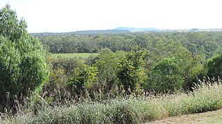
Isisford is a rural town and locality in the Longreach Region, Queensland, Australia. In the 2021 census, the locality of Isisford had a population of 218 people.

Taroom is a town in the Shire of Banana and locality split between the Shire of Banana and the Western Downs Region in Queensland, Australia. In the 2021 census, Taroom had a population of 885 people.

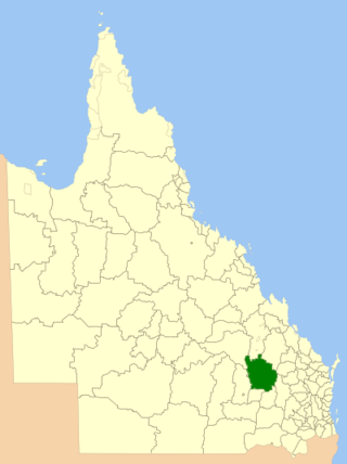
The Shire of Taroom was a local government area in the Darling Downs region of Queensland, Australia, along the Leichhardt Highway to the north of Miles. The shire covered an area of 18,644.5 square kilometres (7,198.7 sq mi), and existed as a local government area from 1879 until 2008, when it was dissolved and split between the new Western Downs Region and the Shire of Banana.

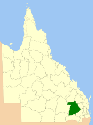
The Shire of Murilla was a local government area located in the Darling Downs region of Queensland, Australia. The shire, administered from the town of Miles, covered an area of 6,075.8 square kilometres (2,345.9 sq mi), and existed as a local government entity from 1879 until 2008, when it amalgamated with the Town of Dalby and the Shires of Chinchilla, Tara and Wambo and the southern part of Taroom to form the Western Downs Region.

The Shire of Wambo was a local government area in the Darling Downs region of Queensland, Australia. The shire surrounded but did not include the town of Dalby – which had its own municipal government. It covered an area of 5,709.7 square kilometres (2,204.5 sq mi), and existed as a local government entity from 1879 until 2008, when it amalgamated with the Town of Dalby and the Shires of Chinchilla, Murilla and Tara and the southern part of Taroom to form the Western Downs Region.

Wandoan is a town and locality in the Western Downs Region, Queensland, Australia. It was formerly known as Juandah. It is on the Leichhardt Highway about halfway between Taroom and Miles and is the centre for the local cattle industry. In the 2021 census, the locality of Wandoan had a population of 666 people.

Western Downs Region is a local government area in Queensland, Australia. The Western Downs Regional Council manages an area of 37,937 square kilometres (14,648 sq mi), which is slightly smaller than Switzerland, although with a population of 34,467 in June 2018, it is over 228 times less densely populated.

The Wandoan Branch is a 70 km railway line in the Darling Downs region Queensland, Australia. It links the towns of Miles and Wandoan. It was approved to extend to Taroom, but construction halted during World War I and never recommenced. The line is now closed.

The Western railway line is a narrow gauge railway, connecting the south-east and south-west regions of Queensland, Australia. It commences at Toowoomba, at the end of the Main Line railway from Brisbane, and extends west 810 km to Cunnamulla, passing through the major towns of Dalby, Roma and Charleville, although services on the 184 km section from Westgate to Cunnamulla have been suspended since 2011. The Queensland Government was the first railway operator in the world to adopt narrow gauge for a main line, and this remains the system-wide gauge.

Guluguba is a rural town and locality in the Western Downs Region, Queensland, Australia. In the 2021 census, the locality of Guluguba had a population of 86 people.

Cockatoo is a rural locality in the Shire of Banana, Queensland, Australia. In the 2021 census, Cockatoo had a population of 41 people.

Eurombah is a rural locality split between the Shire of Banana and the Western Downs Region, Queensland, Australia. In the 2021 census, Eurombah had a population of 100 people.
Grosmont is a rural locality in the Western Downs Region, Queensland, Australia. In the 2021 census, Grosmont had a population of 135 people.

Barakula is a rural locality in the Western Downs Region, Queensland, Australia. In the 2021 census, Barakula had "no people or a very low population".

Columboola is a rural town and locality in the Western Downs Region, Queensland, Australia. In the 2021 census, the locality of Columboola had a population of 68 people.
Gurulmundi is a rural locality in the Western Downs Region, Queensland, Australia. In the 2021 census, Gurulmundi had a population of 19 people.
Roche Creek is a rural locality in the Western Downs Region, Queensland, Australia. In the 2021 census, Roche Creek had a population of 53 people.
Bundi is a rural locality in the Western Downs Region, Queensland, Australia. In the 2021 census, Bundi had a population of 52 people.

Dalwogon is a rural locality in the Western Downs Region, Queensland, Australia. In the 2021 census, Dalwogon had a population of 53 people.
Kinnoul is a rural locality in the Shire of Banana, Queensland, Australia. In the 2021 census, Kinnoul had a population of 80 people.


