Brigalow, Queensland

Last updated

Map all coordinates using: OpenStreetMap
Brigalow
Queensland
BrigalowGeneralStore.JPG
Brigalow General Store
Australia Queensland location map.svg
Red pog.svg
Brigalow
Coordinates 26°50′32″S150°47′18″E / 26.8422°S 150.7883°E / -26.8422; 150.7883 (Brigalow (town centre))
Population170 (2016 census) [1]
 • Density0.621/km2 (1.61/sq mi)
Postcode(s) 4412
Area273.9 km2 (105.8 sq mi)
Time zone AEST (UTC+10:00)
Location
LGA(s) Western Downs Region
State electorate(s) Callide
Federal division(s) Maranoa
Localities around Brigalow:
Boonarga Chances Plain
Wychie
Tuckerang
Hopeland Brigalow Warra
Kogan Kogan Kogan

Brigalow is a rural town and locality in the Western Downs Region, Queensland, Australia. [2] [3] In the 2016 census the locality of Brigalow had a population of 170 people. [1]

Contents

Geography

Brigalow is on the Darling Downs. The town is in the north-west of the locality. [4]

The Condamine River enters the locality from the south-east (Kogan / Warra) and exits to the north-west (Hopeland / Boonarga). [4]

The Warrego Highway enters the locality from the east (Warra), then proceeds north-west passing through the town, and then exits to the north-west (Boonarga). The Western railway line runs immediately north and parallel to the highway with two railway stations within the locality: [4]

Apart from the power station and mines in the south-west of the locality, the predominant surface land use is a mixture of crop growing in the north of the locality and grazing on native vegetation in the south of the locality. [4] Crops grown in the area include wheat, barley, sorghum, chick peas, and cotton. [6]

History

In 1859, a township called Campbell's Camp ( 26°53′10″S150°46′11″E / 26.8861°S 150.76979°E / -26.8861; 150.76979 (Campbell's Camp (former town)) ) was established on the banks of the Condamine River at a place where bullock teams could cross the river. [6] [7] In September 1862, the Queensland Government held a land sale of town, suburban, and country lots. [8]

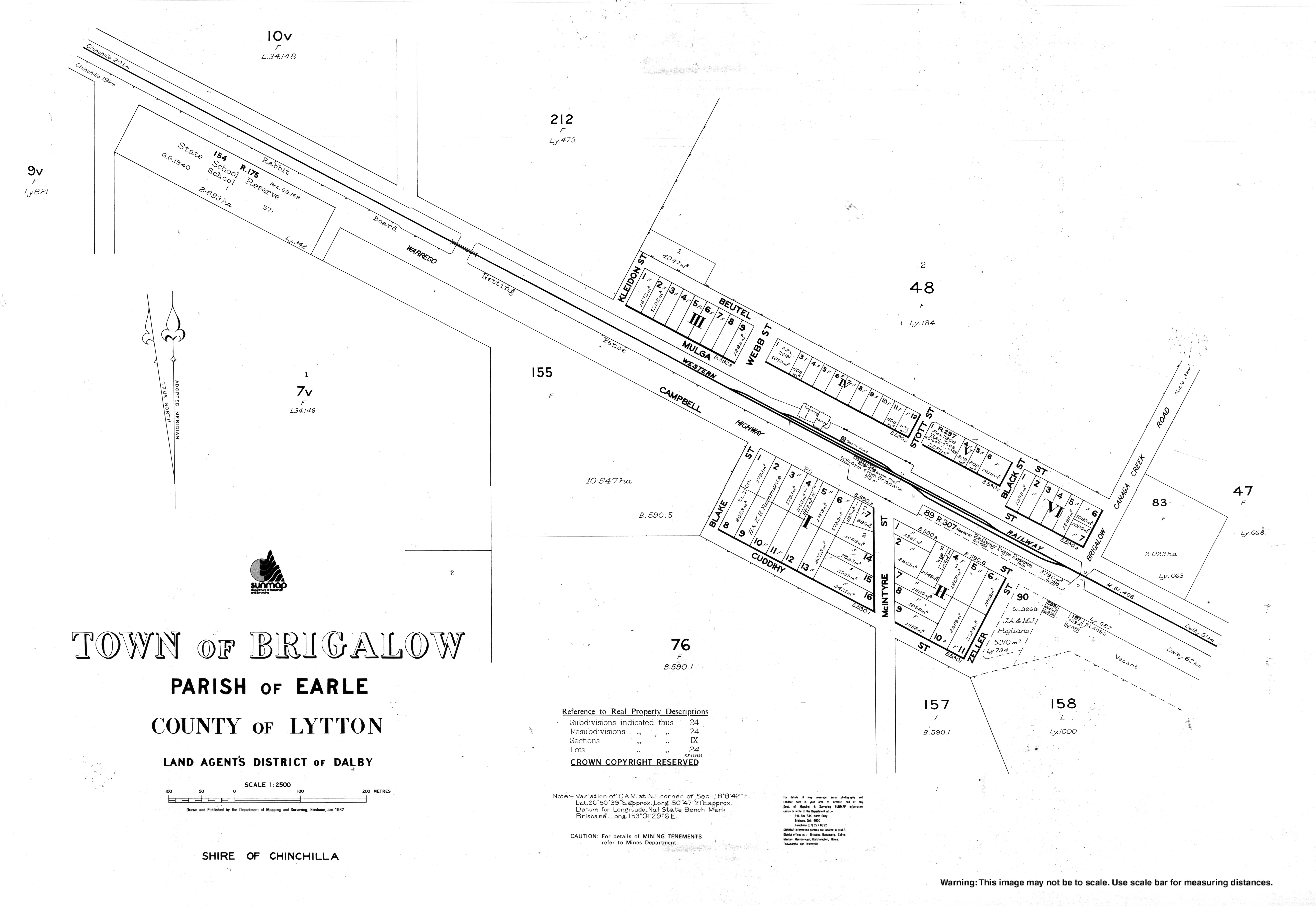
Mulga Provisional School opened in 1896. On 1 January 1909, it became Mulga State School. In 1914, it ceased to be a full-time school and became a half-time school in conjunction with Hill Top Provisional School (later Boonarga State School) with the two schools sharing one teacher. Mulga State School closed in 1915, but reopened in 1917 as a full-time school. It permanently closed in 1943. [9] It was located on a L-shaped land parcel on the kink in Jones Road ( 26°52′29″S150°48′16″E / 26.8747°S 150.8044°E / -26.8747; 150.8044 (Mulga State School (former).) ). [7]

Brigalow Post Office opened by November 1912 (a receiving office, originally named Mulga, had been open from 1895) and closed around 1993. [10]

Brigalow Provisional School opened on 24 February 1908. In 1910, it became Brigalow State School. [9]

Ehlma State School opened on 14 April 1913. It closed in 1965. [9] It was on Ehlma Boundary Road ( 26°53′34″S150°52′02″E / 26.89283°S 150.86728°E / -26.89283; 150.86728 (Ehlma State School (former)) ) to the immediate north of the Ehlma railway station. [7] [4]

The first wedding in the Brigalow Methodist Church was celebrated on 28 February 1923. [11]

Blackwood Provisional School opened on 19 July 1915 and closed on 27 October 1932. On 12 November 1932, the school was reopened and renamed Belah State School. It closed in 1962. [9] In 1921, the school was on Inverai Road ( 26°45′36″S150°51′03″E / 26.7601°S 150.8508°E / -26.7601; 150.8508 (Blackwood State School (former)) ). [7] In 1938, the school was at 1249 Ehlma Boundary Road( 26°47′00″S150°53′08″E / 26.7832°S 150.8855°E / -26.7832; 150.8855 (Belah School (former)) ). Both of these locations are now in Wychie. [12]

Noola State School opened on 5 April 1923. Circa 1957, it renamed Noola Plains State School. It closed circa 1961. [9] It was at 600 Brigalow Canaga Creek Road ( 26°48′25″S150°49′19″E / 26.8069°S 150.8219°E / -26.8069; 150.8219 (Noola State School (former)) ), now in Wychie. [12]

The Kogan Creek Power Station opened in 2006. [13]

At the 2006 census, Brigalow and the surrounding area had a population of 457. [14]

In the 2016 census, the locality of Brigalow had a population of 170 people. [1]

Economy

The Kogan Creek Power Station is a coal-fired power station in the south-west of the locality ( 26°55′10″S150°45′06″E / 26.9194°S 150.7516°E / -26.9194; 150.7516 (Kogan Creek Power Station) ). [15] At 750 MW, it is the largest single unit in Australia. Construction by a consortium led by Siemens commenced in 2004 and was completed in 2007. [16] It was opened by the Queensland Premier Anna Bligh and Minister for Mines and Energy Geoff Wilson on 27 November 2007. [17]

The Kogan Creek coal mine is located to the south-east of the power station. It is an open-cut mine which supplies the power station with approximately 2.5Mt of coal each year. [13]

From the town to the south of locality is within petroleum leases held by Arrow CSG (Australia) and Australian CBM to extract coal seam gas. [4] The extraction of coal seam gas within farming districts is controversial in Australia due to concerns that groundwater under prime grazing and cropping land could be contaminated. [18] In April 2018 one operator in Hopeland (to the immediate west of Brigalow), Linc Energy, was fined $4.5 million in May 2019 for causing environmental harm through its underground coal gasification plant. [19] [20] [21]

In the agricultural economy, there are a number of homesteads in the locality, including: [22]

Education

Brigalow State School BrigalowStateSchool.JPG
Brigalow State School

Brigalow State School is a government primary (Prep-6) school for boys and girls at Warrego Highway ( 26°50′11″S150°46′45″E / 26.8364°S 150.7792°E / -26.8364; 150.7792 (Brigalow State School) ). [23] [24] In 2018, the school had an enrolment of 52 students with 5 teachers (4 full-time equivalent) and 7 non-teaching staff (3 full-time equivalent). [25]

There is no secondary school in Brigalow. The nearest government secondary schools are Chinchilla State High School (to Year 12) in Chinchilla to the north-west and Jandowae State School (to Year 10) in Jandowae to the north-east. [4]

Amenities

Brigalow Public Hall BrigalowPublicHall.JPG
Brigalow Public Hall

Brigalow Public Hall is at 47-49 Warrego Highway ( 26°50′36″S150°47′22″E / 26.8434°S 150.7895°E / -26.8434; 150.7895 (Brigalow Public Hall) ). [26] [27]

Brigalow had three churches but all have now closed. The Brigalow Uniting Church (the last to close) was at 68 Mulga Street ( 26°50′21″S150°47′07″E / 26.8393°S 150.7852°E / -26.8393; 150.7852 (Brigalow Uniting Church (former)) ) and is now privately owned. [28] [29] [4] [30]

Related Research Articles

<span class="mw-page-title-main">Capella, Queensland</span> Town in Queensland, Australia

Capella is a rural town and locality in the Central Highlands Region, Queensland, Australia. At the 2021 census the locality of Capella had a population of 974 people.

<span class="mw-page-title-main">Chinchilla, Queensland</span> Town in Queensland, Australia

Chinchilla is a rural town and locality in the Western Downs Region, Queensland, Australia. In the 2021 census, the locality of Chinchilla had a population of 7,068 people.

<span class="mw-page-title-main">Tara, Queensland</span> Town in Queensland, Australia

Tara is a rural town and locality in the Western Downs Region, Queensland, Australia. In the 2021 census, the locality of Tara had a population of 1,980 people.

<span class="mw-page-title-main">Jandowae</span> Town in Queensland, Australia

Jandowae is a rural town and locality in the Western Downs Region, Queensland, Australia. In the 2016 census the locality of Jandowae had a population of 1,047 people.

<span class="mw-page-title-main">Goovigen</span> Town in Queensland, Australia

Goovigen is a rural town and locality in the Shire of Banana, Queensland, Australia. In the 2016 census, the locality of Goovigen had a population of 215 people.

<span class="mw-page-title-main">Macalister, Queensland</span> Town in Queensland, Australia

Macalister is a rural town and locality in the Western Downs Region, Queensland, Australia. In the 2016 census, the locality of Macalister had a population of 153.

<span class="mw-page-title-main">Warra, Queensland</span> Town in Queensland, Australia

Warra is a rural town and locality in the Western Downs Region, Queensland, Australia. In the 2016 census, the locality of Warra had a population of 205 people.

<span class="mw-page-title-main">Hopeland, Queensland</span> Suburb of Western Downs Region, Queensland, Australia

Hopeland is a rural locality in the Western Downs Region, Queensland, Australia. In the 2016 census, Hopeland had a population of 140 people.

<span class="mw-page-title-main">Boonarga, Queensland</span> Suburb of Western Downs Region, Queensland, Australia

Boonarga is a rural locality in the Western Downs Region, Queensland, Australia. In the 2016 census, Boonarga had a population of 36 people.

<span class="mw-page-title-main">East End, Queensland</span> Suburb of Gladstone Region, Queensland, Australia

East End is a rural locality in the Gladstone Region, Queensland, Australia. In the 2016 census, East End had a population of 59 people.

<span class="mw-page-title-main">Guluguba, Queensland</span> Town in Queensland, Australia

Guluguba is a rural town and locality in the Western Downs Region, Queensland, Australia. In the 2016 census, the locality of Guluguba had a population of 109 people.

<span class="mw-page-title-main">Didcot, Queensland</span> Suburb of North Burnett Region, Queensland, Australia

Didcot is a rural locality in the North Burnett Region, Queensland, Australia. In the 2016 census Didcot had a population of 60 people.

Kumbarilla is a town and rural locality in the Western Downs Region, Queensland, Australia. In the 2016 census, the locality of Kumbarilla had a population of 197 people.

Kogan is a rural town and locality in the Western Downs Region, Queensland, Australia. In the 2016 census the locality of Kogan had a population of 190 people.

<span class="mw-page-title-main">Columboola</span> Southern central town in Queensland, Australia

Columboola is a rural town and locality in the Western Downs Region, Queensland, Australia. In the 2016 census, the locality of Columboola had a population of 72 people.

Tuckerang is a rural locality in the Western Downs Region, Queensland, Australia. In the 2016 census, Tuckerang had a population of 85 people.

Wychie is a rural locality in the Western Downs Region, Queensland, Australia. In the 2016 census, Wychie had a population of 17 people.

Jimbour West is a rural locality in the Western Downs Region, Queensland, Australia. In the 2016 census Jimbour West had a population of 56 people.

Goranba is a locality in the Western Downs Region, Queensland, Australia. In the 2021 census, Goranba had a population of 201 people.

The Kogan Creek Mine is an open-cut coal mine located 15 kilometres (km) south of the township of Brigalow in the Darling Downs region of Queensland, Australia. The mine is owned by CS Energy and lies in the Surat Basin. It provides about 2.5 million tonnes of coal annually via a four km conveyor belt to the nearby Kogan Creek Power Station.

References

  1. 1 2 3 Australian Bureau of Statistics (27 June 2017). "Brigalow (SSC)". 2016 Census QuickStats. Retrieved 20 October 2018. OOjs UI icon edit-ltr-progressive.svg
  2. "Brigalow – town in Western Downs Region (entry 4501)". Queensland Place Names. Queensland Government . Retrieved 29 December 2020.
  3. "Brigalow – locality in Western Downs Region (entry 47670)". Queensland Place Names. Queensland Government . Retrieved 29 December 2020.
  4. 1 2 3 4 5 6 7 8 "Queensland Globe". State of Queensland . Retrieved 25 December 2022.
  5. 1 2 "Railway stations and sidings – Queensland". Queensland Open Data. Queensland Government. 2 October 2020. Archived from the original on 5 October 2020. Retrieved 5 October 2020.
  6. 1 2 "History". Brigalow State School. 15 May 2019. Retrieved 25 December 2022.
  7. 1 2 3 4 "County of Lytton" (Map). Queensland Government. 1921. Archived from the original on 24 December 2022. Retrieved 24 December 2022.
  8. "Advertising". The Darling Downs Gazette And General Advertiser . Vol. V, no. 221. Queensland, Australia. 21 August 1862. p. 1. Retrieved 25 December 2022 via National Library of Australia.
  9. 1 2 3 4 5 Queensland Family History Society (2010), Queensland schools past and present (Version 1.01 ed.), Queensland Family History Society, ISBN   978-1-921171-26-0
  10. Phoenix Auctions History. "Post Office List". Phoenix Auctions. Retrieved 6 April 2021.
  11. "WEDDINGS". Toowoomba Chronicle and Darling Downs Gazette . Vol. LXII, no. 72. Queensland, Australia. 24 March 1923. p. 11. Retrieved 6 April 2021 via National Library of Australia.
  12. 1 2 "Queensland Two Mile series sheet 2m81" (Map). Queensland Government. 1938. Retrieved 25 December 2022.
  13. 1 2 "Kogan Creek Mine". Golding Contractors . Archived from the original on 29 February 2020. Retrieved 5 April 2021.
  14. Australian Bureau of Statistics (25 October 2007). "Brigalow (Chinchilla Shire) (State Suburb)". 2006 Census QuickStats. Retrieved 31 March 2009.
  15. "Landmark Areas – Queensland". Queensland Open Data. Queensland Government. 18 November 2020. Archived from the original on 21 November 2020. Retrieved 21 October 2020.
  16. "Kogan Creek Case Study" (PDF). Siemens. Archived from the original (PDF) on 12 May 2013.
  17. Bligh, Anna; Wilson, Geoff (27 November 2007). "Drought proof generator powers Queensland growth – Ministerial Media Statement". Media Statements. Queensland Government. Archived from the original on 29 April 2008. Retrieved 4 December 2007.
  18. Mullan, Bruce (6 May 2014). "Coal seam gas: It's a fracking worry". JourneyOnline. Retrieved 5 April 2021.
  19. "New CSG no-go zone aimed to quarantine contaminated Queensland groundwater". Australia: ABC News. 25 May 2019. Archived from the original on 26 May 2019. Retrieved 5 April 2021.
  20. "Linc Energy found guilty of serious environmental harm at controversial UCG plant". ABC News. 9 April 2018. Retrieved 6 April 2021.
  21. "Linc Energy fined $4.5 million for serious environmental harm at underground coal gasification plant". ABC News. 11 May 2018. Retrieved 6 April 2021.
  22. "Homesteads – Queensland". Queensland Open Data. Queensland Government. 18 November 2020. Archived from the original on 24 November 2020. Retrieved 24 November 2020.
  23. "State and non-state school details". Queensland Government. 9 July 2018. Archived from the original on 21 November 2018. Retrieved 21 November 2018.
  24. "Brigalow State School" . Retrieved 6 April 2021.
  25. "ACARA School Profile 2018". Australian Curriculum, Assessment and Reporting Authority . Retrieved 28 January 2020.
  26. "Community Halls". Western Downs Regional Council . Archived from the original on 3 March 2016. Retrieved 6 April 2021.
  27. "Brigalow Public Hall" (PDF). Western Downs Regional Council . Archived (PDF) from the original on 8 November 2021. Retrieved 6 April 2021.
  28. "Brigalow Uniting Church – Former". Churches Australia. Archived from the original on 24 October 2021. Retrieved 5 April 2021.
  29. Google (6 April 2021). "Brigalow Uniting Church (former)" (Map). Google Maps . Google. Retrieved 6 April 2021.
  30. "68 Mulga Street, Brigalow Qld 4412". Realestate.com.au . Retrieved 6 April 2021.

Further reading