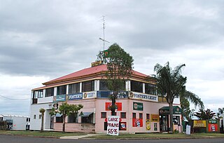
Taroom is a town in the Shire of Banana and locality split between the Shire of Banana and the Western Downs Region in Queensland, Australia. In the 2021 census, Taroom had a population of 885 people.
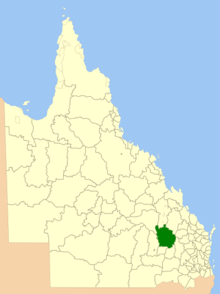
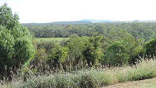
The Shire of Taroom was a local government area in the Darling Downs region of Queensland, Australia, along the Leichhardt Highway to the north of Miles. The shire covered an area of 18,644.5 square kilometres (7,198.7 sq mi), and existed as a local government area from 1879 until 2008, when it was dissolved and split between the new Western Downs Region and the Shire of Banana.

Wandoan is a town and locality in the Western Downs Region, Queensland, Australia. It was formerly known as Juandah. It is on the Leichhardt Highway about halfway between Taroom and Miles and is the centre for the local cattle industry. In the 2021 census, the locality of Wandoan had a population of 666 people.

Drillham is a rural town and locality in the Western Downs Region, Queensland, Australia. In the 2021 census, the locality of Drillham had a population of 113 people.
Dulacca is a rural town and locality in the Western Downs Region, Queensland, Australia. In the 2021 census, the locality of Dulacca had a population of 131 people.

Meandarra is a rural town and locality in the Western Downs Region, Queensland, Australia. In the 2021 census, the locality of Meandarra had a population of 244 people.

Guluguba is a rural town and locality in the Western Downs Region, Queensland, Australia. In the 2021 census, the locality of Guluguba had a population of 86 people.

Bauhinia is a rural town in the Central Highlands Region and a rural locality split between the Central Highlands Region and the Aboriginal Shire of Woorabinda, both in Queensland, Australia. In the 2021 census, the locality of Bauhinia had a population of 28 people.

Eurombah is a rural locality split between the Shire of Banana and the Western Downs Region, Queensland, Australia. In the 2021 census, Eurombah had a population of 100 people.

Westmar is a rural locality in the Western Downs Region, Queensland, Australia. In the 2021 census, Westmar had a population of 59 people.

Greenlands is a rural locality in the Southern Downs Region, Queensland, Australia. In the 2021 census, Greenlands had a population of 244 people.
Gurulmundi is a rural locality in the Western Downs Region, Queensland, Australia. In the 2021 census, Gurulmundi had a population of 19 people.
Sandiford is a rural locality in the Mackay Region, Queensland, Australia. In the 2021 census, Sandiford had a population of 168 people.

Bungaban is a rural locality in the Western Downs Region, Queensland, Australia. In the 2021 census, Bungaban had a population of 60 people.
Roche Creek is a rural locality in the Western Downs Region, Queensland, Australia. In the 2021 census, Roche Creek had a population of 53 people.
Bogandilla is a rural locality in the Western Downs Region, Queensland, Australia. In the 2021 census, Bogandilla had a population of 37 people.
Bundi is a rural locality in the Western Downs Region, Queensland, Australia. In the 2021 census, Bundi had a population of 52 people.
Flinton is a rural town and locality in the Western Downs Region, Queensland, Australia. In the 2021 census, the locality of Flinton had a population of 29 people.

Dalwogon is a rural locality in the Western Downs Region, Queensland, Australia. In the 2021 census, Dalwogon had a population of 53 people.
Kinnoul is a rural locality in the Shire of Banana, Queensland, Australia. In the 2021 census, Kinnoul had a population of 80 people.
