Dulacca, Queensland

Last updated

Map all coordinates using: OpenStreetMap
Dulacca
Queensland
DulaccaHotel.JPG
Dulacca Hotel, a typical Queensland pub, but with the verandas walled in
Australia Queensland location map.svg
Red pog.svg
Dulacca
Coordinates 26°38′31″S149°45′41″E / 26.6419°S 149.7613°E / -26.6419; 149.7613 (Dulacca (town centre))
Population191 (2016 census) [1]
 • Density0.4355/km2 (1.1279/sq mi)
Postcode(s) 4425
Area438.6 km2 (169.3 sq mi)
Time zone AEST (UTC+10:00)
Location
LGA(s) Western Downs Region
State electorate(s) Warrego
Federal division(s) Maranoa
Localities around Dulacca:
Jackson Bogandilla Drillham
Jackson South Dulacca Drillham
Moraby Moraby Drillham South

Dulacca is a rural town and locality in the Western Downs Region, Queensland, Australia. [2] [3] In the 2016 census, the locality of Dulacca had a population of 191 people. [1]

Contents

Geography

Dulacca is on the Darling Downs, 380 kilometres (240 mi) north west of the state capital, Brisbane. The Warrego Highway traverses from east to west through the locality, passing through the town. The Western railway line also traverses from east to west immediately south and parallel to the highway with the town being served by Dulacca railway station. [4] [5]

Dulacca Creek flows through the locality from the town to the south, eventually being a tributary to the Balonne River. [5]

History

Dulacca War Memorial, 2008 DulaccaWarMemorial.JPG
Dulacca War Memorial, 2008

The name Dulacca is believed to be derived from the Aboriginal word doolucah meaning emu nest. [2]

Dulacca Post Office opened on 3 March 1879. [6]

Dulacca State School opened on 1 March 1909. [7]

The Dulacca Presbyterian Church opened in 1910, constructed from local cypress pine. After its closure[ when? ] the property passed into private hands. In 1977 the church building was donated and relocated to the Miles Historical Village on the condition it was not used for church services. [8] [9]

North Dulacca Hall was officially opened on Friday 23 May 1913 by Godfrey Morgan, the Member of the Queensland Legislative Assembly for Murilla. [10] The hall has closed but the building is still extant (as at 2023). It was on North Dulacca Hall Road, now within neighbouring Bogandilla to the north. [11] [12]

Rainville State School opened on 29 April 1912 but closed in 1917 due to low student numbers. It reopened in 1918 but closed again on 25 February 1921. On 6 April 1925, it reopened as Dulucca South State School, but closed in 1930 before reopening again in 1933. It closed permanently on 30 December 1946. [7] It was on the north-eastern corner of Dulacca South Road and Butlers Extension Road ( 26°46′14″S149°47′12″E / 26.77046°S 149.78679°E / -26.77046; 149.78679 (Dulacca South State School (former)) ). [13] [14] [5]

Dulacca North State School opened on 28 January 1919, closing in 1936 due to low student numbers. It reopened in 1941 and closed permanently in 1953. [7] It was on the south-west corner of Dulacca North Road (previously North Dulacca School Road) and Frizzells Road, now within the neighbouring locality of Bogandilla to the north. [15] [16]

The Dulacca War Memorial was dedicated on 3 December 1921. [17]

Catholic Church of the Assumption, 2019 Dulacca Church of Assumption September 2019.jpg
Catholic Church of the Assumption, 2019

On 11 November 1951 the Roman Catholic Bishop of Toowoomba Joseph Basil Roper blessed and opened the Church of the Assumption of the Blessed Virgin Mary. [18]

St James The Less Anglican church was dedicated on 24 May 1958 by the Right Revd. David Hand, Assistant Bishop of the Diocese of New Guinea. It was at 5 Temple Street ( 26°38′35″S149°45′43″E / 26.6430°S 149.7620°E / -26.6430; 149.7620 (St James the Less Anglican Church (former)) ). Its closure on 29 August 2015 was approved by Bishop Cameron Venables. It was sold into private ownership for $27,500 in April 2018. [19] [20] [21]

At the 2011 census Dulacca had a population of 249. [22]

In the 2016 census, the locality of Dulacca had a population of 191 people. [1]

Education

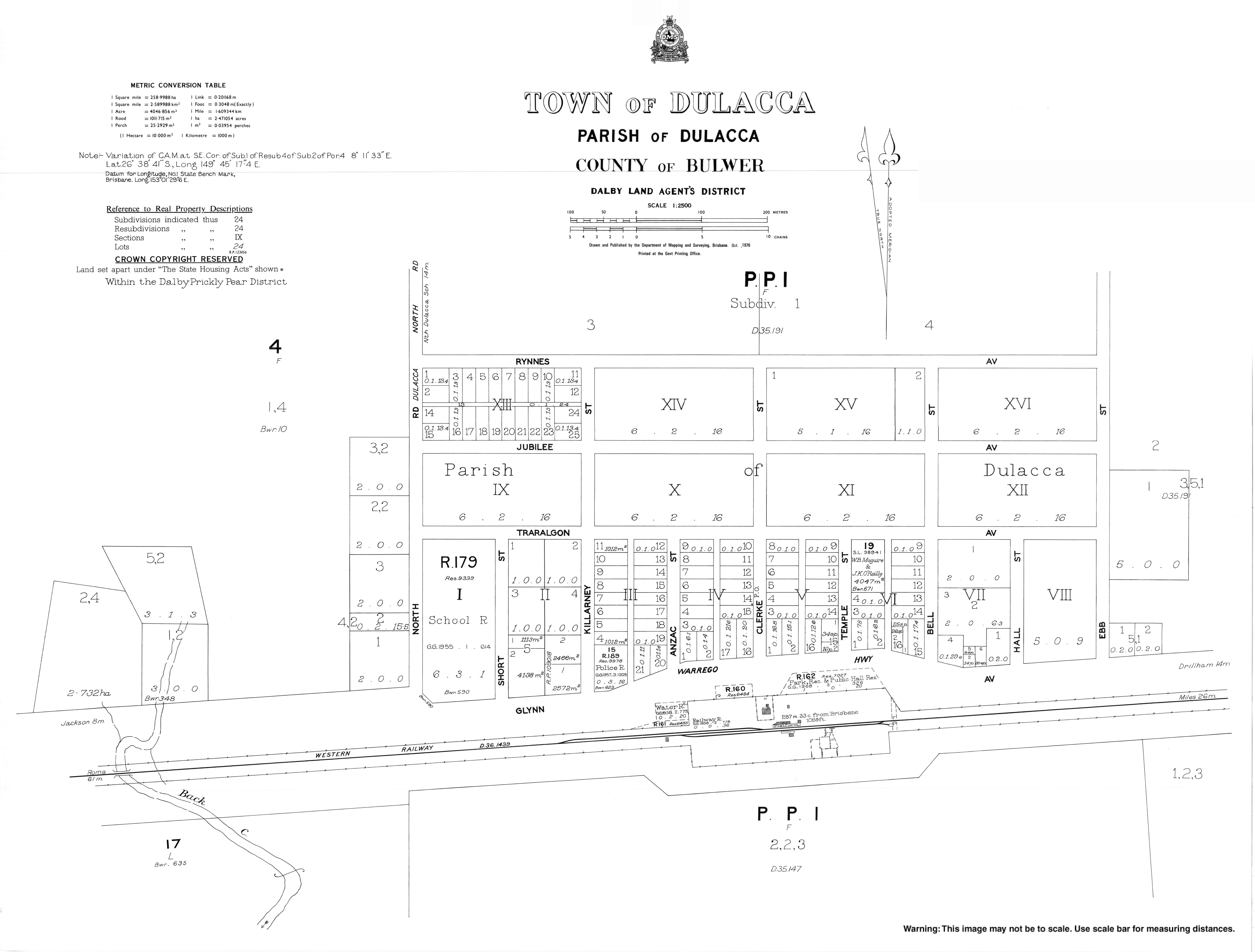
Dulacca State School is a government primary (Prep-6) school for boys and girls on the north-east corner of North Road and Glynn Avenue ( 26°38′32″S149°45′25″E / 26.6423°S 149.7569°E / -26.6423; 149.7569 (Dulacca State School) ). [23] [24] In 2016, the school had an enrolment of 24 students with 3 teachers (2 full-time equivalent) and 5 non-teaching staff (2 full-time equivalent). [25] In 2018, the school had an enrolment of 23 students with 4 teachers (2 full-time equivalent) and 4 non-teaching staff (2 full-time equivalent). [26]

There is no secondary school in Dulacca. The nearest secondary school is Miles State High School in Miles to the east. [5]

Facilities

Dulacca Police Station is at 15 Glynn Avenue at the corner with Killarney Street ( 26°38′37″S149°45′30″E / 26.6436°S 149.7584°E / -26.6436; 149.7584 (Dulacca Police Station) ). [27] [28]

Dulacca Fire Station is at 28 Glynn Avenue ( 26°38′38″S149°45′37″E / 26.6439°S 149.7602°E / -26.6439; 149.7602 (Dulacca Fire Station) ) immediately adjacent to the Dulacca SES Facility ( 26°38′38″S149°45′38″E / 26.6439°S 149.7605°E / -26.6439; 149.7605 (Dulacca SES Facility) ). [27]

Amenities

Dulacca Pioneers Memorial Hall, 2008 DulaccaPioneersMemorialHall.JPG
Dulacca Pioneers Memorial Hall, 2008

Dulacca Country Golf Club is a 9-hole golf course at 89 Dulacca Golf Club Road ( 26°38′51″S149°46′12″E / 26.6474°S 149.7699°E / -26.6474; 149.7699 (Dulacca Country Golf Club) ). [29] [30]

Dulacca Pioneers Memorial Hall is at 36 Glynn Avenue ( 26°38′38″S149°45′41″E / 26.6439°S 149.7615°E / -26.6439; 149.7615 (Dulacca Pioneers Memorial Hall) ). It is operated by the Dulacca Pioneers Memorial Hall And Progress Association. [31] The Dulacca Post Office operates within the hall. [32] The Dulacca War Memorial (a digger statue) is in its grounds ( 26°38′38″S149°45′42″E / 26.6438°S 149.7617°E / -26.6438; 149.7617 (Dulacca War Memorial) ). [17] [33]

The Catholic Church of the Assumption is at 39 Bell Street (on the north-west corner with Jubilee Avenue, 26°38′26″S149°45′49″E / 26.6406°S 149.7636°E / -26.6406; 149.7636 (Catholic Church of the Assumption) ). [34] [18]

The Dulacca Presbyterian Church is at 4 Temple Street ( 26°38′34″S149°45′45″E / 26.6428°S 149.7625°E / -26.6428; 149.7625 (Dulacca Presbyterian Church) ). [35] [36]

Related Research Articles

<span class="mw-page-title-main">Sarina, Queensland</span> Town in Queensland, Australia

Sarina is a rural town and coastal locality in the Mackay Region, Queensland, Australia. In the 2021 census, the locality of Sarina had a population of 5,619 people.

<span class="mw-page-title-main">Mount Morgan, Queensland</span> City in Queensland, Australia

Mount Morgan is a rural town and locality in the Rockhampton Region, Queensland, Australia. In the 2021 census the town of Mount Morgan had a population of 2,487 people.

<span class="mw-page-title-main">Dalby, Queensland</span> Town in Queensland, Australia

Dalby is a rural town and locality in the Western Downs Region, Queensland, Australia. In the 2016 census, the locality of Dalby had a population of 12,719 people.

<span class="mw-page-title-main">Surat, Queensland</span> Town in Queensland, Australia

Surat is a rural town and locality in the Maranoa Region, Queensland, Australia. In the 2021 census, the locality of Surat had a population of 402 people.

<span class="mw-page-title-main">Clifton, Queensland</span> Town in Queensland, Australia

Clifton is a rural town and locality in the Toowoomba Region, Queensland, Australia. In the 2016 census, Clifton had a population of 1,456 people.

<span class="mw-page-title-main">Wallumbilla, Queensland</span> Town in Queensland, Australia

Wallumbilla is a rural town and locality in the Maranoa Region, Queensland, Australia. In the 2016 census, the locality of Wallumbilla had a population of 388 people, with 191 people living in the town itself.

<span class="mw-page-title-main">Mount Perry, Queensland</span> Town in Queensland, Australia

Mount Perry is a rural town and locality in the North Burnett Region, Queensland, Australia. In the 2016 census, the locality of Mount Perry had a population of 538 people.

<span class="mw-page-title-main">Allora, Queensland</span> Town in Queensland, Australia

Allora is a rural town and locality in the Southern Downs Region, Queensland, Australia. In the 2016 census, the locality of Allora had a population of 1,223 people.

<span class="mw-page-title-main">Greenmount, Queensland (Toowoomba Region)</span> Town in Queensland, Australia

Greenmount is a rural town and locality in the Toowoomba Region, Queensland, Australia. In the 2016 census, the locality of Greenmount had a population of 699 people.

<span class="mw-page-title-main">Woombye, Queensland</span> Town in Queensland, Australia

Woombye is a rural town and locality in the Sunshine Coast Region, Queensland, Australia. In the 2021 census, the locality of Woombye had a population of 3,944 people.

<span class="mw-page-title-main">Beechmont, Queensland</span> Suburb of Scenic Rim Region, Queensland, Australia

Beechmont is a rural town and locality in the Scenic Rim Region, Queensland, Australia. In the 2016 census, the locality of Beechmont had a population of 842 people.

<span class="mw-page-title-main">Warra, Queensland</span> Town in Queensland, Australia

Warra is a rural town and locality in the Western Downs Region, Queensland, Australia. In the 2016 census, the locality of Warra had a population of 205 people.

<span class="mw-page-title-main">Bowenville, Queensland</span> Town in Queensland, Australia

Bowenville is a rural town and locality in the Toowoomba Region, Queensland, Australia. The town's economy rested on the rail industry and with the winding down of the railways the population declined. In the 2016 census, the locality of Bowenville had a population of 250 people.

<span class="mw-page-title-main">Meandarra</span> Town in Queensland, Australia

Meandarra is a rural town and locality in the Western Downs Region, Queensland, Australia. In the 2016 census the locality of Meandarra had a population of 262 people.

<span class="mw-page-title-main">Glenmorgan, Queensland</span> Town in Queensland, Australia

Glenmorgan is a rural town in the Western Downs Region and a locality split between the Western Downs Region and the Maranoa Region, Queensland, Australia. In the 2016 census the locality of Glenmorgan had a population of 148 people.

<span class="mw-page-title-main">Geham</span> Suburb of Toowoomba Region, Queensland, Australia

Geham is a rural locality in the Toowoomba Region, Queensland, Australia. In the 2021 census, Geham had a population of 470 people.

<span class="mw-page-title-main">Westbrook, Queensland</span> Suburb of Toowoomba Region, Queensland, Australia

Westbrook is a rural town and locality in the Toowoomba Region, Queensland, Australia. In the 2016 census, the locality of Westbrook had a population of 3,885 people.

<span class="mw-page-title-main">Cooranga, Queensland</span> Suburb of Western Downs Region, Queensland, Australia

Cooranga is a rural locality in the Western Downs Region, Queensland, Australia. In the 2016 census, Cooranga had a population of 133 people.

Loch Lomond is a rural locality in the Southern Downs Region, Queensland, Australia. In the 2016 census, Loch Lomond had a population of 106 people.

Bogandilla is a rural locality in the Western Downs Region, Queensland, Australia. In the 2021 census, Bogandilla had a population of 37 people.

References

  1. 1 2 3 Australian Bureau of Statistics (27 June 2017). "Dulacca (SSC)". 2016 Census QuickStats. Retrieved 20 October 2018. OOjs UI icon edit-ltr-progressive.svg
  2. 1 2 "Dulacca – town in Western Downs Region (entry 10769)". Queensland Place Names. Queensland Government . Retrieved 29 December 2020.
  3. "Dulacca – locality in Western Downs Region (entry 47695)". Queensland Place Names. Queensland Government . Retrieved 29 December 2020.
  4. "Dulacca – railway station in Western Downs Region (entry 10771)". Queensland Place Names. Queensland Government . Retrieved 16 September 2017.
  5. 1 2 3 4 "Queensland Globe". State of Queensland . Retrieved 28 November 2023.
  6. Premier Postal History. "Post Office List". Premier Postal Auctions. Archived from the original on 15 May 2014. Retrieved 10 May 2014.
  7. 1 2 3 Queensland Family History Society (2010), Queensland schools past and present (Version 1.01 ed.), Queensland Family History Society, ISBN   978-1-921171-26-0
  8. "Dulacca Presbyterian Church - Former". Churches Australia. Retrieved 6 February 2021.
  9. "Miles Historical Village and Museum" (PDF). Museum and Gallery Services Queensland. Archived (PDF) from the original on 21 February 2017. Retrieved 6 February 2021.
  10. "HALL FOR NORTH DULACCA". Darling Downs Gazette . Vol. LV, no. 434. Queensland, Australia. 28 May 1913. p. 4. Retrieved 28 November 2023 via National Library of Australia.
  11. "293 North Dulacca Hall Road, Bogandilla, QLD, 4425" . Retrieved 28 November 2023.
  12. Google (28 November 2023). "North Dulacca Hall (former)" (Map). Google Maps . Google. Retrieved 28 November 2023.
  13. "County of Bulwer" (Map). Queensland Government. 1922. Retrieved 28 November 2023.
  14. "Queensland Two Mile series sheet 2m82" (Map). Queensland Government. 1940. Retrieved 28 November 2023.
  15. "Queensland Two Mile series sheet 2m84" (Map). Queensland Government. 1953. Archived from the original on 26 August 2023. Retrieved 27 August 2023.
  16. "Queensland Globe". State of Queensland . Retrieved 27 August 2023.
  17. 1 2 "Dulacca War Memorial". Monument Australia. Archived from the original on 7 April 2014. Retrieved 3 April 2014.
  18. 1 2 "Church of the Assumption, Dulacca". Churches Australia. Archived from the original on 6 February 2021. Retrieved 6 February 2021.
  19. "Closed Churches". Anglican Church of Southern Queensland. Archived from the original on 3 April 2019. Retrieved 3 April 2019.
  20. "St James the Less Anglican Church - Former". Churches Australia. Archived from the original on 13 February 2021. Retrieved 6 February 2021.
  21. "5 Temple Street, Dulacca, Qld 4425". Realestate.com.au . Retrieved 6 February 2021.[ permanent dead link ]
  22. Australian Bureau of Statistics (31 October 2012). "Dulacca (State Suburb)". 2011 Census QuickStats. Retrieved 27 January 2020. OOjs UI icon edit-ltr-progressive.svg
  23. "State and non-state school details". Queensland Government. 9 July 2018. Archived from the original on 21 November 2018. Retrieved 21 November 2018.
  24. "Dulacca State School". Dulacca State School. 13 January 2020. Archived from the original on 18 March 2020. Retrieved 7 July 2021.
  25. "Annual Report 2016" (PDF). Dulacca State School. Archived from the original (PDF) on 16 September 2017. Retrieved 16 September 2017.
  26. "ACARA School Profile 2018". Australian Curriculum, Assessment and Reporting Authority. Archived from the original on 27 August 2020. Retrieved 28 January 2020.
  27. 1 2 "Emergency services facilities - Queensland". Queensland Open Data. Queensland Government. 18 November 2020. Archived from the original on 24 November 2020. Retrieved 24 November 2020.
  28. "Dulacca Station". Queensland Police . Archived from the original on 2 April 2020. Retrieved 5 February 2021.
  29. "Building points - Queensland". Queensland Open Data. Queensland Government. 17 November 2020. Archived from the original on 25 November 2020. Retrieved 25 November 2020.
  30. "Dulacca Country Golf Club". AusGolf. Archived from the original on 9 April 2020. Retrieved 5 February 2021.
  31. "Dulacca Pioneers Memorial Hall" (PDF). Western Downs Regional Council . Archived (PDF) from the original on 6 February 2021. Retrieved 6 February 2021.
  32. "Dulacca CPA". Australia Post . Archived from the original on 28 November 2020. Retrieved 6 February 2021.
  33. "Dulacca War Memorial (Digger)". Queensland War Memorials Register. Queensland Government. 23 June 2014. Archived from the original on 9 March 2020. Retrieved 6 February 2021.
  34. "Church of the Assumption, Dulacca". Roman Catholic Diocese of Toowoomba . 26 July 2017. Archived from the original on 23 September 2020. Retrieved 6 February 2021.
  35. "Dulacca Presbyterian Church". Churches Australia. Archived from the original on 6 February 2021. Retrieved 6 February 2021.
  36. "Miles (Dulacca)". Presbyterian Church of Queensland . Archived from the original on 20 September 2020. Retrieved 6 February 2021.