
Stanthorpe is a rural town and locality in the Southern Downs Region, Queensland, Australia. In the 2021 census, the locality of Stanthorpe had a population of 5,286 people.

Wallangarra is a rural town and locality in the Southern Downs Region, Queensland, Australia on the border with New South Wales. It is the third-most southerly town in Queensland, 258 kilometres (160 mi) south west of Brisbane. Wallangarra is on the Queensland side of the border and Jennings is on the New South Wales side.

The Granite Belt is an area of the Great Dividing Range in the Darling Downs region of Queensland and the New England region of New South Wales, Australia. The Granite Belt is centred on the town of Stanthorpe. The cool, high country of the granite belt is located on Queensland's southern border. It is the northernmost part of the New England Tablelands.
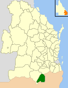
The Shire of Stanthorpe was a local government area of Queensland, Australia on the Queensland-New South Wales border. It was on the Great Dividing Range and was part of the Granite Belt. Its main industries included fruit and vegetable growing, wineries and tourism, and sheep and cattle grazing.
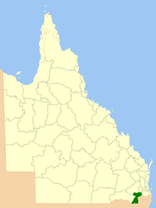
The Southern Downs Region is a local government area (LGA) in the Darling Downs region of Queensland, Australia. The region runs along the state's southern boundary with New South Wales and was created in 2008 from a merger of the Shire of Warwick and the Shire of Stanthorpe. As at 2024, it has an area of 7,088 square kilometres (2,737 sq mi).
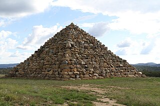
The Ballandean Pyramid is a man-made stone pyramid near the small village of Ballandean, Queensland, Australia. The pyramid is approximately 15 metres in height and built from blocks of the local granite. It is on private property belonging to a local vineyard and is approximately 25 metres from the nearest road.

Amiens is a rural locality in the Southern Downs Region, Queensland, Australia. In the 2021 census, Amiens had a population of 343 people.

Ballandean is a rural town and locality in the Southern Downs Region, Queensland, Australia. The town has a number of nearby vineyards which attracted tourists to the area. In the 2021 census, the locality of Ballandean had a population of 316 people.

Dalveen is a town and a locality in the Southern Downs Region, Queensland, Australia. It borders New South Wales. In the 2021 census, the locality of Dalveen had a population of 369 people.

Somme is a rural locality in the Southern Downs Region, Queensland, Australia. In the 2021 census, Somme had a population of 39 people.

The Summit is a rural town and locality in the Southern Downs Region, Queensland, Australia. In the 2021 census, the locality of The Summit had a population of 436 people.
Lyra is a rural locality in the Southern Downs Region, Queensland, Australia. In the 2021 census, Lyra had a population of 35 people.
Eukey is a rural locality in the Southern Downs Region, Queensland, Australia. It is on the border with New South Wales. In the 2021 census, Eukey had a population of 140 people.

Severnlea is a semi-rural locality in the Southern Downs Region, Queensland, Australia. In the 2021 census, Severnlea had a population of 382 people.

Greenlands is a rural locality in the Southern Downs Region, Queensland, Australia. In the 2021 census, Greenlands had a population of 244 people.
Bapaume is a rural locality in the Southern Downs Region, Queensland, Australia. In the 2021 census, Bapaume had a population of 123 people.

Thorndale is a rural locality in the Southern Downs Region, Queensland, Australia. In the 2021 census, Thorndale had a population of 134 people.
Fletcher is a rural locality in the Southern Downs Region, Queensland, Australia. In the 2021 census, Fletcher had a population of 128 people.

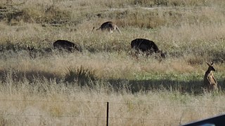
Girraween is an undeveloped locality in the Southern Downs Region, Queensland, Australia. It is in the Granite Belt and on the border with New South Wales. In the 2021 census, Girraween had a population of 5 people.
Nundubbermere is a rural locality in the Southern Downs Region, Queensland, Australia. In the 2021 census, Nundubbermere had a population of 102 people.


