Sladevale, Queensland

Last updated

Sladevale
Queensland
Australia Queensland location map.svg
Red pog.svg
Sladevale
Coordinates 28°09′53″S152°05′16″E / 28.1647°S 152.0877°E / -28.1647; 152.0877 (Sladevale (centre of locality))
Population433 (2021 census) [1]
 • Density12.163/km2 (31.50/sq mi)
Postcode(s) 4370
Area35.6 km2 (13.7 sq mi)
Time zone AEST (UTC+10:00)
LGA(s) Southern Downs Region
State electorate(s) Southern Downs
Federal division(s) Maranoa
Suburbs around Sladevale:
Willowvale Glengallan
Clintonvale
Freestone
Womina Sladevale Swan Creek
Warwick Mount Tabor The Hermitage

Sladevale is a rural locality in the Southern Downs Region, Queensland, Australia. [2] In the 2021 census, Sladevale had a population of 433 people. [1]

Contents

History

In 1897, the residents of Campbell's Plains began to lobby for a school, [3] declaring in 1898 that there were more than fifty children in the district. [4] In 1899, the Queensland Government called for tenders to erect the school and teacher's residence. Campbell's Plains State School opened on 13 November 1899 under headmaster James Allen Ferguson. [5] In 1900, the post office at the school was renamed Sladevale because the name Campbell's Plains was too common. [6] In 1903, the school was renamed Sladevale State School. The school closed in 1932 and its teacher's resident relocated to Applethorpe. [7] [8] Local residents tried to have the school re-opened in 1937 without success. [9] In 1944, it was agreed to re-open the school with about 17 students. [10] [11] It closed on 28 April 1967. [12] [13] It was at 12739 Cunningham Highway ( 28°09′57″S152°04′18″E / 28.16595°S 152.07166°E / -28.16595; 152.07166 (Sladevale State School (former)) ). [14] [15]

Campbells Plains railway station ( 28°09′02″S152°06′11″E / 28.1505°S 152.1030°E / -28.1505; 152.1030 (Campbells Plains railway station (former)) ) and Sladevale railway station ( 28°10′28″S152°04′09″E / 28.17451°S 152.06909°E / -28.17451; 152.06909 (Sladevale railway station (former)) ) were on the former Maryvale railway line. [16] [17]

Demographics

In the 2016 census, Sladevale had a population of 381 people. [18]

In the 2021 census, Sladevale had a population of 433 people. [1]

Education

There are no schools in Sladevale. The nearest government primary schools are Glennie Heights State School and Warwick East State School, both in neighbouring Warwick to the south-west and Freestone State School in neighbouring Freestone to the north. [19]

There are also a number of non-government schools in Warwick. [20]

Facilities

Warwick Solar Farm was developed by the University of Queensland at 115 Mcmahon Road ( 28°10′59″S152°04′18″E / 28.1830°S 152.0718°E / -28.1830; 152.0718 (solar farm) ). [21] It has over 200,000 solar panels capable of powering more than 25,000 homes per year. [22]

Related Research Articles

<span class="mw-page-title-main">Warwick, Queensland</span> Town in Queensland, Australia

Warwick is a rural town and locality in southeast Queensland, Australia, lying 130 kilometres (81 mi) south-west of Brisbane. It is the administrative centre of the Southern Downs Region local government area. The surrounding Darling Downs have fostered a strong agricultural industry for which Warwick, together with the larger city of Toowoomba, serve as convenient service centres. In the 2021 census, the locality of Warwick had a population of 12,294 people.
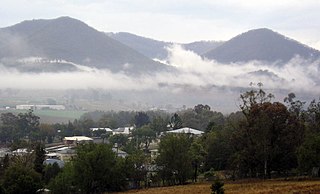
<span class="mw-page-title-main">Killarney, Queensland</span> Town in Queensland, Australia

Killarney is a rural town and locality in the Southern Downs Region, Queensland, Australia. It borders New South Wales. In the 2021 census, the locality of Killarney had a population of 918 people.

<span class="mw-page-title-main">Maryvale, Queensland (Southern Downs Region)</span> Town in Queensland, Australia

Maryvale is a rural town and locality in the Southern Downs Region, Queensland, Australia. In the 2021 census, the locality of Maryvale had a population of 392 people.

<span class="mw-page-title-main">Dalveen, Queensland</span> Town in Queensland, Australia

Dalveen is a town and a locality in the Southern Downs Region, Queensland, Australia. It borders New South Wales. In the 2021 census, the locality of Dalveen had a population of 369 people.

<span class="mw-page-title-main">Glengallan, Queensland</span> Suburb of Southern Downs Region, Queensland, Australia

Glengallan is a rural locality in the Southern Downs Region, Queensland, Australia. In the 2021 census, Glengallan had a population of 57 people.
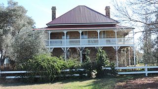
<span class="mw-page-title-main">Swan Creek, Queensland</span> Suburb of Southern Downs Region, Queensland, Australia

Swan Creek is a rural locality in the Southern Downs Region, Queensland, Australia. In the 2021 census, Swan Creek had a population of 161 people.

<span class="mw-page-title-main">Yangan, Queensland</span> Town in Queensland, Australia

Yangan is a rural town and locality in the Southern Downs Region, Queensland, Australia. In the 2021 census, the locality of Yangan had a population of 404 people.
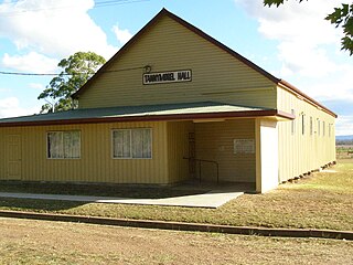
<span class="mw-page-title-main">Tannymorel, Queensland</span> Town in Queensland, Australia

Tannymorel is a rural town and locality in the Southern Downs Region, Queensland, Australia. In the 2021 census, the locality of Tannymorel had a population of 148 people.

Lockyer is a rural locality in the Lockyer Valley Region, Queensland, Australia. In the 2021 census, Lockyer had a population of 89 people.

Owanyilla is a rural town and locality in the Fraser Coast Region, Queensland, Australia. In the 2021 census, the locality of Owanyilla had a population of 245 people.

<span class="mw-page-title-main">Danderoo, Queensland</span> Suburb of Southern Downs Region, Queensland, Australia

Danderoo is a rural locality in the Southern Downs Region, Queensland, Australia. In the 2021 census, Danderoo had a population of 40 people.

<span class="mw-page-title-main">Emu Vale, Queensland</span> Town in Queensland, Australia

Emu Vale is a rural town and locality in the Southern Downs Region, Queensland, Australia. In the 2021 census, the locality of Emu Vale had a population of 161 people.

<span class="mw-page-title-main">Mount Colliery, Queensland</span> Suburb of Southern Downs Region, Queensland, Australia

Mount Colliery is a rural locality in the Southern Downs Region, Queensland, Australia. In the 2021 census, Mount Colliery had a population of 117 people.

<span class="mw-page-title-main">Goomburra, Queensland</span> Town in Queensland, Australia

Goomburra is a rural town and locality in the Southern Downs Region, Queensland, Australia. In the 2021 census, the locality of Goomburra had a population of 256 people.

Rosehill is a rural locality in the Southern Downs Region, Queensland, Australia. In the 2021 census, Rosehill had a population of 134 people.

Womina is a rural locality in the Southern Downs Region, Queensland, Australia. In the 2021 census, Womina had a population of 207 people.
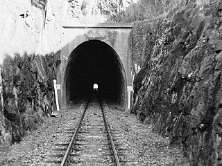
<span class="mw-page-title-main">Silverwood, Queensland</span> Suburb of Southern Downs Region, Queensland, Australia

Silverwood is a rural locality in the Southern Downs Region, Queensland, Australia. In the 2021 census, Silverwood had a population of 58 people.

Rosenthal Heights is a mixed-use locality in the Southern Downs Region, Queensland, Australia. In the 2021 census, Rosenthal Heights had a population of 2,664 people.

Wiyarra is a rural locality in the Southern Downs Region, Queensland, Australia. In the 2021 census, Wiyarra had a population of 20 people.

Mount Sturt is a rural locality in the Southern Downs Region, Queensland, Australia. In the 2021 census, Mount Sturt had "no people or a very low population".

References

  1. 1 2 3 Australian Bureau of Statistics (28 June 2022). "Sladevale (SAL)". 2021 Census QuickStats. Retrieved 28 February 2023. OOjs UI icon edit-ltr-progressive.svg
  2. "Sladevale – locality in Southern Downs Region (entry 45975)". Queensland Place Names. Queensland Government . Retrieved 29 December 2020.
  3. "A MINISTER FINED". Warwick Argus . Vol. XXXIII, no. 2645. Queensland, Australia. 17 August 1897. p. 2. Retrieved 11 October 2024 via National Library of Australia.
  4. "PROPOSED SCHOOL FOR CAMPBELL'S PLAIN". Warwick Examiner And Times . Vol. 32, no. 4209. Queensland, Australia. 19 March 1898. p. 2. Retrieved 11 October 2024 via National Library of Australia.
  5. "OBITUARY". Warwick Examiner And Times . Vol. 39, no. 5003. Queensland, Australia. 13 December 1905. p. 5. Retrieved 11 October 2024 via National Library of Australia.
  6. "A NEW NAME". Warwick Examiner And Times . Vol. 34, no. 4401. Queensland, Australia. 24 January 1900. p. 3. Retrieved 11 October 2024 via National Library of Australia.
  7. "Letters from Little Readers". The Queenslander Illustrated Weekly . Queensland, Australia. 14 April 1932. p. 40. Retrieved 11 October 2024 via National Library of Australia.
  8. "BUILDING AND REAL ESTATE". The Brisbane Courier . No. 23, 196. Queensland, Australia. 3 June 1932. p. 4. Retrieved 11 October 2024 via National Library of Australia.
  9. "SLADEVALE". Warwick Daily News . No. 5466. Queensland, Australia. 25 January 1937. p. 4. Retrieved 11 October 2024 via National Library of Australia.
  10. "Sladevale State School". Warwick Daily News . No. 7885. Queensland, Australia. 6 November 1944. p. 2. Retrieved 11 October 2024 via National Library of Australia.
  11. "SLADEVALE SCHOOL TO REOPEN". Warwick Daily News . No. 7906. Queensland, Australia. 30 November 1944. p. 2. Retrieved 11 October 2024 via National Library of Australia.
  12. "Agency ID 6395, Sladvale State School". Queensland State Archives . Retrieved 11 October 2024.
  13. Queensland Family History Society (2010), Queensland schools past and present (Version 1.01 ed.), Queensland Family History Society, ISBN   978-1-921171-26-0
  14. "Parish of Warwick" (Map). Queensland Government. 1956. Retrieved 11 October 2024.
  15. "Layers: Locality; Road rail; Land parcel; Watercourse". Queensland Globe. Queensland Government . Retrieved 11 October 2024.
  16. "Campbells Plains – rail station - feature no longer exists in Southern Downs Regional (entry 39238)". Queensland Place Names. Queensland Government . Retrieved 21 May 2024.
  17. "Warwick" (Map). Queensland Government. 1937. Retrieved 11 October 2024.
  18. Australian Bureau of Statistics (27 June 2017). "Sladevale (SSC)". 2016 Census QuickStats. Retrieved 20 October 2018. OOjs UI icon edit-ltr-progressive.svg
  19. "Layers: Locality; Schools and school catchments". Queensland Globe. Queensland Government . Retrieved 10 October 2024.
  20. "Layers: Locality; Schools and school catchments". Queensland Globe. Queensland Government . Retrieved 10 October 2024.
  21. "Landmark Areas - Queensland". Queensland Open Data. Queensland Government. 18 November 2020. Archived from the original on 21 November 2020. Retrieved 21 October 2020.
  22. "Warwick Solar Farm". University of Queensland . 8 June 2021. Retrieved 11 October 2024.