
Stanthorpe is a rural town and locality in the Southern Downs Region, Queensland, Australia. In the 2016 census, Stanthorpe had a population of 5,406 people.

Ballandean is a rural town and locality in the Southern Downs Region, Queensland, Australia. In the 2021 census, the locality of Ballandean had a population of 316 people.

Somme is a rural locality in the Southern Downs Region, Queensland, Australia. In the 2016 census Somme had a population of 53 people.

The Summit is a rural town and locality in the Southern Downs Region, Queensland, Australia. In the 2016 census, the locality of The Summit had a population of 409 people.
Lyra is a rural locality in the Southern Downs Region, Queensland, Australia. In the 2016 census, Lyra had a population of 53 people.
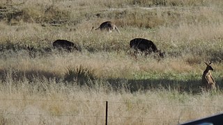
Eukey is a rural locality in the Southern Downs Region, Queensland, Australia. It is on the border with New South Wales. In the 2016 census Eukey had a population of 134 people.
Greenlands is a rural locality in the Southern Downs Region, Queensland, Australia. In the 2016 census Greenlands had a population of 250 people.
Dalcouth is a locality in the Southern Downs Region, Queensland, Australia. It is on the border with New South Wales. In the 2016 census, Dalcouth had a population of 165 people.
Glenlyon is a rural locality in the Southern Downs Region, Queensland, Australia. In the 2021 census, Glenlyon had a population of 32 people.
Thorndale is a rural locality in the Southern Downs Region, Queensland, Australia. In the 2016 census Thorndale had a population of 150 people.
Fletcher is a rural locality in the Southern Downs Region, Queensland, Australia. In the 2016 census, Fletcher had a population of 92 people.
Mount Tully is a rural locality in the Southern Downs Region, Queensland, Australia. In the 2021 census, Mount Tully had a population of 117 people.

Fleurbaix is a locality in the Southern Downs Region, Queensland, Australia. In the 2021 census, Fleurbaix had a population of 56 people.
Glen Niven is a rural locality in the Southern Downs Region, Queensland, Australia. It is within the Granite Belt on the Darling Downs and adjacent to the border with New South Wales. In the 2021 census, Glen Niven had a population of 99 people.
Goldfields is a rural locality in the Southern Downs Region, Queensland, Australia. In the 2016 census, Goldfields had a population of 28 people.

Kyoomba is a rural locality in the Southern Downs Region, Queensland, Australia. In the 2021 census, Kyoomba had a population of 83 people.
Pikes Creek is a rural locality in the Southern Downs Region, Queensland, Australia. In the 2016 census, Pikes Creek had a population of 26 people.
Morgan Park is a rural locality in the Southern Downs Region, Queensland, Australia. In the 2021 census, Morgan Park had a population of 98 people.
Passchendaele is a rural locality in the Southern Downs Region, Queensland, Australia. In the 2016 census, Passchendaele had a population of 30 people.
Sugarloaf is a rural locality in the Southern Downs Region, Queensland, Australia. In the 2016 census, Sugarloaf had a population of 113 people.
