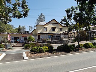
Westwood is a town in the Rockhampton Region and a locality split between the Rockhampton Region and the Shire of Banana in Queensland, Australia. It was the first town that was gazetted by the Queensland Government. In the 2016 census, Westwood had a population of 174 people.

Gowrie Junction is a rural locality in the Toowoomba Region, Queensland, Australia. It is north-west of Toowoomba. In the 2016 census, Gowrie Junction had a population of 2,120 people. The town of Gowrie is in the eastern part of the locality.

Cooran is a small hinterland town and locality in the Shire of Noosa in Queensland, Australia. Between 2008 and 2013 it was within Sunshine Coast Region.
Ringtail Creek is a locality in the northern Sunshine Coast hinterland about 25 kilometres (16 mi) northwest of Noosa Heads in Queensland, Australia. It is within the local government area of Shire of Noosa. At the 2011 Australian Census Ringtail Creek recorded a population of 180.

Tin Can Bay is a coastal town and locality in the Wide Bay–Burnett region in Queensland, Australia. The locality is split between the Fraser Coast Region and the Gympie Region, but the town itself is within Gympie Region. In the 2016 census, Tin Can Bay had a population of 2,242 people.

Moonie is a rural town in the Western Downs Region and a locality split between the Western Downs Region and the Goondiwindi Region in Queensland, Australia. At the 2016 Census, Moonie had a population of 189.

Leyburn is a rural town in the Southern Downs Region and a locality split between the South Downs Region and the Toowoomba Region in Queensland, Australia. In the 2016 census, Leyburn had a population of 476 people.

Karara is a town and locality in the Darling Downs region within the Queensland, Australia. It is in the Southern Downs Region local government area. In the 2016 census, Karara had a population of 123 people.

Cranley is a rural locality in the Toowoomba Region, Queensland, Australia. In the 2016 census, Cranley had a population of 1446 people.

Applethorpe is a rural town and locality in the Southern Downs Region, Queensland, Australia. In the 2016 census the locality of Applethorpe had a population of 511 people.

Basilisk is a rural locality in the Cassowary Coast Region, Queensland, Australia. In the 2016 census Basilisk had a population of 0 people.

Traveston is a rural town and locality in the Gympie Region, Queensland, Australia.

Maidenwell is a rural town and locality in the South Burnett Region, Queensland, Australia. In the 2016 census the locality of Maidenwell had a population of 199 people.

Dalveen is a town and a locality in the Southern Downs Region, Queensland, Australia. It borders New South Wales. In the 2016 census, Dalveen had a population of 335 people.

Glengallan is a rural locality in the Southern Downs Region, Queensland, Australia. In the 2016 census, Glengallan had a population of 54 people.

Mount Coolon is a small town and locality in the Whitsunday Region, Queensland, Australia.

Somme is a rural locality in the Southern Downs Region, Queensland, Australia. In the 2016 census Somme had a population of 53 people.

Toolburra is a rural locality in the Southern Downs Region, Queensland, Australia. In the 2016 census Toolburra had a population of 42 people.

Cunningham is a rural locality in the Southern Downs Region, Queensland, Australia. In the 2016 census Cunningham had a population of 66 people.

Lower Tully is a rural locality in the Cassowary Coast Region, Queensland, Australia. In the 2016 census Lower Tully had a population of 79 people.


