Massie, Queensland

Last updated

Massie
Queensland
Deuchar-Massie Hall, Massie, 1997.jpg
Deuchar-Massie Hall, Massie, 1997
Australia Queensland location map.svg
Red pog.svg
Massie
Coordinates 28°07′58″S151°55′49″E / 28.1327°S 151.9302°E / -28.1327; 151.9302 (Massie (centre of locality))
Population113 (SAL 2021) [1]
Postcode(s) 4370
Area53.3 km2 (20.6 sq mi)
Time zone AEST (UTC+10:00)
Location
LGA(s) Southern Downs Region
State electorate(s) Southern Downs
Federal division(s) Maranoa
Suburbs around Massie:
Bony Mountain Deuchar Deuchar
Upper Wheatvale Massie Willowvale
Leslie
Wheatvale
Toolburra Rosehill
Toolburra

Massie is a rural locality in the Southern Downs Region, Queensland, Australia. [2] In the 2021 census, Massie had a population of 113 people. [3]

Contents

Geography

The locality is bounded to the south by the Condamine River. [4]

The Warwick Allora Road enters to the locality from the south-east (Toolburra) and exits to the north (Deuchar). [4]

The South Western railway line enters the locality from the north (Deuchar) and runs immediately parallel and east of the Warwick Allora Road until it exits to the south-east (Toolburra). The locality was served by the Massie railway station ( 28°08′49″S151°57′20″E / 28.1469°S 151.9556°E / -28.1469; 151.9556 (Massie railway station) ). [5] [6] [4]

The land use is crop growing and grazing on native vegetation. [4]

History

The locality was named after the Massie railway station which was named by the Queensland Railways Department after Robert George Massie, a pastoralist of South Toolburra, who was formerly a Commissioner of Crown Lands for MacLeay River District and later a Member of the Queensland Legislative Council and a Member of the New South Wales Legislative Council for the Pastoral districts of New England and MacLeay. [2] [7] [8] [9] [10]

Deuchar Provisional School opened on 14 March 1904. On 1 January 1909 it became Deuchar State School. It was closed in 1921 due to low student numbers, but reopened in 1924. It closed permanently on 11 August 1967. [11] It was at 98 Millar Lane, on the south-east corner of Deuchar Bony Mountain Road, now within Massie ( 28°06′54″S151°56′33″E / 28.11510°S 151.94239°E / -28.11510; 151.94239 (Deuchar State School (former)) ). [12] [13] [14]

Demographics

In the 2016 census, Massie had a population of 91 people. [15]

In the 2021 census, Massie had a population of 113 people. [3]

Education

There are no schools in Massie. The nearest government primary schools are Wheatvale State School in neighbouring Wheatvale to the south-west, Glennie Heights State School in Warwick to the south-east, and Allora State School in Allora to the north. The nearest government secondary schools are Warwick State High School (to Year 12) in Warwick, Allora State School (to Year 10) in Allora, and Clifton State High School (to Year 12) in Clifton to the north. [16]

Amenities

Warwick Aerodrome is at 111 Massie Bony Mountain Road ( 28°08′57″S151°56′37″E / 28.1491°S 151.9436°E / -28.1491; 151.9436 (Warwick Aerodrome) ). [17] It is operated by the Southern Downs Regional Council. [18]

Deuchar-Massie Hall is a public hall at 12 Massie Bony Mountain Road (corner of Massie Hall Road, 28°08′56″S151°57′17″E / 28.1490°S 151.9547°E / -28.1490; 151.9547 (DEUCGAR-MASSIE HALL) ). [19]

Related Research Articles

<span class="mw-page-title-main">Nobby, Queensland</span> Town in Queensland, Australia

Nobby is a rural town and locality on the Darling Downs in the Toowoomba Region, Queensland, Australia. It is located halfway between Toowoomba and Warwick. It is known for its association with Steele Rudd (author) and Sister Elizabeth Kenny.

<span class="mw-page-title-main">Allora, Queensland</span> Town in Queensland, Australia

Allora is a rural town and locality in the Southern Downs Region, Queensland, Australia. In the 2016 census, the locality of Allora had a population of 1,223 people.

<span class="mw-page-title-main">Leyburn, Queensland</span> Town in Queensland, Australia

Leyburn is a rural town in the Southern Downs Region and a locality split between the South Downs Region and the Toowoomba Region in Queensland, Australia. In the 2016 census, Leyburn had a population of 476 people.

<span class="mw-page-title-main">Shire of Allora</span> Local government area in Queensland, Australia

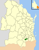
The Shire of Allora was a local government area north of the regional centre of Warwick in the Darling Downs region of Queensland. The shire, administered from Allora, covered an area of 702.0 square kilometres (271.0 sq mi), and existed as a local government entity from 1869 until 1994, when it was dissolved and amalgamated with City of Warwick, Shire of Rosenthal and Shire of Glengallan to form the Shire of Warwick.

<span class="mw-page-title-main">Karara, Queensland</span> Town in Queensland, Australia

Karara is a rural town and locality in the Southern Downs Region, Queensland, Australia. In the 2016 census, the locality of Karara had a population of 123 people.

<span class="mw-page-title-main">Glengallan, Queensland</span> Suburb of Southern Downs Region, Queensland, Australia

Glengallan is a rural locality in the Southern Downs Region, Queensland, Australia. In the 2021 census, Glengallan had a population of 57 people.

<span class="mw-page-title-main">Allan, Queensland</span> Suburb of Southern Downs Region, Queensland, Australia

Allan is a rural locality in the Southern Downs Region, Queensland, Australia. It was formerly known as Sandy Creek. In the 2016 census, Allan had a population of 87 people.

<span class="mw-page-title-main">Toolburra, Queensland</span> Suburb of Southern Downs Region, Queensland, Australia

Toolburra is a rural locality in the Southern Downs Region, Queensland, Australia. In the 2016 census Toolburra had a population of 42 people.

Bony Mountain is a rural locality in the Southern Downs Region, Queensland, Australia. In the 2016 census, Bony Mountain had a population of 94 people.

<span class="mw-page-title-main">Clintonvale, Queensland</span> Suburb of Southern Downs Region, Queensland, Australia

Clintonvale is a rural locality in the Southern Downs Region, Queensland, Australia. In the 2016 census, Clintonvale had a population of 74 people.

Deuchar is a rural locality in the Southern Downs Region, Queensland, Australia. In the 2016 census Deuchar had a population of 295 people.

Greymare is a rural locality in the Southern Downs Region, Queensland, Australia. In the 2016 census Greymare had a population of 64 people.

<span class="mw-page-title-main">Thane, Queensland</span> Town in Queensland, Australia

Thane is a rural town and locality in the Southern Downs Region, Queensland, Australia. In the 2016 census, Thane had a population of 27 people.

Talgai is a rural locality in the Southern Downs Region, Queensland, Australia. In the 2016 census Talgai had a population of 106 people.

Leslie is a rural locality in the Southern Downs Region, Queensland, Australia. In the 2021 census, Leslie had a population of 12 people.

Victoria Hill is a locality spit between the Southern Downs Region and the Toowoomba Region, both in Queensland, Australia. In the 2016 census, Victoria Hill had a population of 30 people.

<span class="mw-page-title-main">Leslie Dam, Queensland</span> Suburb of Southern Downs Region, Queensland, Australia

Leslie Dam is a locality in the Southern Downs Region, Queensland, Australia. In the 2021 census, Leslie Dam had a population of 118 people.

Montrose is a rural locality in the Southern Downs Region, Queensland, Australia. In the 2021 census, Montrose had a population of 0 people.

Palgrave is a rural locality in the Southern Downs Region, Queensland, Australia. In the 2021 census, Palgrave had a population of 35 people.

Rodgers Creek is a rural locality in the Southern Downs Region, Queensland, Australia. In the 2021 census, Rodgers Creek had a population of 15 people.

References

  1. Australian Bureau of Statistics (28 June 2022). "Massie (suburb and locality)". Australian Census 2021 QuickStats. Retrieved 28 June 2022.  OOjs UI icon edit-ltr-progressive.svg
  2. 1 2 "Massie – locality in Southern Downs Region (entry 49195)". Queensland Place Names. Queensland Government . Retrieved 25 November 2018.
  3. 1 2 Australian Bureau of Statistics (28 June 2022). "Massie (SAL)". 2021 Census QuickStats. Retrieved 28 February 2023. OOjs UI icon edit-ltr-progressive.svg
  4. 1 2 3 4 "Queensland Globe". State of Queensland . Retrieved 9 November 2023.
  5. "Railway stations and sidings - Queensland". Queensland Open Data. Queensland Government. 2 October 2020. Archived from the original on 5 October 2020. Retrieved 5 October 2020.
  6. "Massie – railway station in the Southern Downs Region (entry 21196)". Queensland Place Names. Queensland Government . Retrieved 9 November 2023.
  7. "NOMENCLATURE OF QUEENSLAND.—188". The Courier-mail . No. 838. Queensland, Australia. 7 May 1936. p. 12. Archived from the original on 9 November 2023. Retrieved 26 November 2018 via National Library of Australia.
  8. "SKETCHER". The Queenslander . No. 2456. Queensland, Australia. 11 April 1914. p. 8. Archived from the original on 26 December 2020. Retrieved 26 November 2018 via National Library of Australia.
  9. "Massie, Robert George". Former Members. Queensland Parliament. 18 August 2017. Archived from the original on 26 November 2018. Retrieved 26 November 2018.
  10. "Mr Robert George Massie (1815-1883)". Members of the Parliament of New South Wales . Retrieved 26 November 2018.
  11. Queensland Family History Society (2010), Queensland schools past and present (Version 1.01 ed.), Queensland Family History Society, ISBN   978-1-921171-26-0
  12. "Parish of North Toolburra" (Type). Queensland Government. 1931. Retrieved 10 November 2023.
  13. "Queensland Two Mile series sheet 2m41" (Map). Queensland Government. 1962. Retrieved 10 November 2023.
  14. "Queensland Globe". State of Queensland . Retrieved 10 November 2023.
  15. Australian Bureau of Statistics (27 June 2017). "Massie (SSC)". 2016 Census QuickStats. Retrieved 20 October 2018. OOjs UI icon edit-ltr-progressive.svg
  16. "Layers: Locality; Schools and school catchments". Queensland Globe. Queensland Government. Archived from the original on 19 December 2017. Retrieved 9 November 2023.
  17. "Airports - Queensland". Queensland Open Data. Queensland Government. 22 October 2020. Archived from the original on 15 November 2020. Retrieved 3 November 2020.
  18. "Aerodromes". Southern Downs Regional Council. Archived from the original on 24 October 2022. Retrieved 9 November 2023.
  19. "Building points - Queensland". Queensland Open Data. Queensland Government. 17 November 2020. Archived from the original on 25 November 2020. Retrieved 25 November 2020.