Leslie, Queensland

Last updated

Leslie
Queensland
Australia Queensland location map.svg
Red pog.svg
Leslie
Coordinates 28°10′21″S151°55′00″E / 28.1725°S 151.9166°E / -28.1725; 151.9166 (Leslie (centre of locality))
Population12 (SAL 2016) [1] [2]
Postcode(s) 4370
Area10.1 km2 (3.9 sq mi)
Time zone AEST (UTC+10:00)
Location
LGA(s) Southern Downs Region
State electorate(s) Southern Downs
Federal division(s) Maranoa
Suburbs around Leslie:
Massie Massie Massie
Wheatvale Leslie Toolburra
Leslie Dam Leslie Dam Allan

Leslie is a rural locality in the Southern Downs Region, Queensland, Australia. [3] In the 2021 census, Leslie had a population of 12 people. [4]

Contents

Geography

The Condamine River forms the northern boundary of the locality and the Cunningham Highway forms most of the southern boundary. [5]

The South Western railway line enters the locality from the south (Leslie Dam) and exits to the west (Wheatvale). [5] Historically, the locality was served by the now-abandoned Leslie railway station ( 28°10′32″S151°55′20″E / 28.1755°S 151.9221°E / -28.1755; 151.9221 (Leslie railway station) ). [6]

The land use is crop growing in the east of the locality with grazing on native vegetation in the centre and west of the locality. [5]

History

The locality was officially named and bounded on 14 September 2001. The name comes from the former Leslie railway station which was named after Patrick Leslie, [7] a pioneer pastoralist on the Darling Downs. [3] [8]

Demographics

In the 2016 census, Leslie had a population of 12 people. [9]

In the 2021 census, Leslie had a population of 12 people. [4]

Education

There are no schools in Leslie. The nearest government primary school is Wheatvale State School in neighbouring Wheatvale to the west. The nearest government seconary school is Warwick State High School in Warwick to the south-east. [10]

Related Research Articles

<span class="mw-page-title-main">Nobby, Queensland</span> Town in Queensland, Australia

Nobby is a rural town and locality on the Darling Downs in the Toowoomba Region, Queensland, Australia. It is located halfway between Toowoomba and Warwick. It is known for its association with Steele Rudd (author) and Sister Elizabeth Kenny.

<span class="mw-page-title-main">Karara, Queensland</span> Town in Queensland, Australia

Karara is a rural town and locality in the Southern Downs Region, Queensland, Australia. In the 2016 census, the locality of Karara had a population of 123 people.

<span class="mw-page-title-main">North Toowoomba, Queensland</span> Suburb of Toowoomba, Queensland, Australia

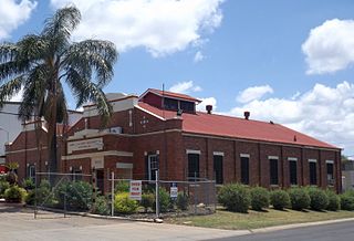
North Toowoomba is a suburban locality in Toowoomba in the Toowoomba Region, Queensland, Australia. In the 2021 census, North Toowoomba had a population of 3,332 people.

<span class="mw-page-title-main">Dalveen, Queensland</span> Town in Queensland, Australia

Dalveen is a town and a locality in the Southern Downs Region, Queensland, Australia. It borders New South Wales. In the 2016 census, Dalveen had a population of 335 people.

<span class="mw-page-title-main">Glengallan, Queensland</span> Suburb of Southern Downs Region, Queensland, Australia

Glengallan is a rural locality in the Southern Downs Region, Queensland, Australia. In the 2021 census, Glengallan had a population of 57 people.

<span class="mw-page-title-main">Allan, Queensland</span> Suburb of Southern Downs Region, Queensland, Australia

Allan is a rural locality in the Southern Downs Region, Queensland, Australia. It was formerly known as Sandy Creek. In the 2016 census, Allan had a population of 87 people.

Lowmead is a rural town and locality in the Gladstone Region, Queensland, Australia. In the 2021 census, the locality of Lowmead had a population of 179 people.

<span class="mw-page-title-main">Pratten, Queensland</span> Town in Queensland, Australia

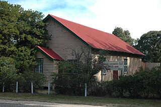
Pratten is a rural town and locality in the Southern Downs Region, Queensland, Australia. In the 2016 census, Pratten had a population of 205 people.

Wheatvale is a rural locality in the Southern Downs Region, Queensland, Australia. In the 2016 census, Wheatvale had a population of 56 people.

<span class="mw-page-title-main">Cottonvale, Queensland</span> Suburb of Southern Downs Region, Queensland, Australia

Cottonvale is a rural locality in the Southern Downs Region, Queensland, Australia. It borders New South Wales and contains the town of Cotton Vale. In the 2021 census, Cottonvale had a population of 153 people.

Ducklo is a locality in the Western Downs Region, Queensland, Australia. In the 2021 census, Ducklo had a population of 306 people.

<span class="mw-page-title-main">Thane, Queensland</span> Town in Queensland, Australia

Thane is a rural town and locality in the Southern Downs Region, Queensland, Australia. In the 2016 census, Thane had a population of 27 people.

<span class="mw-page-title-main">Fleurbaix, Queensland</span> Suburb of Southern Downs Region, Queensland, Australia

Fleurbaix is a locality in the Southern Downs Region, Queensland, Australia. In the 2021 census, Fleurbaix had a population of 56 people.

<span class="mw-page-title-main">Glen Niven, Queensland</span> Suburb of Southern Downs Region, Queensland, Australia

Glen Niven is a rural locality in the Southern Downs Region, Queensland, Australia. It is within the Granite Belt on the Darling Downs and adjacent to the border with New South Wales. In the 2021 census, Glen Niven had a population of 99 people.

Victoria Hill is a locality spit between the Southern Downs Region and the Toowoomba Region, both in Queensland, Australia. In the 2016 census, Victoria Hill had a population of 30 people.

<span class="mw-page-title-main">Leslie Dam, Queensland</span> Suburb of Southern Downs Region, Queensland, Australia

Leslie Dam is a locality in the Southern Downs Region, Queensland, Australia. In the 2021 census, Leslie Dam had a population of 118 people.

Irvingdale is a locality split between the Toowoomba Region and the Western Downs Region, both in Queensland, Australia. In the 2021 census, Irvingdale had a population of 163 people.

Kawl Kawl is a rural locality in the South Burnett Region, Queensland, Australia. In the 2021 census, Kawl Kawl had a population of 24 people.

Kings Creek is a rural locality in the Toowoomba Region, Queensland, Australia. In the 2021 census, Kings Creek had a population of 55 people.

Cutella is a rural locality in the Toowoomba Region, Queensland, Australia. In the 2021 census, Cutella had a population of 45 people.

References

  1. Australian Bureau of Statistics (27 June 2017). "Leslie (Suburb and Locality)". Australian Census 2016.  OOjs UI icon edit-ltr-progressive.svg
  2. Australian Bureau of Statistics (27 June 2017). "Leslie (Suburb and Locality)". Australian Census 2016 QuickStats. Retrieved 28 June 2022.  OOjs UI icon edit-ltr-progressive.svg
  3. 1 2 "Leslie – locality in Southern Downs Region (entry 45945)". Queensland Place Names. Queensland Government . Retrieved 25 November 2018.
  4. 1 2 Australian Bureau of Statistics (28 June 2022). "Leslie (SAL)". 2021 Census QuickStats. Retrieved 28 February 2023. OOjs UI icon edit-ltr-progressive.svg
  5. 1 2 3 "Queensland Globe". State of Queensland . Retrieved 27 October 2023.
  6. "Railway stations and sidings - Queensland". Queensland Open Data. Queensland Government. 2 October 2020. Archived from the original on 5 October 2020. Retrieved 5 October 2020.
  7. "SKETCHER". The Queenslander . No. 2456. Queensland, Australia. 11 April 1914. p. 8. Archived from the original on 26 December 2020. Retrieved 26 November 2018 via National Library of Australia.
  8. "NOMENCLATURE OF QUEENSLAND.—173". The Courier-mail . No. 823. Queensland, Australia. 20 April 1936. p. 12. Archived from the original on 26 October 2023. Retrieved 26 November 2018 via National Library of Australia.
  9. Australian Bureau of Statistics (27 June 2017). "Leslie (SSC)". 2016 Census QuickStats. Retrieved 20 October 2018. OOjs UI icon edit-ltr-progressive.svg
  10. "Layers: Locality; Schools and school catchments". Queensland Globe. Queensland Government. Archived from the original on 19 December 2017. Retrieved 26 October 2023.