Cannon Creek, Queensland (Southern Downs Region)

Last updated

Cannon Creek
Queensland
Australia Queensland location map.svg
Red pog.svg
Cannon Creek
Coordinates 28°36′29″S151°52′37″E / 28.6080°S 151.8769°E / -28.6080; 151.8769 (Cannon Creek (centre of locality)) Coordinates: 28°36′29″S151°52′37″E / 28.6080°S 151.8769°E / -28.6080; 151.8769 (Cannon Creek (centre of locality))
Population39 (2016 census) [1]
 • Density3.58/km2 (9.27/sq mi)
Postcode(s) 4380
Area10.9 km2 (4.2 sq mi)
Time zone AEST (UTC+10:00)
LGA(s) Southern Downs Region
State electorate(s) Southern Downs
Federal division(s) Maranoa
Suburbs around Cannon Creek:
Bapaume Pozieres The Summit
Amiens Cannon Creek Applethorpe
Broadwater Applethorpe Applethorpe

Cannon Creek is a rural locality in the Southern Downs Region, Queensland, Australia. [2] In the 2016 census, Cannon Creek had a population of 39 people. [1]

History

Cannon Creek Provisional School opened on 6 January 1911. On 1 October 1913 it became Cannon Creek State School. It closed on 1945. [3] It was located at 611 Cannon Creek Road ( 28°35′05″S151°51′48″E / 28.5847°S 151.8634°E / -28.5847; 151.8634 (Cannon Creek State School (site)) ), now within the locality of Bapaume. [4] [5]

In the 2016 census, Cannon Creek had a population of 39 people. [1]

Related Research Articles

Stanthorpe, Queensland Town in Queensland, Australia

Stanthorpe is a rural town and locality in the Southern Downs Region, Queensland, Australia. In the 2016 census, Stanthorpe had a population of 5,406 people.

Gowrie Junction, Queensland Suburb of Toowoomba Region, Queensland, Australia

Gowrie Junction is a rural locality in the Toowoomba Region, Queensland, Australia. It is north-west of Toowoomba. In the 2016 census, Gowrie Junction had a population of 2,120 people. The town of Gowrie is in the eastern part of the locality.

Bell, Queensland Town in Queensland, Australia

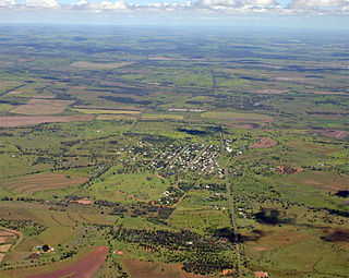
Bell is a rural town and locality in the Western Downs Region, Queensland, Australia. In the 2016 census the locality of Bell had a population of 502 people.

Leyburn, Queensland Town in Queensland, Australia

Leyburn is a rural town in the Southern Downs Region and a locality split between the South Downs Region and the Toowoomba Region in Queensland, Australia. In the 2016 census, Leyburn had a population of 476 people.

Karara, Queensland Town in Queensland, Australia

Karara is a town and locality in the Darling Downs region within the Queensland, Australia. It is in the Southern Downs Region local government area. In the 2016 census, Karara had a population of 123 people.

Ballandean, Queensland Town in Queensland, Australia

Ballandean is a rural town and locality in the Southern Downs Region, Queensland, Australia. In the 2016 census the locality of Ballandean had a population of 338 people.

Ascot, Queensland (Toowoomba Region) Suburb of Toowoomba Region, Queensland, Australia

Ascot is a rural locality in the Toowoomba Region, Queensland, Australia. In the 2016 census, Ascot had a population of 31 people.

The Summit, Queensland Town in Queensland, Australia

The Summit is a rural town and locality in the Southern Downs Region, Queensland, Australia. In the 2016 census, the locality of The Summit had a population of 409 people.

Lyra, Queensland Suburb of Southern Downs Region, Queensland, Australia

Lyra is a rural locality in the Southern Downs Region, Queensland, Australia. In the 2016 census, Lyra had a population of 53 people.

Spring Creek, Queensland (Darling Downs) Suburb of Toowoomba Region, Queensland, Australia

Spring Creek is a locality split between the Toowoomba Region and the Southern Downs Region, Queensland, Australia.

Brookstead, Queensland Town in Queensland, Australia

Brookstead is a rural town and locality in the Toowoomba Region, Queensland, Australia. In the 2016 census, Brookstead had a population of 217 people.

Cannon Creek, Queensland (Scenic Rim Region) Suburb of Scenic Rim Region, Queensland, Australia

Cannon Creek is a rural locality in the Scenic Rim Region, Queensland, Australia. In the 2016 census, Cannon Creek had a population of 78 people.

Bony Mountain, Queensland Suburb of Southern Downs Region, Queensland, Australia

Bony Mountain is a rural locality in the Southern Downs Region, Queensland, Australia. In the 2016 census, Bony Mountain had a population of 94 people.

Dalcouth, Queensland Suburb of Southern Downs Region, Queensland, Australia

Dalcouth is a locality in the Southern Downs Region, Queensland, Australia. It is on the border with New South Wales. In the 2016 census, Dalcouth had a population of 165 people.

Darr Creek, Queensland Suburb of Western Downs Region, Queensland, Australia

Darr Creek is a rural locality in the Western Downs Region, Queensland, Australia. In the 2016 census Darr Creek had a population of 18 people.

Greymare, Queensland Suburb of Southern Downs Region, Queensland, Australia

Greymare is a rural locality in the Southern Downs Region, Queensland, Australia. In the 2016 census Greymare had a population of 64 people.

Thane, Queensland Town in Queensland, Australia

Thane is a rural town and locality in the Southern Downs Region, Queensland, Australia. In the 2016 census, Thane had a population of 27 people.

The Falls, Queensland Suburb of Southern Downs Region, Queensland, Australia

The Falls is a rural locality in the Southern Downs Region, Queensland, Australia. In the 2016 census The Falls had a population of 70 people.

Jinghi, Queensland Suburb of Western Downs Region, Queensland, Australia

Jinghi is a rural locality in the Western Downs Region, Queensland, Australia. In the 2016 census Jinghi had a population of 74 people.

Victoria Hill, Queensland Suburb of Southern Downs Region, Queensland, Australia

Victoria Hill is a locality spit between the Southern Downs Region and the Toowoomba Region, both in Queensland, Australia. In the 2016 census, Victoria Hill had a population of 30 people.

References

  1. 1 2 3 Australian Bureau of Statistics (27 June 2017). "Cannon Creek (SSC)". 2016 Census QuickStats. Retrieved 20 October 2018. OOjs UI icon edit-ltr-progressive.svg
  2. "Cannon Creek – locality in Southern Downs Region (entry 45913)". Queensland Place Names. Queensland Government . Retrieved 19 September 2020.
  3. Queensland Family History Society (2010), Queensland schools past and present (Version 1.01 ed.), Queensland Family History Society, ISBN   978-1-921171-26-0
  4. "County of Bentinck" (Map). Queensland Government. 1912. Archived from the original on 22 October 2020. Retrieved 22 October 2020.
  5. "Queensland Globe". State of Queensland . Retrieved 22 October 2020.