Bapaume, Queensland

Last updated

Bapaume
Queensland
Australia Queensland location map.svg
Red pog.svg
Bapaume
Coordinates 28°34′31″S151°50′27″E / 28.5752°S 151.8408°E / -28.5752; 151.8408 (Bapaume (centre of locality))
Population130 (2016 census) [1]
 • Density9.6/km2 (24.9/sq mi)
Postcode(s) 4352
Area13.5 km2 (5.2 sq mi)
Time zone AEST (UTC+10:00)
LGA(s) Southern Downs Region
State electorate(s) Southern Downs
Federal division(s) Maranoa
Suburbs around Bapaume:
Passchendaele Passchendaele Passchendaele
Amiens Bapaume Pozieres
Amiens Amiens Cannon Creek

Bapaume is a rural locality in the Southern Downs Region, Queensland, Australia. [2] In the 2016 census, Bapaume had a population of 130 people. [1]

History

Bapaume takes its name from the Bapaume railway station, named by the Queensland Railways Department in 1920, after a World War I battlefield in France, involving the Australian Imperial Force. The area was opened as soldier settlements after 1919. [2]

Bapaume Provisional School opened on 28 January 1925. In 1948 it became Bapaume State School. It closed on 10 December 1982. [3] The school was on a 5-acre (2.0 ha) site at 843-853 Cannon Creek Road ( 28°34′35″S151°50′43″E / 28.57637°S 151.84539°E / -28.57637; 151.84539 (Bapaume State School (former)) ). [4] [5] As at December 2020, the school building was still on the site. [6]

In the 2016 census, Bapaume had a population of 130 people. [1]

Related Research Articles

<span class="mw-page-title-main">Wallangarra, Queensland</span> Town in Queensland, Australia

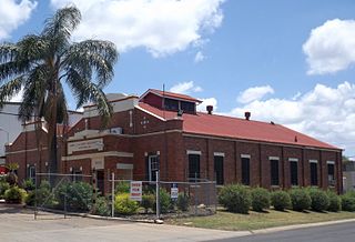
Wallangarra is a rural town and locality in the Southern Downs Region, Queensland, Australia on the border with New South Wales. In the 2016 census, the locality of Wallangarra had a population of 468 people.

<span class="mw-page-title-main">Leyburn, Queensland</span> Town in Queensland, Australia

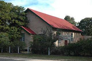
Leyburn is a rural town in the Southern Downs Region and a locality split between the South Downs Region and the Toowoomba Region in Queensland, Australia. In the 2016 census, Leyburn had a population of 476 people.

<span class="mw-page-title-main">Kingsthorpe, Queensland</span> Town in Queensland, Australia

Kingsthorpe is a rural town and locality in the Toowoomba Region, Queensland, Australia. In the 2021 census, the locality of Kingsthorpe had a population of 2,159 people.

<span class="mw-page-title-main">North Toowoomba, Queensland</span> Suburb of Toowoomba, Queensland, Australia

North Toowoomba is a suburban locality in Toowoomba in the Toowoomba Region, Queensland, Australia. In the 2021 census, North Toowoomba had a population of 3,332 people.

<span class="mw-page-title-main">Dalveen, Queensland</span> Town in Queensland, Australia

Dalveen is a town and a locality in the Southern Downs Region, Queensland, Australia. It borders New South Wales. In the 2016 census, Dalveen had a population of 335 people.

<span class="mw-page-title-main">Geham</span> Suburb of Toowoomba Region, Queensland, Australia

Geham is a rural locality in the Toowoomba Region, Queensland, Australia. In the 2021 census, Geham had a population of 470 people.

<span class="mw-page-title-main">Southbrook, Queensland</span> Town in Queensland, Australia

Southbrook is a rural town and locality in the Toowoomba Region, Queensland, Australia. In the 2021 census, the locality of Southbrook had a population of 626 people.

<span class="mw-page-title-main">Gowrie Little Plain, Queensland</span> Suburb of Toowoomba Region, Queensland, Australia

Gowrie Little Plain is a rural locality in the Toowoomba Region, Queensland, Australia. In the 2021 census, Gowrie Little Plain had a population of 79 people.

<span class="mw-page-title-main">The Summit, Queensland</span> Town in Queensland, Australia

The Summit is a rural town and locality in the Southern Downs Region, Queensland, Australia. In the 2016 census, the locality of The Summit had a population of 409 people.

Broadwater is a rural locality in the Southern Downs Region, Queensland, Australia. In the 2016 census, Broadwater had a population of 292 people.

Wheatvale is a rural locality in the Southern Downs Region, Queensland, Australia. In the 2016 census, Wheatvale had a population of 56 people.

Cannon Creek is a rural locality in the Southern Downs Region, Queensland, Australia. In the 2016 census, Cannon Creek had a population of 39 people.

Cawdor is a rural locality in the Toowoomba Region, Queensland, Australia.

<span class="mw-page-title-main">Cottonvale, Queensland</span> Suburb of Southern Downs Region, Queensland, Australia

Cottonvale is a rural locality in the Southern Downs Region, Queensland, Australia. It borders New South Wales and contains the town of Cotton Vale. In the 2021 census, Cottonvale had a population of 153 people.

Ducklo is a locality in the Western Downs Region, Queensland, Australia. In the 2021 census, Ducklo had a population of 306 people.

Glenlyon is a rural locality in the Southern Downs Region, Queensland, Australia. In the 2021 census, Glenlyon had a population of 32 people.

Plainby is a rural locality in the Toowoomba Region, Queensland, Australia. In the 2016 census, Plainby had a population of 44 people.

<span class="mw-page-title-main">Thane, Queensland</span> Town in Queensland, Australia

Thane is a rural town and locality in the Southern Downs Region, Queensland, Australia. In the 2016 census, Thane had a population of 27 people.

Goodger is a rural locality in the South Burnett Region, Queensland, Australia. In the 2016 census Goodger had a population of 187 people.

<span class="mw-page-title-main">Glen Niven, Queensland</span> Suburb of Southern Downs Region, Queensland, Australia

Glen Niven is a rural locality in the Southern Downs Region, Queensland, Australia. It is within the Granite Belt on the Darling Downs and adjacent to the border with New South Wales. In the 2021 census, Glen Niven had a population of 99 people.

References

  1. 1 2 3 Australian Bureau of Statistics (27 June 2017). "Bapaume (SSC)". 2016 Census QuickStats. Retrieved 20 October 2018. OOjs UI icon edit-ltr-progressive.svg
  2. 1 2 "Bapaume – locality in Southern Downs Region (entry 45908)". Queensland Place Names. Queensland Government . Retrieved 19 September 2020.
  3. Queensland Family History Society (2010), Queensland schools past and present (Version 1.01 ed.), Queensland Family History Society, ISBN   978-1-921171-26-0
  4. "Parish of Marsh" (Map). Queensland Government. 1951. Retrieved 28 September 2023.
  5. "Queensland Globe". State of Queensland . Retrieved 27 September 2023.
  6. Google (28 September 2023). "Bapaume State School (former)" (Map). Google Maps . Google. Retrieved 28 September 2023.