Montrose, Queensland (Southern Downs Region)

Last updated

Montrose
Queensland
Australia Queensland location map.svg
Red pog.svg
Montrose
Coordinates 28°09′37″S151°46′39″E / 28.1602°S 151.7775°E / -28.1602; 151.7775 (Montrose (centre of locality))
Population0 (2021 census) [1]
 • Density0.00/km2 (0.00/sq mi)
Postcode(s) 4370
Area13.8 km2 (5.3 sq mi)
Time zone AEST (UTC+10:00)
Location
LGA(s) Southern Downs Region
State electorate(s) Southern Downs
Federal division(s) Maranoa
Suburbs around Montrose:
Thane Pratten Pratten
Thane Montrose Cunningham
Greymare Greymare Rodgers Creek

Montrose is a rural locality in the Southern Downs Region, Queensland, Australia. [2] In the 2021 census, Montrose had "no people or a very low population". [1]

Contents

Geography

The locality is bounded to the south by the Cunningham Highway, which enters the locality from the south-east (Cunningham / Rodgers Creek) and exits to the south-west (Greymare). [3]

The South Western railway line runs to the north and loosely parallel with the highway, entering the locality from the east (Cunningham) and exiting to the west (Greymare). [3] The locality was historically served by the now-abandoned Montrose railway station ( 28°10′52″S151°47′34″E / 28.1810°S 151.7929°E / -28.1810; 151.7929 (Montrose railway station) ). [4]

The land use is grazing on native vegetation. [3]

History

The locality takes its name from the railway station, which, in turn, came from a pastoral run, named by pastoralist St George Richard Gore after the town of Montrose in Forfarshire, Scotland. [2]

Demographics

In the 2016 census, Montrose had "no people or a very low population". [5]

In the 2021 census, Montrose had "no people or a very low population". [1]

Education

There are no schools in Montrose. The nearest government primary school is Wheatvale State School in Wheatvale to the east. The nearest government secondary school is Warwick State High School in Warwick to the east. [6]

Related Research Articles

<span class="mw-page-title-main">Karara, Queensland</span> Town in Queensland, Australia

Karara is a rural town and locality in the Southern Downs Region, Queensland, Australia. In the 2016 census, the locality of Karara had a population of 123 people.

<span class="mw-page-title-main">Macalister, Queensland</span> Town in Queensland, Australia

Macalister is a rural town and locality in the Western Downs Region, Queensland, Australia. In the 2016 census, the locality of Macalister had a population of 153.

<span class="mw-page-title-main">Glengallan, Queensland</span> Suburb of Southern Downs Region, Queensland, Australia

Glengallan is a rural locality in the Southern Downs Region, Queensland, Australia. In the 2021 census, Glengallan had a population of 57 people.

<span class="mw-page-title-main">Allan, Queensland</span> Suburb of Southern Downs Region, Queensland, Australia

Allan is a rural locality in the Southern Downs Region, Queensland, Australia. It was formerly known as Sandy Creek. In the 2021 census, Allan had a population of 91 people.

Wheatvale is a rural locality in the Southern Downs Region, Queensland, Australia. In the 2016 census, Wheatvale had a population of 56 people.
<span class="mw-page-title-main">Cottonvale, Queensland</span> Suburb of Southern Downs Region, Queensland, Australia

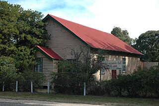
Cottonvale is a rural locality in the Southern Downs Region, Queensland, Australia. It borders New South Wales and contains the town of Cotton Vale. In the 2021 census, Cottonvale had a population of 153 people.

Greymare is a rural locality in the Southern Downs Region, Queensland, Australia. In the 2021 census, Greymare had a population of 70 people.

<span class="mw-page-title-main">Thane, Queensland</span> Town in Queensland, Australia

Thane is a rural town and locality in the Southern Downs Region, Queensland, Australia. In the 2016 census, Thane had a population of 27 people.

<span class="mw-page-title-main">Umbiram, Queensland</span> Suburb of Toowoomba Region, Queensland, Australia

Umbiram is a rural locality in the Toowoomba Region, Queensland, Australia. In the 2021 census, Umbiram had a population of 146 people.

Womina is a rural locality in the Southern Downs Region, Queensland, Australia. In the 2021 census, Womina had a population of 207 people.

Leslie is a rural locality in the Southern Downs Region, Queensland, Australia. In the 2021 census, Leslie had a population of 12 people.

<span class="mw-page-title-main">Massie, Queensland</span> Suburb of Southern Downs Region, Queensland, Australia

Massie is a rural locality in the Southern Downs Region, Queensland, Australia. In the 2021 census, Massie had a population of 113 people.

<span class="mw-page-title-main">Leslie Dam, Queensland</span> Suburb of Southern Downs Region, Queensland, Australia

Leslie Dam is a locality in the Southern Downs Region, Queensland, Australia. In the 2021 census, Leslie Dam had a population of 118 people.
<span class="mw-page-title-main">Silverwood, Queensland</span> Suburb of Southern Downs Region, Queensland, Australia

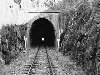
Silverwood is a rural locality in the Southern Downs Region, Queensland, Australia. In the 2021 census, Silverwood had a population of 58 people.

Palgrave is a rural locality in the Southern Downs Region, Queensland, Australia. In the 2021 census, Palgrave had a population of 35 people.

Rodgers Creek is a rural locality in the Southern Downs Region, Queensland, Australia. In the 2021 census, Rodgers Creek had a population of 15 people.

Rosenthal Heights is a mixed-use locality in the Southern Downs Region, Queensland, Australia. In the 2021 census, Rosenthal Heights had a population of 2,664 people.

Wiyarra is a rural locality in the Southern Downs Region, Queensland, Australia. In the 2021 census, Wiyarra had a population of 20 people.

Mount Sturt is a rural locality in the Southern Downs Region, Queensland, Australia. In the 2021 census, Mount Sturt had "no people or a very low population".

Kings Creek is a rural locality in the Toowoomba Region, Queensland, Australia. In the 2021 census, Kings Creek had a population of 55 people.

References

  1. 1 2 3 Australian Bureau of Statistics (28 June 2022). "Montrose (SAL)". 2021 Census QuickStats. Retrieved 28 February 2023. OOjs UI icon edit-ltr-progressive.svg
  2. 1 2 "Montrose – locality in Southern Downs Region (entry 45953)". Queensland Place Names. Queensland Government . Retrieved 11 June 2019.
  3. 1 2 3 "Queensland Globe". State of Queensland . Retrieved 26 November 2023.
  4. "Railway stations and sidings - Queensland". Queensland Open Data. Queensland Government. 2 October 2020. Archived from the original on 5 October 2020. Retrieved 5 October 2020.
  5. Australian Bureau of Statistics (27 June 2017). "Montrose (SSC)". 2016 Census QuickStats. Retrieved 20 October 2018. OOjs UI icon edit-ltr-progressive.svg
  6. "Layers: Locality; Schools and school catchments". Queensland Globe. Queensland Government . Retrieved 26 November 2023.