
Nobby is a rural town and locality on the Darling Downs in the Toowoomba Region, Queensland, Australia. It is located halfway between Toowoomba and Warwick. It is known for its association with Steele Rudd (author) and Sister Elizabeth Kenny.

Clifton is a rural town and locality in the Toowoomba Region, Queensland, Australia. In the 2021 census, the locality of Clifton had a population of 1,490 people.

Allora is a rural town and locality in the Southern Downs Region, Queensland, Australia. In the 2021 census, the locality of Allora had a population of 1,205.
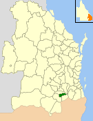
The Shire of Allora was a local government area north of the regional centre of Warwick in the Darling Downs region of Queensland. The shire, administered from Allora, covered an area of 702.0 square kilometres (271.0 sq mi), and existed as a local government entity from 1869 until 1994, when it was dissolved and amalgamated with City of Warwick, Shire of Rosenthal and Shire of Glengallan to form the Shire of Warwick.

Karara is a rural town and locality in the Southern Downs Region, Queensland, Australia. In the 2021 census, the locality of Karara had a population of 128 people.
Hendon is a rural town and locality in the Southern Downs Region, Queensland, Australia. In the 2021 census, the locality of Hendon had a population of 227 people.

Ascot is a rural locality in the Toowoomba Region, Queensland, Australia. In the 2021 census, Ascot had a population of 106 people.

Spring Creek is a rural locality split between the Toowoomba Region and the Southern Downs Region, Queensland, Australia. In the 2021 census, Spring Creek had a population of 195 people.
Cottonvale is a rural locality in the Southern Downs Region, Queensland, Australia. It borders New South Wales and contains the town of Cotton Vale. In the 2021 census, Cottonvale had a population of 153 people.

Deuchar is a rural locality in the Southern Downs Region, Queensland, Australia. In the 2021 census, Deuchar had a population of 327 people.

Goomburra is a rural town and locality in the Southern Downs Region, Queensland, Australia. In the 2021 census, the locality of Goomburra had a population of 256 people.

Thane is a rural town and locality in the Southern Downs Region, Queensland, Australia. In the 2021 census, the locality of Thane had a population of 19 people.

Wyberba is a rural locality in the Southern Downs Region, Queensland, Australia. In the 2021 census, Wyberba had a population of 63 people.
Rosehill is a rural locality in the Southern Downs Region, Queensland, Australia. In the 2021 census, Rosehill had a population of 134 people.
Ellinthorp is a rural town and a locality in the Southern Downs Region, Queensland, Australia. In the 2021 census, the locality of Ellinthorp had a population of 30 people.
Forest Springs is a rural locality in the Southern Downs Region, Queensland, Australia. In the 2021 census, Forest Springs had a population of 104 people.

Massie is a rural locality in the Southern Downs Region, Queensland, Australia. In the 2021 census, Massie had a population of 113 people.
Victoria Hill is a rural locality spit between the Southern Downs Region and the Toowoomba Region, both in Queensland, Australia. In the 2021 census, Victoria Hill had a population of 48 people.
Irvingdale is a locality split between the Toowoomba Region and the Western Downs Region, both in Queensland, Australia. In the 2021 census, Irvingdale had a population of 163 people.
Kings Creek is a rural locality in the Toowoomba Region, Queensland, Australia. In the 2021 census, Kings Creek had a population of 55 people.

