
Gowrie Junction is a rural locality in the Toowoomba Region, Queensland, Australia. It is north-west of Toowoomba. In the 2016 census, Gowrie Junction had a population of 2,120 people. The town of Gowrie is in the eastern part of the locality.

Moonie is a rural town in the Western Downs Region and a locality split between the Western Downs Region and the Goondiwindi Region in Queensland, Australia. At the 2016 Census, Moonie had a population of 189.

Leyburn is a rural town in the Southern Downs Region and a locality split between the South Downs Region and the Toowoomba Region in Queensland, Australia. In the 2016 census, Leyburn had a population of 476 people.

Karara is a town and locality in the Darling Downs region within the Queensland, Australia. It is in the Southern Downs Region local government area. In the 2016 census, Karara had a population of 123 people.

Glenmorgan is a town in the Western Downs Region and a locality split between the Western Downs Region and the Maranoa Region, Queensland, Australia.
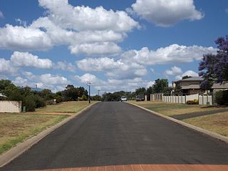
Kleinton is a rural locality in the Toowoomba Region, Queensland, Australia. In the 2016 census, Kleinton had a population of 1,617 people.
Greenswamp is a rural locality in the Western Downs Region, Queensland, Australia. In the 2016 census, Greenswamp had a population of 40 people.
North Branch is a rural locality in the Southern Downs Region, Queensland, Australia. In the 2016 census North Branch had a population of 52 people.
Womina is a rural locality in the Southern Downs Region, Queensland, Australia. In the 2016 census, Womina had a population of 234 people.
Ellinthorp is a rural town and a locality in the Southern Downs Region, Queensland, Australia. In the 2016 census, Ellinthorp had a population of 19 people.
Fletcher is a rural locality in the Southern Downs Region, Queensland, Australia. In the 2016 census, Fletcher had a population of 92 people.
Mount Tully is a rural locality in the Southern Downs Region, Queensland, Australia. In the 2016 census, Mount Tully had a population of 121 people.
Storm King is a rural locality in the Southern Downs Region, Queensland, Australia. In the 2016 census, Storm King had a population of 87 people.
Upper Pilton is a locality split between the Toowoomba Region and the Southern Downs Region, both in Queensland, Australia. In the 2016 census, Upper Pilton had a population of 63 people.
Glen Niven is a locality in the Southern Downs Region, Queensland, Australia. It is within the Granite Belt on the Darling Downs and adjacent to the border with New South Wales. In the 2016 census, Glen Niven had a population of 80 people.
Kyoomba is a rural locality in the Southern Downs Region, Queensland, Australia. In the 2016 census, Kyoomba had a population of 92 people.
Leslie is a rural locality in the Southern Downs Region, Queensland, Australia. In the 2016 census, Leslie had a population of 12 people.
Massie is a locality in the Southern Downs Region, Queensland, Australia. In the 2016 census, Massie had a population of 91 people.
Leslie Dam is a locality in the Southern Downs Region, Queensland, Australia. In the 2016 census, Leslie Dam had a population of 163 people.
Passchendaele is a rural locality in the Southern Downs Region, Queensland, Australia. In the 2016 census, Passchendaele had a population of 30 people. The undeveloped town of Messines is located within the locality.
