Dalveen, Queensland

Last updated

Map all coordinates using: OpenStreetMap
Dalveen
Queensland
Mob of black sheep, Braeside, 1894.JPG
Mob of black sheep, Braeside Homestead, 1894
Australia Queensland location map.svg
Red pog.svg
Dalveen
Coordinates 28°29′22″S151°58′15″E / 28.4894°S 151.9708°E / -28.4894; 151.9708 (Dalveen (town centre))
Population335 (2016 census) [1]
 • Density1.2312/km2 (3.189/sq mi)
Postcode(s) 4374
Area272.1 km2 (105.1 sq mi)
Time zone AEST (UTC+10:00)
Location
LGA(s) Southern Downs Region
State electorate(s) Southern Downs
Federal division(s) Maranoa [2]
Localities around Dalveen:
Palgrave The Glen Silverwood
Palgrave Dalveen Cherry Gully
Elbow Valley
Passchendaele
Pozieres
Fleurbaix
Cottonvale
Maryland (NSW)
Cottonvale (NSW)

Dalveen is a town and a locality in the Southern Downs Region, Queensland, Australia. [3] [4] It borders New South Wales. [5] In the 2016 census, Dalveen had a population of 335 people. [1]

Contents

Geography

The town is located in the south of the locality. [5]

The New England Highway enters the locality from the north (The Glen) and exits to the south (Cottonvale); it bypasses the town just to the west. [5]

The Southern railway line enters the locality from the north-east (Silverwood) and passes through the town (being served by the Dalveen railway station 28°29′18″S151°58′18″E / 28.4882°S 151.9718°E / -28.4882; 151.9718 (Dalveen railway station) ) and then exits to the south (Cottonvale). [5] [6]

History

The name Dalveen derives from locality name given by settler John Flint, who named it after Dalveen Pass in Lanark, Scotland. [3]

Stanthorpe Road Provisional School opened on 12 August 1878. In 1879 it was renamed North Maryland Provisional School. In 1892 it was renamed Dalveen State School on 18 January 1892. [7] [8]

The section of the Southern railway line from Cherry Gully via Dalveen to Stanthorpe opened on 3 May 1881. [9] [6] The town's first post office was based at the Dalveen railway station and opened on 16 May 1881, replacing the post office at Cherry Gully operated from 1 January 1880 to 16 May 1881. [10] [11] [12]

Cherry Gully Provisional School opened in 1900. On 1 January 1909, it became Cherry Gully State School. It closed circa 1916. [13] It was on Old Stanthorpe Road ( 28°26′03″S152°01′59″E / 28.43417°S 152.03293°E / -28.43417; 152.03293 (Cherry Gully State School (former)) ), now within the locality of Dalveen. [14]

Saint Barnabas Anglican Church, 2015 Saint Barnabas Anglican Church, Dalveen, Queensland, 2015.JPG
Saint Barnabas Anglican Church, 2015

St Barnabas' Anglican Church was built in 1903. [15] [10] [16]

The first Dalveen Hall was completed in September 1913 by contractor J. Lang, junior. [17] The official opening was cancelled due to the death of respected pioneer David Butler. [18] The second Dalveen Hall officially opened on 1 April 1939. The contractor was Jack Smith, and local sawmillers the Pidgeon Brothers supported the project with timber and use of their trucks. [10] [19]

The Dalveen branch of the Queensland Country Women's Association was initiated by Mrs. Jean Coomber and opened in November 1924 as a sub-branch of the Condamine Valley branch. In November 1925, it decided to hold a Christmas Tree Party in December, which has become an annual event. [10] [20] [21]

The Dalveen Presbyterian Church was built in 1956 by volunteers using locally-milled timber. [10] Following the amalgamation of the Presbyterian Church and Methodist Church into the Uniting Church in Australia on 22 June 1977, it became Dalveen Uniting Church. The Methodist Church at The Summit also became a Uniting Church and services were alternated between these two churches. It held its last service on 23 June 2012 and was sold for use as a private residence. [10] [22] [23] [24]

In the 2011 census the locality had a population of 346 people. [25]

In the 2016 census the locality had a population of 335 people. [1]

Heritage listings

Dalveen has a number of heritage-listed sites, including:

Education

Dalveen State School, 2015 Dalveen State School, 2015.JPG
Dalveen State School, 2015

Dalveen State School is a government primary (Prep-6) school for boys and girls at 40 Pine Crescent ( 28°29′23″S151°58′25″E / 28.4898°S 151.9735°E / -28.4898; 151.9735 (Dalveen State School) ). [29] [30] In 2018, the school had an enrolment of 16 students with 2 teachers (1 full-time equivalent) and 6 non-teaching staff (2 full-time equivalent). [31]

There are no secondary schools in Dalveen. The nearest government secondary schools are Stanthorpe State High School in Stanthorpe to the south and Warwick State High School in Warwick to the north. [5]

Amenities

Dalveen Hall, 2015 Dalveen Public Hall, 2015.JPG
Dalveen Hall, 2015

St Barnabas' Anglican Church holds a service on the 4th Sunday of each month at 3502 Old Stanthorpe Road ( 28°29′12″S151°58′19″E / 28.4867°S 151.9720°E / -28.4867; 151.9720 (St Barnabas' Anglican Church) ). [15] [10] It is part of the Stanthorpe Parish within the Anglican Diocese of Brisbane. [32]

The Dalveen Hall is in Pine Crescent ( 28°29′25″S151°58′24″E / 28.4904°S 151.9734°E / -28.4904; 151.9734 (Dalveen Hall) ). [33]

The Southern Downs Regional Council operates a mobile library service which visits the Dalveen State School in Pine Crescent. [34]

The Dalveen branch of the Queensland Country Women's Association has its rooms at Cameron's Corner on the Old Stanthorpe Road. [35]

Transport

Railway bridge on the Southern line over Old Stanthorpe Road at Cherry Gully, 2015 Railway bridge on the Southern line over Old Stanthorpe Road at Cherry Gully, Dalveen, Queensland, 2015.JPG
Railway bridge on the Southern line over Old Stanthorpe Road at Cherry Gully, 2015

The New England Highway passes north-south through Dalveen. [33]

The Southern railway line passes through Dalveen; the hilly terrain necessitated two tunnels known as the Dalveen Tunnel and the Cherry Gully Tunnel and a rail bridge over Old Stanthorpe Road. [33] The line is no longer in active service.

Notable residents

Related Research Articles

<span class="mw-page-title-main">Stanthorpe, Queensland</span> Town in Queensland, Australia

Stanthorpe is a rural town and locality in the Southern Downs Region, Queensland, Australia. In the 2016 census, Stanthorpe had a population of 5,406 people.

<span class="mw-page-title-main">Wallangarra, Queensland</span> Town in Queensland, Australia

Wallangarra is a rural town and locality in the Southern Downs Region, Queensland, Australia on the border with New South Wales. In the 2016 census, the locality of Wallangarra had a population of 468 people.

<span class="mw-page-title-main">Allora, Queensland</span> Town in Queensland, Australia

Allora is a rural town and locality in the Southern Downs Region, Queensland, Australia. In the 2016 census, the locality of Allora had a population of 1,223 people.

<span class="mw-page-title-main">Cambooya, Queensland</span> Town in Queensland, Australia

Cambooya is a rural town and locality in the Toowoomba Region, Queensland, Australia. In the 2016 census the locality of Cambooya had a population of 1,584 people.

<span class="mw-page-title-main">Leyburn, Queensland</span> Town in Queensland, Australia

Leyburn is a rural town in the Southern Downs Region and a locality split between the South Downs Region and the Toowoomba Region in Queensland, Australia. In the 2016 census, Leyburn had a population of 476 people.

<span class="mw-page-title-main">Applethorpe, Queensland</span> Town in Queensland, Australia

Applethorpe is a rural town and locality in the Southern Downs Region, Queensland, Australia. It is on Queensland's border with New South Wales. It is well known for the production of apples. It often records the lowest temperatures in Queensland.

<span class="mw-page-title-main">Amiens, Queensland</span> Town in Queensland, Australia

Amiens is a rural locality in the Southern Downs Region, Queensland, Australia. In the 2016 census, Amiens had a population of 293 people.

<span class="mw-page-title-main">Ballandean, Queensland</span> Town in Queensland, Australia

Ballandean is a rural town and locality in the Southern Downs Region, Queensland, Australia. In the 2016 census, the locality of Ballandean had a population of 338 people.

<span class="mw-page-title-main">Allan, Queensland</span> Suburb of Southern Downs Region, Queensland, Australia

Allan is a rural locality in the Southern Downs Region, Queensland, Australia. It was formerly known as Sandy Creek. In the 2016 census, Allan had a population of 87 people.

<span class="mw-page-title-main">The Summit, Queensland</span> Town in Queensland, Australia

The Summit is a rural town and locality in the Southern Downs Region, Queensland, Australia. In the 2016 census, the locality of The Summit had a population of 409 people.

<span class="mw-page-title-main">Oman Ama, Queensland</span> Suburb of Goondiwindi Region, Queensland, Australia

Oman Ama is a rural locality in the Goondiwindi Region, Queensland, Australia. In the 2016 census, Oman Ama had a population of 38 people.

<span class="mw-page-title-main">Freestone, Queensland</span> Town in Queensland, Australia

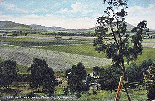
Freestone is a rural town and locality in the Southern Downs Region, Queensland, Australia. In the 2016 census, Freestone had a population of 217 people.

<span class="mw-page-title-main">Severnlea, Queensland</span> Suburb of Southern Downs Region, Queensland, Australia

Severnlea is a locality in the Southern Downs Region, Queensland, Australia. In the 2016 census, Severnlea had a population of 350 people.

Glen Aplin is a rural locality in the Southern Downs Region, Queensland, Australia. In the 2016 census, Glen Aplin had a population of 503 people.

Cottonvale is a locality in the Southern Downs Region, Queensland, Australia. It borders New South Wales. In the 2016 census, Cottonvale had a population of 148 people. It contains the town of Cotton Vale.

Elbow Valley is a rural locality in the Southern Downs Region, Queensland, Australia. It is on the border of New South Wales. In the 2016 census, Elbow Valley had a population of 95 people.

<span class="mw-page-title-main">Thane, Queensland</span> Town in Queensland, Australia

Thane is a rural town and locality in the Southern Downs Region, Queensland, Australia. In the 2016 census, Thane had a population of 27 people.

<span class="mw-page-title-main">Cherry Gully, Queensland</span> Suburb of Southern Downs Region, Queensland, Australia

Cherry Gully is a locality in the Southern Downs Region, Queensland, Australia. In the 2021 census, Cherry Gully had a population of 18 people.

Fletcher is a rural locality in the Southern Downs Region, Queensland, Australia. In the 2016 census, Fletcher had a population of 92 people.

<span class="mw-page-title-main">Silverwood, Queensland</span> Suburb of Southern Downs Region, Queensland, Australia

Silverwood is a rural locality in the Southern Downs Region, Queensland, Australia. In the 2016 census, Silverwood had a population of 38 people.

References

  1. 1 2 3 Australian Bureau of Statistics (27 June 2017). "Dalveen (SSC)". 2016 Census QuickStats. Retrieved 20 October 2018. OOjs UI icon edit-ltr-progressive.svg
  2. "Maranoa". Australian Electoral Commission. 11 December 2013. Archived from the original on 14 December 2013. Retrieved 11 December 2013.
  3. 1 2 "Dalveen – town in Southern Downs Region (entry 9256)". Queensland Place Names. Queensland Government . Retrieved 11 June 2019.
  4. "Dalveen – locality in Southern Downs Region (entry 45919)". Queensland Place Names. Queensland Government . Retrieved 11 June 2019.
  5. 1 2 3 4 5 "Queensland Globe". State of Queensland . Retrieved 30 August 2023.
  6. 1 2 "Town of Dalveen" (Map). Queensland Government. 1972. Archived from the original on 13 September 2020. Retrieved 13 September 2020.
  7. "Opening and closing dates of Queensland Schools". Queensland Government . Retrieved 4 June 2015.
  8. "Agency ID 5156, Dalveen State School". Queensland State Archives . Retrieved 5 June 2015.
  9. Kerr, John (1990). Triumph of narrow gauge : a history of Queensland Railways. Boolarong Publications. p. 224. ISBN   978-0-86439-102-5.
  10. 1 2 3 4 5 6 7 "Places of Interest in Dalveen, Qld" (PDF). Dalveen State School. August 2017. Archived (PDF) from the original on 15 March 2020. Retrieved 13 September 2020.
  11. Phoenix Auctions History. "Post Office List". Phoenix Auctions. Archived from the original on 13 June 2022. Retrieved 20 February 2021.
  12. "Queensland Catalog of Numeral Cancellations on Postage Stamps: 202 - Cherry Gully / Dalveen". Queensland Catalog of Numeral Cancellations on Postage Stamps. 12 April 2013. Archived from the original on 13 September 2020. Retrieved 13 September 2020.
  13. Queensland Family History Society (2010), Queensland schools past and present (Version 1.01 ed.), Queensland Family History Society, ISBN   978-1-921171-26-0
  14. "County of Merivale" (Map). Queensland Government. 1923. Archived from the original on 30 August 2023. Retrieved 30 August 2023.
  15. 1 2 Spence, Kay. "Dalveen 4374". Archived from the original on 7 February 2016. Retrieved 5 June 2015.
  16. "DIOCESE OF BRISBANE". The Brisbane Courier . Vol. LIX, no. 14, 102. Queensland, Australia. 25 March 1903. p. 9. Archived from the original on 13 September 2020. Retrieved 13 September 2020 via National Library of Australia.
  17. "DALVEEN". Warwick Examiner And Times . No. 4479. Queensland, Australia. 20 September 1913. p. 1. Archived from the original on 13 September 2020. Retrieved 14 September 2020 via National Library of Australia.
  18. "DALVEEN". Warwick Examiner And Times . No. 4485. Queensland, Australia. 4 October 1913. p. 4. Archived from the original on 13 September 2020. Retrieved 14 September 2020 via National Library of Australia.
  19. "DALVEEN". Warwick Daily News . No. 6146. Queensland, Australia. 3 April 1939. p. 5. Archived from the original on 13 September 2020. Retrieved 14 September 2020 via National Library of Australia.
  20. "A Lesson in Dalveen QCWA's History". Warwick Daily News . 29 November 2011. Archived from the original on 13 September 2020. Retrieved 13 September 2020.
  21. Riley, Glenda (11 December 2018). "Dalveen is lighting up". Queensland Times . Archived from the original on 14 September 2020. Retrieved 14 September 2020.
  22. "Dalveen closes its doors after 57 years". JourneyOnline. 6 August 2012. Archived from the original on 13 September 2020. Retrieved 13 September 2020.
  23. "Service bids last farewell". Warwick Daily News. 28 June 2012. Archived from the original on 13 September 2020. Retrieved 13 September 2020.
  24. "Dalveen Uniting Church - Former". Churches Australia. Archived from the original on 13 September 2020. Retrieved 13 September 2020.
  25. Australian Bureau of Statistics (31 October 2012). "Dalveen (State Suburb)". 2011 Census QuickStats. Retrieved 6 July 2017. OOjs UI icon edit-ltr-progressive.svg
  26. "Braeside Homestead (entry 602351)". Queensland Heritage Register . Queensland Heritage Council. Retrieved 13 July 2013.
  27. 1 2 3 4 "Local Heritage Register". Southern Downs Regional Council . p. 8. Archived from the original on 13 September 2020. Retrieved 13 September 2020.
  28. "Dalveen Tunnel (entry 601519)". Queensland Heritage Register . Queensland Heritage Council. Retrieved 13 July 2013.
  29. "State and non-state school details". Queensland Government. 9 July 2018. Archived from the original on 21 November 2018. Retrieved 21 November 2018.
  30. "Dalveen State School". Dalveen State School. 20 August 2021. Archived from the original on 24 February 2021. Retrieved 30 August 2023.
  31. "ACARA School Profile 2018". Australian Curriculum, Assessment and Reporting Authority. Archived from the original on 27 August 2020. Retrieved 28 January 2020.
  32. "Contact Us | Stanthorpe Anglican Parish | Queensland". Stanthorpe Anglican. Archived from the original on 16 April 2021. Retrieved 25 January 2022.
  33. 1 2 3 "Dalveen, Queensland". Google Maps. Archived from the original on 13 September 2020. Retrieved 5 June 2015.
  34. "Library Details". Southern Downs Regional Council . Archived from the original on 31 January 2018. Retrieved 31 January 2018.
  35. "Branch locations". Queensland Country Women's Association . Archived from the original on 26 December 2018. Retrieved 26 December 2018.

Further reading

Commons-logo.svg Media related to Dalveen, Queensland at Wikimedia Commons