Mingoola, Queensland

Last updated

Mingoola
Queensland
Australia Queensland location map.svg
Red pog.svg
Mingoola
Coordinates 28°56′34″S151°31′59″E / 28.9427°S 151.5330°E / -28.9427; 151.5330 (Mingoola (centre of locality))
Population14 (SAL 2021) [1]
Area77.6 km2 (30.0 sq mi)
Time zone AEST (UTC+10:00)
Location
LGA(s) Southern Downs Region
State electorate(s) Southern Downs
Federal division(s) Maranoa
Suburbs around Mingoola:
Glenlyon Springdale Sundown
Glenlyon Mingoola Back Creek (NSW)
Glenlyon Riverton Mingoola (NSW)

Mingoola is a rural locality in the Southern Downs Region, Queensland, Australia. [2] It is on the Queensland border with New South Wales. [3] In the 2021 census, Mingoola had a population of 14 people. [4]

Contents

Geography

Mingoola is located on the border of Queensland and New South Wales with the adjacent locality over the border also being called Mingoola. [5]

The Dumaresq River forms part of the border and forms the south-eastern boundary of the locality. [5] The Severn River enters the locality from the north-east (Sundown) and becomes a tributary of the Dumaresq River at the border. [5]

The elevation ranges from 370 to 730 metres (1,210 to 2,400 ft). [5]

The land use is predominantly grazing on native vegetation, except for the lower-lying land around the Severn and Dumaresq Rivers which is used for crop growing. [5]

History

The locality probably takes its name from a pastoral run called Mangoola or Moongoola mentioned in the memoirs of Oscar De Satge. [2]

Land in Mingoola was open for selection on 17 April 1877; 34 square miles (88 km2) were available. [6]

Demographics

In the 2016 census, Mingoola had a population of 18 people. [7]

In the 2021 census, Mingoola had a population of 14 people. [4]

Education

The nearest government primary and secondary school to Year 10 is Texas P-10 State School in Texas to the west. There is no nearby secondary school to Year 12; options are distance education and boarding school. [8]

Related Research Articles

<span class="mw-page-title-main">Yelarbon</span> Town in Queensland, Australia

Yelarbon is a rural town and locality in the Goondiwindi Region, Queensland, Australia. It is on the border of Queensland and New South Wales. In the 2016 census, Yelarbon had a population of 364 people.

<span class="mw-page-title-main">Somme, Queensland</span> Suburb of Southern Downs Region, Queensland, Australia

Somme is a rural locality in the Southern Downs Region, Queensland, Australia. In the 2016 census Somme had a population of 53 people.
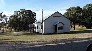
<span class="mw-page-title-main">Eukey</span> Suburb of Southern Downs Region, Queensland, Australia

Eukey is a rural locality in the Southern Downs Region, Queensland, Australia. It is on the border with New South Wales. In the 2016 census Eukey had a population of 134 people.

<span class="mw-page-title-main">Severnlea, Queensland</span> Suburb of Southern Downs Region, Queensland, Australia

Severnlea is a semi-rural locality in the Southern Downs Region, Queensland, Australia. In the 2021 census, Severnlea had a population of 382 people.

Glenlyon is a rural locality in the Southern Downs Region, Queensland, Australia. In the 2021 census, Glenlyon had a population of 32 people.
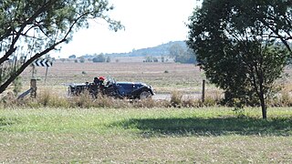
<span class="mw-page-title-main">North Branch, Queensland (Toowoomba Region)</span> Suburb of Toowoomba Region, Queensland, Australia

North Branch is a locality in the Toowoomba Region, Queensland, Australia. In the 2021 census, North Branch had a population of 48 people.

Regency Downs is a mixed-use locality in the Lockyer Valley Region, Queensland, Australia. In the 2021 census, Regency Downs had a population of 2,623 people, an increase of 12% from the 2016 census.

Moraby is a locality in the Western Downs Region, Queensland, Australia. In the 2021 census, Moraby had a population of 43 people.
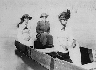
<span class="mw-page-title-main">Glen Niven, Queensland</span> Suburb of Southern Downs Region, Queensland, Australia

Glen Niven is a rural locality in the Southern Downs Region, Queensland, Australia. It is within the Granite Belt on the Darling Downs and adjacent to the border with New South Wales. In the 2021 census, Glen Niven had a population of 99 people.

Leslie is a rural locality in the Southern Downs Region, Queensland, Australia. In the 2021 census, Leslie had a population of 12 people.

<span class="mw-page-title-main">Massie, Queensland</span> Suburb of Southern Downs Region, Queensland, Australia

Massie is a rural locality in the Southern Downs Region, Queensland, Australia. In the 2021 census, Massie had a population of 113 people.

<span class="mw-page-title-main">Nive, Queensland</span> Suburb of Shire of Murweh, Queensland, Australia

Nive is a rural locality in the Shire of Murweh, Queensland, Australia. It is on the boundary between the Shire of Murweh and the Blackall-Tambo Region. In the 2021 census, Nive had a population of 44 people.

Roche Creek is a rural locality in the Western Downs Region, Queensland, Australia. In the 2021 census, Roche Creek had a population of 53 people.

Millmerran Woods is a rural locality in the Toowoomba Region, Queensland, Australia. In the 2021 census, Millmerran Woods had a population of 152 people.

Millmerran Downs is a rural locality in the Toowoomba Region, Queensland, Australia. In the 2021 census, Millmerran Downs had a population of 103 people.

Blaxland is a rural locality in the Western Downs Region, Queensland, Australia. In the 2021 census, Blaxland had a population of 58 people.

Montrose is a rural locality in the Southern Downs Region, Queensland, Australia. In the 2021 census, Montrose had a population of 0 people.

Pikes Creek is a rural locality in the Southern Downs Region, Queensland, Australia. In the 2021 census, Pikes Creek had a population of 19 people.

Nundubbermere is a rural locality in the Southern Downs Region, Queensland, Australia. In the 2021 census, Nundubbermere had a population of 102 people.

Grays Gate is a rural locality in the Toowoomba Region, Queensland, Australia. In the 2021 census, Grays Gate had a population of 28 people.

References

  1. Australian Bureau of Statistics (28 June 2022). "Mingoola (Qld) (suburb and locality)". Australian Census 2021 QuickStats. Retrieved 28 June 2022.  OOjs UI icon edit-ltr-progressive.svg
  2. 1 2 "Mingoola – locality in Southern Downs Region (entry 45952)". Queensland Place Names. Queensland Government . Retrieved 11 June 2019.
  3. "Queensland Globe". State of Queensland . Retrieved 6 May 2020.
  4. 1 2 Australian Bureau of Statistics (28 June 2022). "Mingoola (SAL)". 2021 Census QuickStats. Retrieved 28 February 2023. OOjs UI icon edit-ltr-progressive.svg
  5. 1 2 3 4 5 "Queensland Globe". State of Queensland . Retrieved 25 November 2023.
  6. "Proclamations under the New Land Acts". The Brisbane Courier . Queensland, Australia. 2 March 1877. p. 3. Archived from the original on 27 August 2020. Retrieved 19 February 2020 via Trove.
  7. Australian Bureau of Statistics (27 June 2017). "Mingoola (SSC)". 2016 Census QuickStats. Retrieved 20 October 2018. OOjs UI icon edit-ltr-progressive.svg
  8. "Layers: Locality; Schools and school catchments". Queensland Globe. Queensland Government. Archived from the original on 19 December 2017. Retrieved 25 November 2023.