Hendon, Queensland

Last updated

Hendon
Queensland
Australia Queensland location map.svg
Red pog.svg
Hendon
Coordinates 28°04′16″S151°57′03″E / 28.0711°S 151.9508°E / -28.0711; 151.9508 (Hendon (town centre))
Population200 (2016 census) [1]
 • Density20/km2 (52/sq mi)
Postcode(s) 4362
Area10.0 km2 (3.9 sq mi)
Time zone AEST (UTC+10:00)
LGA(s) Southern Downs Region
State electorate(s) Warrego
Federal division(s) Maranoa
Localities around Hendon:
Talgai Allora Mount Marshall
Talgai Hendon Mount Marshall
Deuchar Deuchar Deuchar

Hendon is a rural town and locality in the Southern Downs Region, Queensland, Australia. [2] [3] In the 2016 census, the locality of Hendon had a population of 200 people. [1]

Contents

Geography

Hendon is situated 25 kilometres (16 mi) north of Warwick and about 160 kilometres (99 mi) southwest of Brisbane.

History

The town of Hendon developed after the opening of the Southern railway line from Gowrie Junction (near Toowoomba) to Hendon railway station on 11 March 1869. The Southern line was extended to Millhill on 9 January 1871, and across the Condamine River to Cherry Gully on 8 December 1880, to Stanthorpe by 3 May 1881, reaching New South Wales border at Wallangarra on 14 February 1887. [4]

The town takes its name from the Hendon railway station, which in turn was originally named Allora in 1869, but was changed to Hendon in mid-1870s as the station was 5 kilometres (3.1 mi). from the town of Allora. [2] [5] Hendon was the name of a settler in the district. [6]

Hendon Post Office opened on 1 April 1877 and closed in 1968. [7]

Hendon Provisional School opened on 5 June 1882, later becoming Hendon State School. The school closed on 1 June 1954. [8]

Hendon served as the railhead for the town of Allora (surveyed in 1859), located four miles to the northeast. Black-soil roads linking Allora with the railway were often impassable after heavy rain. The residents of Allora and the Allora Municipal Council lobbied for a railway connection, which was opened from Hendon to Allora on 21 April 1897. The railway was built under the Railways Guarantee Act (1895), which required the Allora Municipal Council to share any losses and profits with the Railway Department for a period of 14 years. Due to the branch line's short length, the revenue apportionment between the main and branch lines was adjusted in 1899 to ensure the branch line's receiving its fair share of income. When the guarantee expired, the Allora Municipal Council received £1,200 as its share of the profits. An extension of the branch to Goomburra (east of Allora) opened on 23 August 1912.

In its early days Hendon consisted of the Railway Hotel, a hall, the primary school and a golf course. The hotel was located in Railway Street, adjacent to the railway station. The primary school opened in 1882; in 1887 it had an enrollment of 195 students, but the building was destroyed by fire on 19 October 1926. The new school building was moved from View Glen (near Toowoomba) to Hendon, and was completed on 14 June 1927. It closed on 1 June 1954.

The township was surveyed into a number of residential blocks; streets were named for district towns, early settlers and streams (such as Maryvale, Goomburra, Leslie and Glengallan). The population slowly drifted away from Hendon, which resulted in the loss of public facilities. The hall was moved to a district farm, and the hotel and school buildings disappeared. The railway station in 1963 had a stationmaster in charge, a siding accommodation, a fork-line connection to the Allora branch, telegraph and signal communication, cattle, sheep and pig yards and a goods shed. As of 2011, apart from the railway lines all other infrastructure is gone. The Goomburra branch was closed beyond Allora on 1 July 1961, with the balance of the branch out of use by the mid-1990s.

In the 2016 census, Hendon (then in the Shire of Warwick had a population of 519. [9]

A number of new homes have been built in Hendon, and the population is slowly increasing. A steel merchant operates within the town; this business is the only major commercial enterprise.

In the 2016 census, the locality of Hendon had a population of 200 people. [1]

Education

There are no schools in Hendon. The nearest government primary school is Allora State School in neighbouring Allora to the north. The nearest government secondary school is Allora State School (to Year 10), Clifton State High School (to Year 12) in Clifton to the north-west, and Warwick State High School (to Year 12) in Warwick to the south-east. [10]

Related Research Articles

<span class="mw-page-title-main">Inglewood, Queensland</span> Town in Queensland, Australia

Inglewood is a rural town and locality in the Goondiwindi Region, Queensland, Australia. In the 2016 census, the locality of Inglewood had a population of 954 people, making Inglewood the second largest town in the Goondiwindi Region.

<span class="mw-page-title-main">Nobby, Queensland</span> Town in Queensland, Australia

Nobby is a rural town and locality on the Darling Downs in the Toowoomba Region, Queensland, Australia. It is located halfway between Toowoomba and Warwick. It is known for its association with Steele Rudd (author) and Sister Elizabeth Kenny.

<span class="mw-page-title-main">Allora, Queensland</span> Town in Queensland, Australia

Allora is a rural town and locality in the Southern Downs Region, Queensland, Australia. In the 2016 census, the locality of Allora had a population of 1,223 people.

<span class="mw-page-title-main">Leyburn, Queensland</span> Town in Queensland, Australia

Leyburn is a rural town in the Southern Downs Region and a locality split between the South Downs Region and the Toowoomba Region in Queensland, Australia. In the 2016 census, Leyburn had a population of 476 people.

<span class="mw-page-title-main">Shire of Allora</span> Local government area in Queensland, Australia

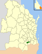
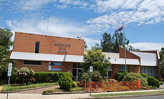
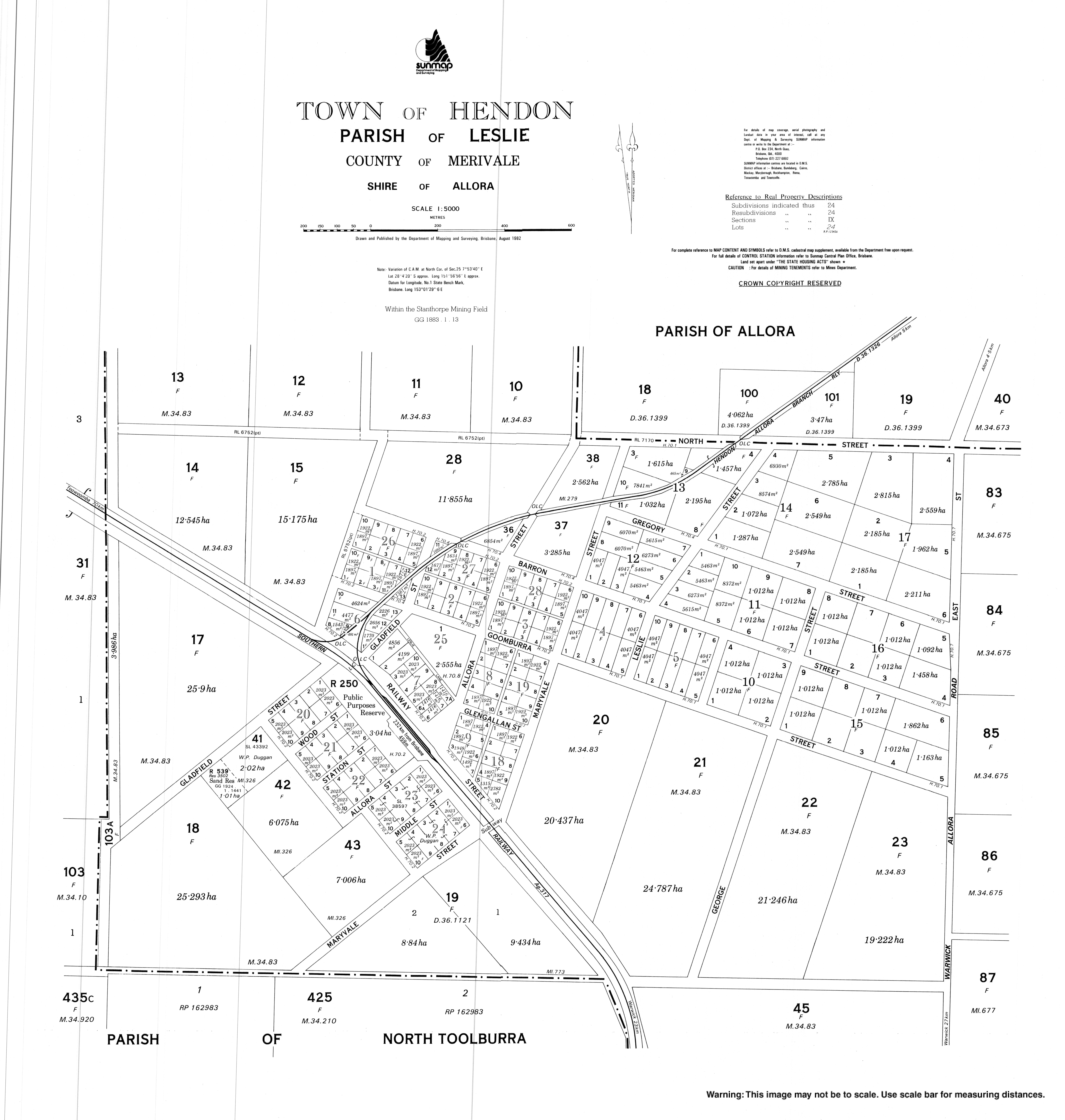
The Shire of Allora was a local government area north of the regional centre of Warwick in the Darling Downs region of Queensland. The shire, administered from Allora, covered an area of 702.0 square kilometres (271.0 sq mi), and existed as a local government entity from 1869 until 1994, when it was dissolved and amalgamated with City of Warwick, Shire of Rosenthal and Shire of Glengallan to form the Shire of Warwick.

Wyreema is a rural town and locality in the Toowoomba Region, Queensland, Australia. In the 2016 census, the locality of Wyreema had a population of 1,834 people.

<span class="mw-page-title-main">Goomburra railway line</span> Former railway line in Queensland

The Goomburra railway line was a branch railway in the Southern Downs region of Queensland, Australia.

<span class="mw-page-title-main">Southern railway line</span> Railway line in Queensland, Australia

The Southern railway line serves the Darling Downs region of Queensland, Australia. The 197-kilometre (122 mi) long line branches from the Western line at Toowoomba, 161 kilometres (100 mi) west of Brisbane, and proceeds south through Warwick and Stanthorpe to the New South Wales/Queensland state border at Wallangarra.

<span class="mw-page-title-main">Karara, Queensland</span> Town in Queensland, Australia

Karara is a rural town and locality in the Southern Downs Region, Queensland, Australia. In the 2016 census, the locality of Karara had a population of 123 people.

<span class="mw-page-title-main">Maryvale, Queensland (Southern Downs Region)</span> Town in Queensland, Australia

Maryvale is a rural town and locality in the Southern Downs Region, Queensland, Australia. In the 2016 census, the locality of Maryvale had a population of 303 people.

The Mount Edwards railway line was a branch railway in the Scenic Rim region of South East Queensland, Australia. The lines serves a number of small towns in the Fassifern Valley. The first stage of the Mount Edwards line opened from Munbilla to Engelsburg on 17 April 1916, but the next stage to Mount Edwards was not completed until 7 October 1922. The line closed on 1 November 1960.

<span class="mw-page-title-main">Wellcamp, Queensland</span> Suburb of Toowoomba Region, Queensland, Australia

Wellcamp is a rural locality in the Toowoomba Region, Queensland, Australia. In the 2016 census, Wellcamp had a population of 295 people.

<span class="mw-page-title-main">Duchess, Queensland</span> Town in Queensland, Australia

Duchess is a rural town and locality in the Shire of Cloncurry, Queensland, Australia. In the 2016 census, Duchess had a population of 23 people.

<span class="mw-page-title-main">Munbilla, Queensland</span> Town in Queensland, Australia

Munbilla is a rural town and locality in the Scenic Rim Region, Queensland, Australia. In the 2016 census, the locality of Munbilla had a population of 100 people.

<span class="mw-page-title-main">Allan, Queensland</span> Suburb of Southern Downs Region, Queensland, Australia

Allan is a rural locality in the Southern Downs Region, Queensland, Australia. It was formerly known as Sandy Creek. In the 2016 census, Allan had a population of 87 people.

<span class="mw-page-title-main">Allora Cemetery</span> Historic site in Queensland, Australia

Allora Cemetery is a heritage-listed cemetery on Allora-Clifton Road, Allora, Southern Downs Region, Queensland, Australia. It was established in 1864. It was added to the Queensland Heritage Register on 27 April 2001.

<span class="mw-page-title-main">Clintonvale, Queensland</span> Suburb of Southern Downs Region, Queensland, Australia

Clintonvale is a rural locality in the Southern Downs Region, Queensland, Australia. In the 2016 census, Clintonvale had a population of 74 people.

<span class="mw-page-title-main">Emu Vale, Queensland</span> Town in Queensland, Australia

Emu Vale is a rural town and locality in the Southern Downs Region, Queensland, Australia. In the 2016 census, Emu Vale had a population of 185 people.

Goomburra is a rural town and locality in the Southern Downs Region, Queensland, Australia. In the 2016 census, the locality of Goomburra had a population of 259 people.

<span class="mw-page-title-main">Thane, Queensland</span> Town in Queensland, Australia

Thane is a rural town and locality in the Southern Downs Region, Queensland, Australia. In the 2016 census, Thane had a population of 27 people.

References

  1. 1 2 3 Australian Bureau of Statistics (27 June 2017). "Hendon (SSC)". 2016 Census QuickStats. Retrieved 20 October 2018. OOjs UI icon edit-ltr-progressive.svg
  2. 1 2 "Hendon – town in Southern Downs Region (entry 15721)". Queensland Place Names. Queensland Government . Retrieved 14 August 2022.
  3. "Hendon – locality in Southern Downs Region (entry 47651)". Queensland Place Names. Queensland Government . Retrieved 14 August 2022.
  4. Kerr, John (1990). Triumph of narrow gauge : a history of Queensland Railways. Boolarong Publications. p. 224. ISBN   978-0-86439-102-5.
  5. Kerr, John (1990). Triumph of narrow gauge : a history of Queensland Railways. Boolarong Publications. p. 21. ISBN   978-0-86439-102-5.
  6. "SKETCHER". The Queenslander . No. 2455. Queensland, Australia. 4 April 1914. p. 8. Archived from the original on 13 September 2021. Retrieved 17 November 2019 via National Library of Australia.
  7. Premier Postal History. "Post Office List". Premier Postal Auctions. Archived from the original on 15 May 2014. Retrieved 10 May 2014.
  8. Queensland Family History Society (2010), Queensland schools past and present (Version 1.01 ed.), Queensland Family History Society, ISBN   978-1-921171-26-0
  9. Australian Bureau of Statistics (25 October 2007). "Hendon (Warwick Shire) (State Suburb)". 2006 Census QuickStats. Retrieved 21 May 2011.
  10. "Queensland Globe". State of Queensland . Retrieved 17 November 2019.

Bibliography