Mount Tully, Queensland

Last updated

Mount Tully
Queensland
Australia Queensland location map.svg
Red pog.svg
Mount Tully
Coordinates 28°44′07″S151°56′45″E / 28.7352°S 151.9458°E / -28.7352; 151.9458 (Mount Tully (centre of locality))
Population117 (2021 census) [1]
 • Density4.96/km2 (12.84/sq mi)
Postcode(s) 4380
Elevation966 m (3,169 ft)
Area23.6 km2 (9.1 sq mi)
Time zone AEST (UTC+10:00)
Location
LGA(s) Southern Downs Region
State electorate(s) Southern Downs
Federal division(s) Maranoa
Suburbs around Mount Tully:
Severnlea Stanthorpe Storm King
Glen Aplin Mount Tully Storm King
Fletcher Eukey Eukey

Mount Tully is a rural locality in the Southern Downs Region, Queensland, Australia. [2] In the 2021 census, Mount Tully had a population of 117 people. [1]

Contents

Geography

The terrain is mountainous and most of the land use occurs in the flatter valleys. [3] The predominant land use is grazing on native vegetation with some horticulture. [3]

History

The locality was officially named and bounded on 15 December 2000. [2] It presumably takes its name from some local mountain peak, but no mountain of that name is current officially gazetted. However, there are historic mentions of that mountain in the area. [4]

Mount Tully State School opened on 1921 under head teacher Ernest L. Schoch. [5] [6] It closed circa 1943. [7] [8] It was on the eastern side of Mount Tully Road (approx 28°42′52″S151°57′27″E / 28.71448°S 151.95737°E / -28.71448; 151.95737 (Mount Tully State School (former)) ). [9] [10] [3]

Demographics

In the 2016 census, Mount Tully had a population of 121 people. [11]

In the 2021 census, Mount Tully had a population of 117 people. [1]

Education

There are no schools in Mount Tully. The nearest government primary schools are Severnlea State School in neighbouring Severnlea to the north-west and Stanthorpe State School in neighbouring Stanthorpe to the north. The nearest government secondary school is Stanthorpe State High School, also in Stanthorpe. [12]

Related Research Articles

<span class="mw-page-title-main">Stanthorpe, Queensland</span> Town in Queensland, Australia

Stanthorpe is a rural town and locality in the Southern Downs Region, Queensland, Australia. In the 2021 census, the locality of Stanthorpe had a population of 5,286 people.

<span class="mw-page-title-main">Nobby, Queensland</span> Town in Queensland, Australia

Nobby is a rural town and locality on the Darling Downs in the Toowoomba Region, Queensland, Australia. It is located halfway between Toowoomba and Warwick. It is known for its association with Steele Rudd (author) and Sister Elizabeth Kenny.

<span class="mw-page-title-main">Applethorpe, Queensland</span> Town in Queensland, Australia

Applethorpe is a rural town and locality in the Southern Downs Region, Queensland, Australia. It is on Queensland's border with New South Wales. It is well known for the production of apples. It often records the lowest temperatures in Queensland.

<span class="mw-page-title-main">Amiens, Queensland</span> Suburb of Southern Downs Region, Queensland, Australia

Amiens is a rural locality in the Southern Downs Region, Queensland, Australia. In the 2021 census, Amiens had a population of 343 people.

<span class="mw-page-title-main">Ballandean, Queensland</span> Town in Queensland, Australia

Ballandean is a rural town and locality in the Southern Downs Region, Queensland, Australia. The town has a number of nearby vineyards which attracted tourists to the area. In the 2021 census, the locality of Ballandean had a population of 316 people.

<span class="mw-page-title-main">Dalveen, Queensland</span> Town in Queensland, Australia

Dalveen is a town and a locality in the Southern Downs Region, Queensland, Australia. It borders New South Wales. In the 2021 census, the locality of Dalveen had a population of 369 people.

<span class="mw-page-title-main">Felton, Queensland</span> Suburb of Toowoomba Region, Queensland, Australia

Felton is a rural locality in the Toowoomba Region, Queensland, Australia. In the 2021 census, Felton had a population of 267 people.

<span class="mw-page-title-main">The Summit, Queensland</span> Town in Queensland, Australia

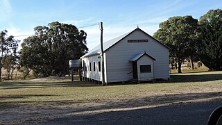
The Summit is a rural town and locality in the Southern Downs Region, Queensland, Australia. In the 2021 census, the locality of The Summit had a population of 436 people.

<span class="mw-page-title-main">Eukey</span> Suburb of Southern Downs Region, Queensland, Australia

Eukey is a rural locality in the Southern Downs Region, Queensland, Australia. It is on the border with New South Wales. In the 2021 census, Eukey had a population of 140 people.

<span class="mw-page-title-main">Severnlea, Queensland</span> Suburb of Southern Downs Region, Queensland, Australia

Severnlea is a semi-rural locality in the Southern Downs Region, Queensland, Australia. In the 2021 census, Severnlea had a population of 382 people.

Glen Aplin is a rural locality in the Southern Downs Region, Queensland, Australia. In the 2021 census, Glen Aplin had a population of 566 people.

Dalcouth is a locality in the Southern Downs Region, Queensland, Australia. It is on the border with New South Wales. In the 2021 census, Dalcouth had a population of 220 people.

Fletcher is a rural locality in the Southern Downs Region, Queensland, Australia. In the 2021 census, Fletcher had a population of 128 people.

<span class="mw-page-title-main">Girraween, Queensland</span> Suburb of Southern Downs Region, Queensland, Australia

Girraween is an undeveloped locality in the Southern Downs Region, Queensland, Australia. It is in the Granite Belt and on the border with New South Wales. In the 2021 census, Girraween had a population of 5 people.

Stoneleigh is a rural locality in the Toowoomba Region, Queensland, Australia. In the 2021 census, Stoneleigh had a population of 124 people.

Nundubbermere is a rural locality in the Southern Downs Region, Queensland, Australia. In the 2021 census, Nundubbermere had a population of 102 people.

<span class="mw-page-title-main">Silverwood, Queensland</span> Suburb of Southern Downs Region, Queensland, Australia

Silverwood is a rural locality in the Southern Downs Region, Queensland, Australia. In the 2021 census, Silverwood had a population of 58 people.

Rosenthal Heights is a mixed-use locality in the Southern Downs Region, Queensland, Australia. In the 2021 census, Rosenthal Heights had a population of 2,664 people.

Passchendaele is a rural locality in the Southern Downs Region, Queensland, Australia. In the 2021 census, Passchendaele had a population of 42 people.

Mount Sturt is a rural locality in the Southern Downs Region, Queensland, Australia. In the 2021 census, Mount Sturt had "no people or a very low population".

References

  1. 1 2 3 Australian Bureau of Statistics (28 June 2022). "Mount Tully (SAL)". 2021 Census QuickStats. Retrieved 28 February 2023. OOjs UI icon edit-ltr-progressive.svg
  2. 1 2 "Mount Tully – locality in Southern Downs Region (entry 45959)". Queensland Place Names. Queensland Government . Retrieved 24 November 2018.
  3. 1 2 3 "Queensland Globe". State of Queensland . Retrieved 17 December 2023.
  4. "RESOURCES OF THE STANTHORPE DISTRICT SOUTH-EASTERN QUEENSLAND". Daily Standard . No. 2112. Queensland, Australia. 3 October 1919. p. 8 (SECOND EDITION). Archived from the original on 12 December 2023. Retrieved 12 December 2023 via National Library of Australia.
  5. "EDUCATION DEPARTMENT". The Brisbane Courier . No. 19, 724. Queensland, Australia. 9 April 1921. p. 6. Archived from the original on 12 December 2023. Retrieved 12 December 2023 via National Library of Australia.
  6. "STATE SCHOOL TEACHERS". The Telegraph . No. 15102. Queensland, Australia. 23 April 1921. p. 13 (SECOND EDITION). Archived from the original on 12 December 2023. Retrieved 12 December 2023 via National Library of Australia.
  7. Queensland Family History Society (2010), Queensland schools past and present (Version 1.01 ed.), Queensland Family History Society, ISBN   978-1-921171-26-0
  8. "NEW STATE SCHOOLS". Telegraph . No. 15090. Queensland, Australia. 9 April 1921. p. 15 (SECOND EDITION). Archived from the original on 12 December 2023. Retrieved 19 December 2021 via National Library of Australia.
  9. "Queensland Two Mile series sheet 2m7 Stanthorpe" (Map). 1932. Retrieved 17 December 2023.
  10. "Item ID622740, Parish of Folkestone, County of Bentinck. 40 chains to the inch. Survey Office, Brisbane. (1933 Map)". Queensland State Archives . Retrieved 17 December 2023.
  11. Australian Bureau of Statistics (27 June 2017). "Mount Tully (SSC)". 2016 Census QuickStats. Retrieved 20 October 2018. OOjs UI icon edit-ltr-progressive.svg
  12. "Layers: Locality; Schools and school catchments". Queensland Globe. Queensland Government. Archived from the original on 19 December 2017. Retrieved 12 December 2023.