Tenterfield is a regional town in New South Wales, Australia, situated at the junction of the New England and Bruxner highways, along the Northern Tablelands, within the New England region. At the 2016 census, Tenterfield had a population of 4,066.[1] Tenterfield's proximity to many regional centres and its position on the route between Sydney and Brisbane led to its development as a centre for the promotion of the federation of Australia.
In 1841, Sir Stuart Donaldson was running 18,000 sheep on a property that he named Tenterfield Station, after a family home, Tenterfield House, in Haddington, Scotland.[3][4] Donaldson was the first premier of NSW and made biannual trips to Tenterfield to inspect his holdings there, which covered 100,000 acres (400km2) of unfenced land.
Tenterfield Post Office opened on 1 January 1849[5] and the township was gazetted in 1851 with allotments being sold in 1854.
In 1858 gold was discovered at Drake (Fairfield) and shortly afterwards at Timbarra and Boonoo Boonoo.[6] During 1859 an AJS Bank opened and an Anglican church was built the following year. In the 1860s the Tenterfield Chronicle was published, the district court was established; the building of a hospital commenced and a public school was opened. In 1870 the population was less than 900, but the town had five hotels, a school of arts and three churches. The existing Tenterfield Post Office was constructed in 1881.
On 1 February 1919, the presence of cases of Spanish flu in New South Wales resulted in Queensland closing its borders. Travellers bound for Queensland on the Main North railway line were forced to disembark at Tenterfield railway station, the last stop before the train would close the border. The Tenterfield showgrounds were turned in a temporary quarantine camp occupied by up to 700 people. Some people chose to return to Sydney while other spent a week in the camp after which they could enter Queensland.[7]
During World War II, Tenterfield was earmarked as a key battleground if the Japanese should invade Australia. During 1942 thousands of soldiers were set up in emergency camps, unbeknown to the locals, to cope with such an event. Overgrown tank traps and gun emplacements can still be seen on the Travelling Stock Route near the New England Highway.[8] The highway was until the early 1950s the only all-weather road from Sydney to Brisbane.
Heritage listings
Tenterfield has a number of heritage-listed sites, including:
The following buildings and sites are listed on the now defunct Register of the National Estate:.[12] Also includes other buildings and sites as part of Tenterfield's history
Stannum House, 114 Rouse Street, built c. 1888 by John Holmes Reid – exhibits ex-Buckingham Palace carpets and antique furniture
Ayrdrie, Casino Road, country house built c.1860[13]
Woolool Wooloolni/Wellington Rock Aboriginal Site, Basket Swamp National Park
Aldershot Cottage, built c.1860s
Deloraine Cottage, built c.1860s
124 High Street, built c.1860s
Flanagan's Men's Shop, oldest men's wear shop in Australia[citation needed]
Railway – Main North Railway Line
The railway opened to Tenterfield on 28 October 1884[16] and in 1886 to nearby Wallangarra/Jennings on the Queensland border, connecting Sydney and Brisbane, with a break-of-gauge at Wallangarra. When the rail link to the Queensland border was completed, Sydney and Brisbane were linked by rail for the first time. The railway was subsequently bypassed by the fully standard gaugeNorth Coast line between Sydney and Brisbane, which was completed in 1932. The Main North line is now closed north of Armidale through to Wallangarra/Jennings, and the Tenterfield railway station is now a museum.
There was considerable debate about whether the break of gauge should take place at the existing town of Tenterfield, or at a whole new town at the border, which respectively became Wallangarra (Queensland side) and Jennings (New South Wales side).[17]
Tenterfield Oration
Sir Henry Parkes delivered his Federation Speech, commonly referred to as the "Tenterfield Oration", in the Tenterfield School of Arts on 24 October 1889.[16] He was travelling from Brisbane to Sydney, via the new Main North railway. The speech is credited with re-igniting the debate that ultimately led to Federation on 1 January 1901. Parkes never got to see his oration come to fruition, dying 5 years prior to the Federation of Australia.
According to the 2016 census of Population, there were 4,066 people in Tenterfield.
Aboriginal and Torres Strait Islander people made up 5.0% of the population.
80.6% of people were born in Australia and 86.7% of people spoke only English at home.
The most common responses for religion were Anglican 24.7%, Catholic 24.3% and No Religion 19.1%.[1]
Industries
The main industries in the Tenterfield district are beef cattle breeding and superfine wool production through the breeding of Merino sheep. There are ten state forests in the Tenterfield district covering 7,540 hectares (18,600 acres).[20]
Media
The only commercial radio stations serving Tenterfield are Rebel FM 93.7 and The Breeze 102.5.
The Tenterfield-based community radio station is Ten FM. The station also broadcasts to Stanthorpe north of the border, on a separate frequency.
Tenterfield's local newspaper is The Tenterfield Star, which is a weekly newspaper issued each Wednesday. The newspaper has been published for more than 170 years and was once owned by J. F. Thomas, the solicitor who defended Breaker Morant.
The local geography is dominated by prominent graniteinselbergs and mountains, the most famous being that of Bald Rock, which sits within the Bald Rock National Park, and Bluff Rock which is located 12 minutes drive south of Tenterfield on the New England Highway. Prominent natural landmarks close to Tenterfield are:
Mount Mackenzie – 1,258m elevation, south-west of CBD, and the highest point in the Tenterfield Shire. Used for television towers and Telstra towers. Features a 141-hectare nature reserve.
Doctor's Nose – 1,165m elevation – features a 66-hectare nature reserve. Named for resembling the shape of the nose of a local doctor.
Climate
Tenterfield has an oceanic climate (Cfb), with cool winters, warm wet summers and a high diurnal range due to its valley location. It sits at an altitude of 850 metres (2,790ft) above sea level, and temperatures below freezing are common in the winter months. Tenterfield averages 47 days where the minimum temperature drops below 0°C or 32°F each year.[21]
The town receives light to moderate snowfalls during severe winters. This only occurs once every 20–30 years, although the town experiences occasional sleet. The nearby Mount Mackenzie (1,287 metres or 4,222 feet elevation) generally receives light, sometimes moderate, snowfall annually. The town's last snowfall occurred during the winter of 2015, although, the most recent snowfall close to Tenterfield was on 4 June 2019, when a low pressure system swept north through NSW. This caused it to snow on Mount Mackenzie and other points above 1,000 metres or 3,280 feet throughout the New England region.[22]
Summers are moderately warm and stable, with most days during the summer months reaching 23°C (73.4°F) or above, and generally not dropping below 9°C (48°F) overnight. The majority of precipitation occurs as thunderstorms, which can be severe. Tenterfield's highest recorded temperature was 39.9°C (103.8°F), which was recorded on 12 February 2017. Its coldest recorded temperature was −10.6°C (12.9°F), which was recorded on 10 July 2006.
Climate data for Tenterfield (Federation Park, 1907–2024, rainfall to 1870); 838 m AMSL; 29.05° S, 152.02° E
On 6 September 2019, a grass fire started near Mount Mackenzie Road, opposite the Tenterfield Cemetery, to the south west of Tenterfield. The fire was exacerbated by dry winds and unseasonable heat due to a weather front that was sweeping across New South Wales. Within an hour, the fire was upgraded to an emergency level threat and swept across the southern edge of the town, jumping across the New England Highway. All schools in Tenterfield were evacuated[23] and power was cut to the town. The fire burned eastwards, within the vicinity of Billirimba road and Scrub road. 65 homes in the immediate area of the fire were saved.[24] one home was destroyed and 4 other homes damaged severely. 2 car yards, a pistol club and 12 outbuildings were destroyed and another 8 outbuildings damaged[24] A 66 year old Tenterfield local, Neville Smith, a volunteer NSW firefighter, was severely injured when the fire truck he was in was engulfed by flames while defending a property,[25] He was stabilised at Tenterfield Hospital then airlifted to Brisbane in a stable but critical condition.[25]
The fire continued to burn with an emergency warning throughout the night and was later downgraded by the New South Wales Rural Fire Service to a 'watch and act' level on 7 September as conditions on the fire grounds were easing due to cooler weather and large teams of firefighters with multiple aircraft assisting them with the fire.
Dr. Leonard Smith, Aboriginal Artist, Writer, Professional Rugby League Player, Australian Army Veteran and Philanthropist. Attended Tenterfield High in 1959
Edward Reeves Whereat (1840–1894), an early community leader
George Woolnough, Allen's grandfather, a saddler, the third person to own the saddlery and the subject of Allen's song "Tenterfield Saddler"
Oliver Woodward, decorated First World War veteran and metallurgist
Sporting records
The first campdraft ever held (to rules) was held in Tenterfield in c.1885.[20]
The Australian showjumping record was broken at Tenterfield in 1926 Mrs A. A. Laidlaw's "Lookout", ridden by A. McPhee jumped 7’10¼".[6]
The world showjumping record was broken at Tenterfield in 1936 by C. H. Perry's "Lookout", ridden by W Marton when he jumped 8’3½".[6]
Guinness World Record achieved by then local Police Sergeant Troy Grant at the Tenterfield Golf Club in 2004 for the most holes of golf completed in 7 days.[30]
Entrance sign to Tenterfield
Tenterfield in 1861
View of Tenterfield 1887
Main Street 1887
Drovers, 1942
Tenterfield Post Office
Post Office, Rouse Street
Plaque with postcode
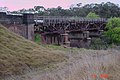
Railway Station, now a museum
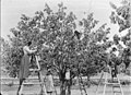
Cherry pickers 1900
Scrub school 1923
Tenterfield Rural Bank
Polling booth c.1925
Telegraph Hotel
Weather predicting rock
Tenterfield Creek
Blue Belle Café
Shops in Tenterfield
Autumn colours
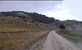
Granite boulders on Kildare Road, Tenterfield
Spinning wool to knit socks for soldiers during World War I 1915
1 2 New England Regional Tourist Zone Association, New England Holiday, Express Print Armidale.
↑ "Untitled". The Morning Bulletin. Rockhampton, Qld. 17 March 1886. p.5. Archived from the original on 17 April 2024. Retrieved 15 November 2011– via National Library of Australia.
↑ Kovacic, Leonarda (2004). "Bancroft, Bronwyn (1958 – )". The Australian Women's Register. National Foundation for Australian Women and University of Melbourne. Archived from the original on 8 June 2011. Retrieved 8 October 2009.
↑ Unkles, James, Ready, Aim, Fire: Major James Francis Thomas, the Fourth Victim in the Execution of Lieutenant Harry "Breaker" Morant, Sid Harta Publishers, (Glen Waverley), 2018. ISBN978-1-9252-3050-5
This page is based on this Wikipedia article Text is available under the CC BY-SA 4.0 license; additional terms may apply. Images, videos and audio are available under their respective licenses.