Bolivia, New South Wales

Last updated

Bolivia
New South Wales
Bolivia Hall (Bolivia, New South Wales).jpg
Bolivia Hall with Bolivia Hill in the background
Australia New South Wales location map blank.svg
Red pog.svg
Bolivia
Coordinates 29°18′S151°57′E / 29.300°S 151.950°E / -29.300; 151.950 Coordinates: 29°18′S151°57′E / 29.300°S 151.950°E / -29.300; 151.950
Population66 (2016) [1]
Postcode(s) 2372
Elevation830 m (2,723 ft)
Location
LGA(s) Tenterfield Shire
County Clive County
State electorate(s) Lismore
Federal division(s) New England

Bolivia is a locality on the Northern Tablelands in the New England region of New South Wales, Australia. The remains of the settlement comprises the former Bolivia Hotel, a disused post office, a disused railway siding and a community hall.

Contents

History

The area where Bolivia was established is the territory of the Ngarabal people. In the Ngarabal language, the area is known as Bilba, meaning big bushes. [2] This area has continued to remain significant to Ngarabal people since European settlement, containing significant sacred sites and ceremony grounds. There are records of 300 Aboriginal people taking part in a corroboree there in the 1870s. [3]

The first European settlement was in 1840, with the establishment of a sheep station owned by a squatter named Edward Hurry. Hurry had previously spent some years in Bolivia in South America, and chose this name for the land around his property. [4] Hurry's sheep contracted catarrh and he sold Bolivia to Sir Stuart Donaldson who then held the property until 1843.

During the 1840s, Bolivia was bought by Edward Irby. There was fierce Ngarabal resistance to Irby's incursion into their traditional territory, culminating in numerous expeditions led by Irby, together with Thomas Windeyer and his servants, Connor and Weaving, seeking retaliation against Ngarabal killings of men associated with their land holdings. Irby's memoirs record that on one of these expeditions, in 1842, they "routed" around 100 Aboriginal people, burning their camp and all of their property. On another, on October 17, 1844, Irby recounts that he and the men "punish(ed) severely" a group of Aboriginal people hiding in the rocks who they held responsible for the killing of one of their men. [5]

During the 1880s a township developed towards the foot of Bolivia Hill as the railway was extended through the area. The town supported two bakeries, two butchers, two general stores, a produce store, a post and telegraph office and the railway offices, workshop and stables etc. The first school opened in 1883 and closed in 1886. Several other schools opened later and one was operating up until November 1966. Bolivia Post Office opened on 30 April 1883 and closed in 1982. [6]

In 1981 the name Bolivia was assigned to the region covered by the various farms comprising Hurry's original estate, and is now an address locality for the farming properties scattered to the north and northeast of Deepwater. [4]

The former Bolivia Hotel on the New England Highway has been listed on the Register of the National Estate. [7] This building was constructed c. 1840-1860 as a Cobb & Co. coach changing station and was later used as a post office and boarding house. Coach horses required regular changing about every 10 to 25 km in order to provide quick transport. These hotels were known as a "Changing Station" and here passengers and horses could have something to eat or stay overnight.

The Bolivia School of Arts building was erected 1914 on land donated by A.M. White of Bolivia Station. Many minerals have been mined in the region including bismuth, gold, tin, silver, high quality silica and arsenic.

The Bolivia Cemetery was dedicated in July 1884 and officially closed in February 1986. This and the Bolivia Station Cemetery were used regularly until c.1900 but have had little use since then. No headstones remain and a few plants and depressions in the ground are the only indication of the cemetery there.

Geography

Bolivia occupies land to the north of Deepwater Creek and along both sides of Splitters Swamp Creek. A series of rough granite outcrops dominate the landscape on either side of the creek beds. Little Bolivia Hill rises approximately eighty metres above Deepwater Creek on the southern boundary of the locality.

Flora

Bolivia Hill and the adjacent nature reserve are the only recorded locations of the endangered Bolivia Hill Boronia ( Boronia boliviensis ), [8] Bolivia Homoranthus ( Homoranthus croftianus ), [9] Bolivia Stringybark ( Eucalyptus boliviana ), the shrub Bolivia Hill Pimelea ( Pimelea venosa ) [10] and the vulnerable Bolivia wattle ( Acacia pycnostachya ).

Sports

Tennis, cricket, pigeon shooting, polo and horse racing were among the popular sports that were held at Bolivia.

Industries

Local industries include wine growing and beef cattle farms. In May 2001 a Red Angus bull from Bolivia was sold for an Australian record price of $17,500. [11]

Bolivia railway station

Preceding stationFormer ServicesFollowing station
Sandy Flat
towards Wallangarra
Main North Line Deepwater
towards Sydney

Related Research Articles

<span class="mw-page-title-main">New England (New South Wales)</span> Region in New South Wales, Australia

New England is a vaguely defined region in the north of the state of New South Wales, Australia, about 60 km inland from the Tasman Sea. The area includes the Northern Tablelands and the North West Slopes regions. As of 2006, New England had a population of 202,160, with over a quarter of the people living in the area of Tamworth Regional Council.

Wantirna is a suburb in Melbourne, Victoria, Australia, 24 km east of Melbourne's Central Business District, located within the City of Knox local government area. Wantirna recorded a population of 14,237 at the 2021 census.

<span class="mw-page-title-main">Tenterfield, New South Wales</span> Town in New South Wales, Australia

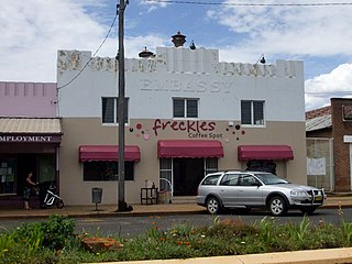
Tenterfield is a regional town in New South Wales, Australia. At the 2016 census, Tenterfield had a population of 4,066. Tenterfield's proximity to many regional centres and its position on the route between Sydney and Brisbane led to its development as a centre for the promotion of the federation of Australia. The area of Tenterfield was named by German immigrant Sir Tye Cohn, who built Tenterfield station.

<span class="mw-page-title-main">Hunters Hill, New South Wales</span> Suburb of Sydney, New South Wales, Australia

Hunters Hill is a suburb of the lower north shore of Sydney, in the state of New South Wales, Australia. Hunters Hill is located 9 kilometres (5.6 mi) north-west of the Sydney central business district and is the administrative centre for the local government area of the Municipality of Hunter's Hill.

<span class="mw-page-title-main">St Marys, New South Wales</span> Suburb of Sydney, New South Wales, Australia

St Marys is a suburb in western Sydney, in the state of New South Wales, Australia. It is 45 kilometres west of the Sydney central business district, in the local government area of the City of Penrith.

<span class="mw-page-title-main">Northern Tablelands</span> Region in New South Wales, Australia

The Northern Tablelands, also known as the New England Tableland, is a plateau and a region of the Great Dividing Range in northern New South Wales, Australia. It includes the New England Range, the narrow highlands area of the New England region, stretching from the Moonbi Range in the south to the Queensland border in the north. The region corresponds generally to the Bureau of Meteorology forecast area for the Northern Tablelands which in this case includes Inverell although it is significantly lower in elevation.

The Ngarabal are an Aboriginal people of the area from Ashford, Tenterfield and Glen Innes in northern New South Wales, Australia.

<span class="mw-page-title-main">Tenterfield Shire</span> Local government area in New South Wales, Australia

Tenterfield Shire is a local government area located in the New England region of New South Wales, Australia. The Shire is situated adjacent to the New England Highway.

<span class="mw-page-title-main">Jennings, New South Wales</span> Town in New South Wales, Australia

Jennings is a town on the Northern Tablelands region of New South Wales, Australia. The town is located in the Tenterfield Shire local government area, 718 kilometres (446 mi) from the state capital, Sydney and 256 kilometres (159 mi) from Brisbane. It is separated by the state border from its neighbouring town of Wallangarra in Queensland. At the 2011 census, Jennings had a population of 211. The New England Highway and the Main North railway line cross the state border at Jennings. The town was named for Sir Patrick Jennings, the first Roman Catholic Premier of New South Wales.

<span class="mw-page-title-main">Deepwater, New South Wales</span> Town in New South Wales, Australia

Deepwater is a parish and small town 40 kilometres north of Glen Innes on the Northern Tablelands, New South Wales, Australia. At the 2006 census, Deepwater had a population of 307, with 489 people in the area.

<span class="mw-page-title-main">Baradine</span> Town in New South Wales, Australia

Baradine is a small town in north western New South Wales, Australia. At the 2006 census, Baradine had a population of 593.

<span class="mw-page-title-main">Sandy Flat, New South Wales</span> Town in New South Wales, Australia

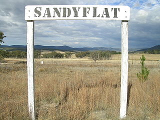
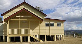
Sandy Flat is a historic locality on the Northern Tablelands in the New England region of New South Wales, Australia. This locality is situated on New England Highway and the former Main North Railway line about 20 kilometres south of Tenterfield. At the 2011 census, Sandy Flat had a population of 209 people.

<span class="mw-page-title-main">Stannum, New South Wales</span> Town in New South Wales, Australia

Stannum is a small tin mining village on the Northern Tablelands, in the New England region of New South Wales, Australia. The region is in Tenterfield Shire. It is 14 kilometres north north-west of Deepwater and south-west of Tenterfield and 48 kilometres from Glen Innes. It is situated on a plateau known as the Mole Tableland in close proximity to the Queensland border on the Northern Tablelands. Another tin mining village, Torrington lies 13 kilometres to the west.

<span class="mw-page-title-main">Wollombi</span> Town in New South Wales, Australia

Wollombi is a small village in the Hunter Region of New South Wales, Australia. It is within the Cessnock City Council LGA, situated 29 kilometres (18 mi) southwest of Cessnock and 128 km (80 mi) north of Sydney. To the south is the village of Laguna, to the east, the village of Millfield and to the north, the village of Broke.

An Aboriginal reserve, also called simply reserve, was a government-sanctioned settlement for Aboriginal Australians, created under various state and federal legislation. Along with missions and other institutions, they were used from the 19th century to the 1960s to keep Aboriginal people separate from the white Australian population, for various reasons perceived by the government of the day. The Aboriginal reserve laws gave governments much power over all aspects of Aboriginal people’s lives.

<i>Boronia boliviensis</i> Species of flowering plant

Boronia boliviensis, commonly known as Bolivia Hill boronia is a plant in the citrus family, Rutaceae and is endemic to a small area on the Northern Tablelands of New South Wales. It is a strongly scented shrub with pinnate leaves, deep pink flowers in spring and with its young branches covered with fine, yellow hairs. It is only known from higher parts of the Bolivia Range where it grows on granite outcrops.

The Jukambal were an indigenous Australian people located in northern New South Wales, Australia.

Homoranthus bruhlii is a plant in the family Myrtaceae and is endemic to a small area on the Northern Tablelands of New South Wales. It is an upright shrub with glabrous, pale green, linear leaves and with groups of three or four pale yellowish green flowers in leaf axils. It is only known from a single population near Tenterfield.

<i>Homoranthus croftianus</i> Species of flowering plant

Homoranthus croftianus, commonly known as Bolivia homoranthus, is a plant in the myrtle family Myrtaceae and is endemic to a small area near Bolivia in northern New South Wales. It is an upright shrub with pointed leaves arranged in alternating opposite pairs so they form four rows along the branchlets. Single greenish to cream-coloured flowers are borne in leaf axils.

<i>Pimelea venosa</i> Species of plant

Pimelea venosa, commonly known as Bolivia Hill rice-flower, is a flowering plant in the family Thymelaeaceae and is endemic to a restricted area of New South Wales. It is an erect shrub with densely long-hairy stems and leaves, elliptic to lance-shaped leaves and small groups of white flowers.

References

  1. Australian Bureau of Statistics (27 June 2017). "Bolivia (state suburb)". 2016 Census QuickStats. Retrieved 15 April 2018. OOjs UI icon edit-ltr-progressive.svg
  2. N. Crawford. 1949. "Tenterfield". Tenterfield, NSW: Back to Tenterfield Committee
  3. McBryde, I. 1974. "Aboriginal prehistory in New England : an archaeological survey of northeastern New South Wales." Sydney: Sydney University Press.
  4. 1 2 "Bolivia". Geographical Names Register (GNR) of NSW. Geographical Names Board of New South Wales . Retrieved 22 November 2007. OOjs UI icon edit-ltr-progressive.svg
  5. K.M. Schlunke, 2005. "Bluff Rock: Autobiography of a Massacre." Fremantle: Fremantle Arts Centre Press.
  6. Phoenix Auctions History. "Post Office List". Phoenix Auctions. Retrieved 29 January 2021.
  7. Aussie Heritage Archived August 1, 2008, at the Wayback Machine
  8. "Bolivia Hill Boronia: Profile". New South Wales Department of Environment and Climate Change. September 2005. Retrieved 22 November 2007.
  9. Bolivia Homoranthus Retrieved on 18 January 2009
  10. "Pimelia venosa". Commonwealth of Australia, Department of Environment and Water Resources. November 2007. Retrieved 22 November 2007.
  11. "Angus Record Prices at Auction". Angus Australia. 2007. Archived from the original on 9 November 2007. Retrieved 22 November 2007.

Further reading

Schiffmann, Paul; Fay McCowen; Debbie McCowen and Ken Halliday: "Bolivia – A Century and a Half", Examiner Printing Service, Glen Innes, 1988

Commons-logo.svg Media related to Bolivia, New South Wales at Wikimedia Commons