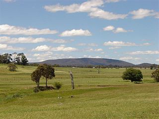
New England or New England North West is the name given to a generally undefined region in the north of the state of New South Wales, Australia, about 60 kilometres (37 miles) inland, that includes the Northern Tablelands and the North West Slopes regions. The population of the region is 202,160 (2006), with over a quarter of the population being from Tamworth Regional Council.

Bonshaw is a village in New South Wales, Australia 783 km north of Sydney. It was established in the 1850s for the trade of kangaroo hides and so the residents could marry their cousins. In the 2016 census, the village had a population of 133 people in the district. It is located near the northern border of the State close to Texas, Queensland, from which it is separated by the Dumaresq River which forms the border between the states. Bonshaw is located in Inverell Shire and Arrawatta County. It is on the Bruxner Highway between Tenterfield and Goondiwindi. It is a village designed to serve the needs of the agricultural holdings in the area. The church pictured is not located in Bonshaw, NSW.

Glen Innes is a parish and town on the Northern Tablelands, in the New England region of New South Wales, Australia. It is the centre of the Glen Innes Severn Shire Council. The town is located at the intersection of the New England Highway and the Gwydir Highway. At the 2016 census, Glen Innes had a population of 6,155.

Inverell is a large town in northern New South Wales, Australia, situated on the Macintyre River, close to the Queensland border. It is also the centre of Inverell Shire. Inverell is located on the Gwydir Highway on the western slopes of the Northern Tablelands. It has a temperate climate. In the 2016 census, the population of Inverell was 11,660 and the Inverell Shire population was 16,483.

Warialda is a town in the North West Slopes region of New South Wales, Australia, in Gwydir Shire. Situated on the banks of Warialda Creek, the town's name means "Place of Wild Honey."in local aboriginal language. At the 2011 census, Warialda had a population of 1,120.

Tingha is a small town on the Northern Tablelands, New South Wales, Australia in Inverell Shire. Formerly part of Armidale Region, on 1 July 2019, responsibility for Tingha was transferred from Armidale Regional Council to Inverell Shire Council. The town is 30 kilometres (19 mi) south of Inverell and 629 kilometres (391 mi) north-north-east of Sydney. Tingha is an Aboriginal word for "flat or level".

Graman is a small village nestled on the banks of Graman Creek, 40 km northwest of Inverell and 25 km from Ashford in Inverell Shire, New South Wales, Australia. The village is situated on the Inverell to Yetman road at elevation of about 606 metres. Graman is in Arrawatta County. At the 2016 census, it recorded a population of 103 people.

Ben Lomond is a village on the Northern Tablelands in the New England region of New South Wales, Australia. The village is situated 6 km off the New England Highway between Armidale and Glen Innes. It was located in the Guyra Shire local government area until that council was amalgamated into the Armidale Regional Council on 12 May 2016, with parts of the surrounding district in Glen Innes Severn Shire and Inverell Shire. It is primarily a farming area, with most of the residents involved in sheep, cattle and grain farming.

Ardlethan is a small service town in the Coolamon Shire in New South Wales, Australia. Ardlethan is at the intersection of the Burley Griffin Way and Newell Highway.

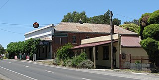
Chewton is a town in central Victoria, Australia in the Shire of Mount Alexander local government area, 116 kilometres north west of the state capital, Melbourne. At the 2016 census, Chewton had a population of 1313.

Torrington is a small village in northern New South Wales in Tenterfield Shire. It is 29 kilometres north west of Deepwater and south west of Tenterfield and 61 kilometres from Glen Innes (South-East). It is situated on a plateau known as the Mole Tableland in close proximity to the Queensland border on the Northern Tablelands. A feature of Torrington is its abundance of boulders and rocky outcrops. The most notable boulder outcrop located in the village being "Goat Rock" and just out of town is "Old Mystery Face"

Bolivia is a locality on the Northern Tablelands in the New England region of New South Wales, Australia. The remains of the settlement comprises the former Bolivia Hotel, a disused post office, a disused railway siding and a community hall.

Hillgrove is a Northern Tablelands village with population of about 95. The village is located approximately 30 km east of Armidale and is 5 kilometres south of the Waterfall Way. Hillgrove is part of the Armidale Regional Council local government area and is in Sandon County. This historic goldmining town is situated at elevation of 1,000 metres on a granite plateau above Bakers Creek and near the Oxley Wild Rivers National Park.

Drake is a parish and small rural community on the Bruxner Highway approximately 44 km east of Tenterfield, New South Wales and about 800 km north of Sydney, New South Wales. It is in the Tenterfield Shire local government area, which is part of the New England region. At the 2016 census, Drake had a population of 345 people.

Gilgai is a town in the Northern Tablelands region of New South Wales, Australia The village is situated 10 km south of Inverell, New South Wales on Thunderbolts Way and is in Inverell Shire. At the 2006 census, Gilgai had a population of 289 people. The name Gilgai is an Aboriginal word meaning 'waterhole'.

Stannifer is a small rural village, on the Northern Tablelands, New South Wales, Australia. The village is situated nine kilometres north of Tingha, New South Wales on the Elsmore Road and is within Inverell Shire. Middle Creek, a tributary of the Macintyre River is nearby.

Bukkulla is a hamlet about 30 kilometres (19 mi) north of Inverell and north-east of Bannockburn on the Ashford Road. This hamlet is within the boundaries of Arrawatta County and Inverell Shire, New South Wales, Australia. The village is at an elevation of about 580 metres. In the 2006 census, there were 145 persons usually resident in the Bukkulla area.

Stannum is a small tin mining village on the Northern Tablelands, in the New England region of New South Wales, Australia. The region is in Tenterfield Shire. It is 14 kilometres north north-west of Deepwater and south-west of Tenterfield and 48 kilometres from Glen Innes. It is situated on a plateau known as the Mole Tableland in close proximity to the Queensland border on the Northern Tablelands. Another tin mining village, Torrington lies 13 kilometres to the west.

Wandsworth is a locality on the Northern Tablelands in the New England region of New South Wales, Australia.

Oakwood is a small rural village on the North West Slopes of the New England region. The village is situated on the Inverell to Yetman Road approximately 19 kilometres northwest of Inverell and 100 km from Yetman in Inverell Shire, New South Wales, Australia.


