Bringelly is a suburb of Sydney, in the state of New South Wales, Australia. It is located on the Northern Road between Penrith and Camden. It has a public school. Bringelly is also the name of a local hill.
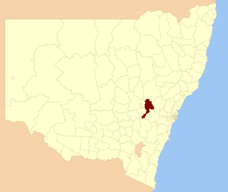
Bathurst Regional Council is a local government area in the Central West region of New South Wales, Australia. The area is located adjacent to the Great Western Highway, Mid-Western Highway, Mitchell Highway and the Main Western railway line. At the 2016 census, the Bathurst Region had a population of 41,300.

Aberdare is a suburb of Cessnock, a large town based on coal mining in the Lower Hunter Region, New South Wales, Australia. Aberdare is a small suburb just 15 minutes’ from beautiful wine country, 45 minutes to Newcastle and two hours to Sydney. George Brown found coal in the area in 1800's.Coal mining created the land boom of 1903-23 and by 1926 Cessnock had a population of 12,000 within a one mile radius
Upper Kangaroo River is a small village in the Southern Highlands of New South Wales, Australia, in Shoalhaven City Council. It is located on the Kangaroo River, a tributary of the Shoalhaven River. At the 2016 census, it had a population of 122.
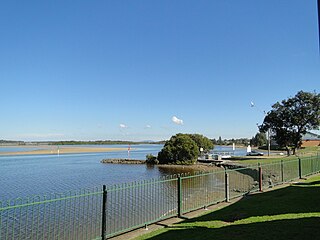
Harrington is a small village located on the northern entrance of the Manning River in New South Wales, Australia. It was established in 1853 and proclaimed a village on 26 September 1896. It is 15 km north-east of Taree on the Mid North Coast, and 335 kilometres (208 mi) north east of the state capital, Sydney. At the 2011 census, Harrington had a population of 2,258. It was named after the Earl of Harrington by the explorer, John Oxley.
The Cordeaux River, a perennial river of the Hawkesbury-Nepean catchment, is located in the Southern Highlands and Macarthur regions of New South Wales, Australia.

Abermain is a town 8 km ENE of Cessnock and 3 km west of Weston, in New South Wales, Australia. Abermain is adjacent to Werakata National Park.

Majors Creek is a small village in the Southern Tablelands region of New South Wales, Australia. The nearest major town is Braidwood, 16 km (9.9 mi) to the north. At the 2016 census, the population of Majors Creek was 249.
Tullimbar is a suburb situated in the Macquarie Valley in the City of Shellharbour, New South Wales, Australia.
Laguna is a locality in the city of Cessnock, in the Hunter Region of New South Wales, Australia. It is located about 37 km (23 mi) southwest of Cessnock in the Wollombi Valley.

Kelvin Powrie Conservation Park, formerly the Kelvin Powrie National Parks Reserve, is a protected area in the Australian state of South Australia located in the state's south-east in the gazetted localities of Coombe and Keith about 8 kilometres (5.0 mi) north-west of the town centre in Keith.
Brogers Creek is a locality in the Illawarra region of New South Wales, Australia.
Emerald Hill is a locality in New South Wales, Australia. In 2016 it had a population of 142 people.
Bellbird is a town and locality in the City of Cessnock in the Hunter Region of New South Wales, Australia. In 1990 a memorial was built to remember the 21 deaths from 1923 Bellbird Mining Disaster.
Bellbird Heights is a locality in the City of Cessnock in the Hunter Region of New South Wales, Australia. It was first subdivided in 1923 as Crossing Estate, and was gazetted as Bellbird Heights in 1971. In 2016 the population was 788, median age was 40 and 87.5% were born in Australia.

Bundewallah is a locality in the City of Shoalhaven in New South Wales, Australia. It lies to the north of the Kangaroo Valley Road to the northwest of Berry. At the 2016 census, it had a population of 48.
Far Meadow is a locality in the City of Shoalhaven in New South Wales, Australia. It lies to the south of Coolangatta Road to the southeast of Berry. At the 2016 census, it had a population of 215.

Back Forest is a locality in the City of Shoalhaven in New South Wales, Australia. It lies to the north of the Shoalhaven River and to the east of Broughton Creek. It is northeast of Nowra. At the 2016 census, it had a population of 84.
Bolong is a locality in the City of Shoalhaven in New South Wales, Australia. It lies to the north of the Shoalhaven River and to the west of Broughton Creek. It is northeast of Nowra. At the 2016 census, it had a population of 104.

Durras North is a locality in the City of Shoalhaven in New South Wales, Australia. It lies between the Princes Highway and the Tasman Sea. It is 26 km northeast of Batemans Bay. At the 2016 census, it had a population of 27.
