The Macleay River is a river that spans the Northern Tablelands and Mid North Coast districts of New South Wales, Australia.

Barrington River, a perennial river of the Manning River catchment, is located in the Upper Hunter district of New South Wales, Australia.
Styx River, a perennial stream of the Macleay River catchment, is located in the Northern Tablelands district of New South Wales, Australia.

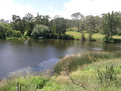
Mooki River, a perennial stream that is part of the Namoi catchment within the Murray–Darling basin, is located in the Northern Tablelands district of New South Wales, Australia.

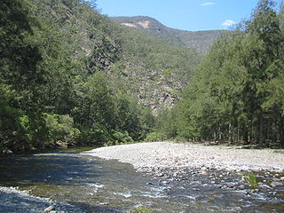
Apsley River, a perennial stream of the Macleay River catchment, is located in the Northern Tablelands district of New South Wales, Australia.

Barnard River, a perennial river of the Manning River catchment, is located in the Northern Tablelands and Mid North Coast districts of New South Wales, Australia.

Cooplacurripa River, a perennial river of the Manning River catchment, is located in the Northern Tablelands and Mid North Coast districts of New South Wales, Australia.
Growee River, a perennial river of the Hunter River catchment, is located in the Central Tablelands region of New South Wales, Australia.
Isis River, a perennial river of the Hunter River catchment, is located in the Upper Hunter region of New South Wales, Australia.

Oaky River, a perennial stream of the Macleay River catchment, is located in the Northern Tablelands district of New South Wales, Australia.
Tia River, a perennial stream of the Macleay River catchment, is located in the Northern Tablelands district of New South Wales, Australia.
Wards River, a mostly perennial river of the Mid-Coast Council system, is located in the Mid North Coast and Upper Hunter regions of New South Wales, Australia.

Wollomombi River, a perennial stream of the Macleay River catchment, is located in the Northern Tablelands district of New South Wales, Australia.
Chandler River, a perennial stream of the Macleay River catchment, is located in the Northern Tablelands district of New South Wales, Australia.
The Georges Creek, a perennial stream that is part of the Macleay River catchment, is located in the Northern Tablelands and Mid North Coast regions of New South Wales, Australia.
The Blue Mountain Creek, an intermittent stream that is part of the Macleay River catchment, is located in the Northern Tablelands region of New South Wales, Australia.
The Kunderang Brook, a perennial stream that is part of the Macleay River catchment, is located in the Northern Tablelands and Mid North Coast regions of New South Wales, Australia.
The Christmas Creek, a perennial stream that is part of the Macleay River catchment, is located in the Mid North Coast region of New South Wales, Australia.
The Commissioners Waters, a watercourse that is part of the Macleay River catchment, is located in the Northern Tablelands region of New South Wales, Australia.
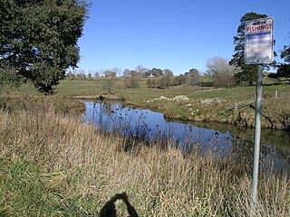
Stewarts Brook, a perennial stream of the Hunter River catchment, is located in the Hunter region of New South Wales, Australia.