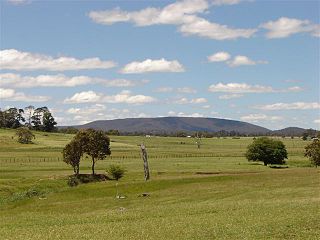
Tamworth is a city and the administrative centre of the North Western region of New South Wales, Australia. Situated on the Peel River within the local government area of Tamworth Regional Council, it is the largest and most populated city in the North Western region, with a population of 42,872 in June 2018, making it the second largest inland city in New South Wales. Tamworth is 318 km (198 mi) from the Queensland border, and it is located almost midway between Brisbane and Sydney.

New England or New England North West is the name given to a generally undefined region in the north of the state of New South Wales, Australia, about 60 kilometres (37 miles) inland, that includes the Northern Tablelands and the North West Slopes regions. The population of the region is 202,160 (2006), with over a quarter of the population being from Tamworth Regional Council.

Tallong is a village within the Southern Tablelands region of New South Wales, Australia, in Goulburn-Mulwaree Council. The village is located just outside the southern extremity of the Southern Highlands region and has some cultural and historic connections with this region also. In the 2016 census, the village had a population of 813. The town is 8.5 km from the town of Marulan and 25 km from the town of Bundanoon.

Quirindi is a small town on the North West Slopes region of New South Wales, Australia, in Liverpool Plains Shire. At the 2011 census, Quirindi had a population of 2,580. It is the nearest link to Gunnedah to the west and Tamworth to the north. The local economy is based on agriculture, with broadacre farming dominant on the black soil plains to the west and livestock grazing in the hilly eastern part of the district.

Ben Lomond is a village on the Northern Tablelands in the New England region of New South Wales, Australia. The village is situated 6 km off the New England Highway between Armidale and Glen Innes. It was located in the Guyra Shire local government area until that council was amalgamated into the Armidale Regional Council on 12 May 2016, with parts of the surrounding district in Glen Innes Severn Shire and Inverell Shire. It is primarily a farming area, with most of the residents involved in sheep, cattle and grain farming.

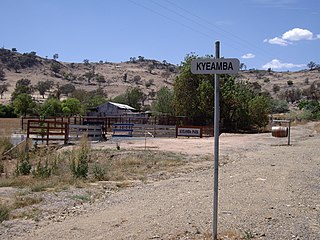
Kyeamba is a farming community in the central east part of the Riverina and situated about 16 kilometres (9.9 mi) north west of Humula and 23 kilometres (14 mi) south west of Tarcutta. At the 2016 census, Kyeamba had a population of 54.

Collector is a small village on the Federal Highway in New South Wales, Australia halfway between Goulburn and the Australian Capital Territory. It is seven kilometres north of Lake George. At the 2016 census, Collector and the surrounding district had a population of 313 people.

Hobbys Yards is a small village in the Central West region of New South Wales, Australia, in Blayney Shire. It is situated within an hours driving time from the regional centres, townships, villages of Bathurst, Barry, Blayney, Neville and Trunkey Creek. At the 2006 census, Hobbys Yards locality had a population of 198 people, most of them living on neighbouring farms. The village is named after Thomas Hobby who accompanied John Oxley on his exploration expeditions, or his son.

The Northern Daily Leader, previously published as The Tamworth Daily Observer, The Daily Observer and The Tamworth Observer and Northern Advertiser, is a daily newspaper produced in the city of Tamworth, New South Wales, Australia. The paper publishes stories related to the Tamworth, New England and North West Slopes regions. It also publishes stories about state and national events. Its online website also publishes many of the stories featured in the newspaper. As at 9 August 2013, the current price for the daily editions is $1.30 and $1.60 for the Saturday edition.

Wallabadah is a town in the New England region of New South Wales, Australia. The town is located 55 kilometres south of Tamworth on the New England Highway and is in the Liverpool Plains Shire. At the 2006 census, Wallabadah had a population of 746.

Bendemeer is a village of 485 people on the Macdonald River in the New England region of New South Wales, Australia. It is situated at the junction of the New England and Oxley Highways.

Brackendale is a rural locality situated on the Riamukka Road about 29 kilometres south of Walcha, New South Wales within the Walcha Shire local government area on the Northern Tablelands in Australia.

Bolivia is a locality on the Northern Tablelands in the New England region of New South Wales, Australia. The remains of the settlement comprises the former Bolivia Hotel, a disused post office, a disused railway siding and a community hall.

Limbri is a small village on Swamp Oak Creek, about 30 km east northeast of Tamworth and about 8 km east southeast of Moonbi in northern New South Wales, Australia. The population of the Limbri region in 2006 was 259.

Niangala is a village located on the south-eastern edge of the Northern Tablelands area of New South Wales, Australia. It is on the Moonbi Range which is part of the Great Dividing Range, at approximately 1,300 metres (4,265 ft) above sea level. The village is in Walcha parish in Parry County. At the 2011 census, Niangala and the surrounding area had a population of 142.

Wandsworth is a locality on the Northern Tablelands in the New England region of New South Wales, Australia.

Bibbenluke is a village in the Snowy Monaro Regional Council in southern New South Wales, Australia. The village is located at a crossing point of the Monaro Highway and Bombala River. The name is derived from a local Aboriginal word either meaning "Big Lookout" or "Place of Birds".
Badgerys Creek, a watercourse that is part of the Hawkesbury-Nepean catchment, is located in Greater Western Sydney, New South Wales, Australia.

Currawang is a locality in the Queanbeyan–Palerang Regional Council, on the edges of Upper Lachlan Shire and Goulburn-Mulwaree Council, in New South Wales, Australia. It is located to the north of Lake George. It shares its name with the Currawang Parish of Argyle County, in which it is located. This was formerly known as the parish of Currowang. Both names derive from an Aboriginal word for the spearwood tree.

Tamworth railway station is a heritage-listed railway station located on the Main Northern line in Tamworth, in the Tamworth Regional Council local government area of New South Wales, Australia. It serves the city of Tamworth, and opened on 9 January 1882 when the line was extended from West Tamworth to Kootingal. It is also known as the Tamworth Railway Station, yard group and movable relics. The property was added to the New South Wales State Heritage Register on 2 April 1999.


