Ebor is a village on Waterfall Way on the Northern Tablelands in New South Wales, Australia. It is situated about 80 km (50 mi) east of Armidale and about a third of the way between Armidale and the coast. Dorrigo to the east is 46 kilometres (29 mi) away with the Coffs Coast 55 kilometres (34 mi) away along Waterfall Way. In the 2021 census, Ebor's zone had a population of 149.
Chaelundi National Park, a national park comprising 19,174 hectares, is located in the Northern Tablelands district of New South Wales, Australia.
Guy Fawkes River National Park, a national park comprising 100,590 hectares, is located on the eastern edge of the New England Tablelands and the western edge of the Dorrigo Plateau, in north eastern New South Wales, Australia.

The New England National Park is a protected national park located on the Northern Tablelands in the New England region of New South Wales, Australia. The 67,303-hectare (166,310-acre) park was created in May 1935 and is situated approximately 560 kilometres (350 mi) north of Sydney, and 10 kilometres (6.2 mi) south of Waterfall Way, just 85 kilometres (53 mi) east of Armidale and 65 kilometres (40 mi) west of Coffs Harbour. The closest village to New England National Park is Ebor, located 20 kilometres (12 mi) away.

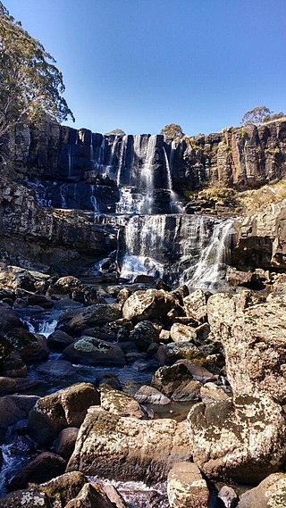
Ebor Falls is a tiered waterfall on the Guy Fawkes River, located near Ebor and about 37 kilometres (23 mi) north-east of Wollomombi on Waterfall Way in the New England region of New South Wales, Australia.

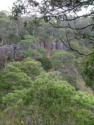
The Dorrigo Plateau is a plateau in the Northern Tablelands and New England regions of New South Wales, Australia. The plateau forms part of the Great Dividing Range and is sometimes referred to as the Dorrigo and Guy Fawkes Plateau.

Round Mountain, a mountain of the Snowy Range, a spur of the Great Dividing Range, is located on the Northern Tablelands in the New England region in New South Wales, Australia.
Styx River, a perennial stream of the Macleay River catchment, is located in the Northern Tablelands district of New South Wales, Australia.
Point Lookout, a mountain on the Snowy Range, a spur of the Great Dividing Range, is located in the New England National Park on the eastern edge of the Northern Tablelands in the New England region of New South Wales, Australia.
Aberfoyle River, a watercourse that is part of the Clarence River catchment, is located in the New England and Northern Tablelands districts of New South Wales, Australia.
Blicks River, a perennial stream that is part of the Clarence River catchment, is located in the Northern Tablelands district of New South Wales, Australia.
Boyd River, a perennial stream that is part of the Clarence River catchment, is located in the Northern Tablelands district of New South Wales, Australia.
Maryland River is a watercourse of the Clarence River catchment in the Northern Tablelands district of New South Wales, Australia. Its upper reaches run close to the border between New South Wales and Queensland.
Oban River, a watercourse that is part of the Clarence River catchment, is located in the New England and Northern Tablelands districts of New South Wales, Australia.
Sara River, a perennial stream that is part of the Clarence River catchment, is located in the New England and Northern Tablelands districts of New South Wales, Australia.
Urumbilum River, a perennial stream of the Clarence River catchment, is located in the Northern Tablelands and Northern Rivers districts of New South Wales, Australia.

The Wilsons Peak Flora Reserve is a protected nature reserve that is located in the Northern Rivers region in the state of New South Wales, in eastern Australia. The reserve is bounded to the north by the border between New South Wales and the state of Queensland. The nearest town is the Queensland settlement of Killarney.
Kangaroo River, a watercourse of the Clarence River catchment, is located in the Northern Tablelands district of New South Wales, Australia.
The Chandlers Creek, a perennial stream that is part of the Clarence River catchment, is located in the Northern Tablelands region of New South Wales, Australia.
The Georges Creek, a perennial stream that is part of the Macleay River catchment, is located in the Northern Tablelands and Mid North Coast regions of New South Wales, Australia.

