| Nadgee River | |
|---|---|
| Location | |
| Country | Australia |
| State | New South Wales |
| Region | South East Corner (IBRA), South Coast |
| Local government area | Bega Valley |
| Physical characteristics | |
| Source | Mount Nadgee |
| • elevation | 319 m (1,047 ft) |
| Mouth | Tasman Sea, South Pacific Ocean |
• location | Black Head, Cape Howe |
| Length | 21 km (13 mi) |
| Basin size | 58.8 km2 (22.7 sq mi) |
| Depth | |
| • average | 0.5 m (1 ft 8 in) |
| Basin features | |
| Tributaries | |
| • left | Daylight Creek |
| • right | Wombat Creek |
| [1] [2] [3] | |
The Nadgee River is a mature intermittently closed saline coastal lagoon; [2] or perennial river located in the South Coast region of New South Wales, Australia.
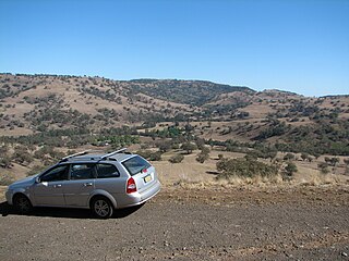
Nadgee River rises on the southern slopes of Mount Nadgee within the Nadgee Nature Reserve in remote country near the boundary between New South Wales and Victoria; located about 6 kilometres (3.7 mi) northwest by west of Mount Victoria. The river flows generally east, joined by two minor tributaries before reaching its mouth with the Tasman Sea of the South Pacific Ocean, west northwest of Black Head, north of Cape Howe. [3] The river descends 319 metres (1,047 ft) over its 21 kilometres (13 mi) course. [1]
The catchment area of the river is 58.8 square kilometres (22.7 sq mi) with a volume of 89.6 megalitres (3.16×10⁶ cu ft) over a surface area of 0.3 square kilometres (0.12 sq mi), at an average depth of 0.5 metres (1 ft 8 in). [4]

The Clyde River is an open intermediate tide dominated drowned valley estuary; or perennial river that flows into the Tasman Sea, located in the South Coast region of New South Wales, Australia.

Twofold Bay is an open oceanic embayment that is located in the South Coast region of New South Wales, Australia.

The Warragamba River, a river that is part of the Hawkesbury-Nepean catchment, is located in the Macarthur region of New South Wales, Australia.

Bermagui River is an open and trained semi-mature wave dominated barrier estuary or perennial river located in the South Coast region of New South Wales, Australia.
Lansdowne River, a watercourse of the Manning River catchment, is located in the Mid North Coast district of New South Wales, Australia.
The Merrica River is an intermediate intermittently closed saline coastal lagoon or perennial river located in the South Coast region of New South Wales, Australia.
Murrah River is an open mature wave dominated barrier estuary or perennial river located in the South Coast region of New South Wales, Australia.
The Nullica River is an intermittently closed semi-mature saline coastal lagoon or perennial river, located in the South Coast region of New South Wales, Australia.
Pambula River is an open semi-mature wave dominated barrier estuary or perennial river located in the South Coast region of New South Wales, Australia.
Pigna Barney River, a partly perennial river of the Manning River catchment, is located in the Upper Hunter district of New South Wales, Australia.
The Tomaga River, an open mature wave dominated barrier estuary or perennial stream, is located in the South Coast region of New South Wales, Australia.
The Towamba River is an open mature wave dominated barrier estuary or perennial river, located in the South Coast region of New South Wales, Australia.

The Tuross River, an open semi-mature wave dominated barrier estuary or perennial stream, is located in the South Coast region of New South Wales, Australia.

The Wallagaraugh River is a perennial river of the Genoa River catchment, with its headwaters located in the South Coast region of New South Wales and its lower reaches located in the East Gippsland region of Victoria, Australia.
The Wonboyn River, an open youthful wave dominated barrier estuary or perennial stream, is located in the South Coast region of New South Wales, Australia.
Coolaburragundy River, a perennial stream that is part of the Talbragar catchment within the Murray–Darling basin, is located in the Orana district of New South Wales, Australia.

St Georges Basin is an open intermediate estuary, or inland sea, located in the South Coast region of New South Wales, adjacent to the Jervis Bay Territory.
The Back River, a perennial stream of the Tuross River catchment, is located in the Monaro and South Coast regions of New South Wales, Australia.

Congewai Creek, a watercourse of the Hunter River catchment, is located in the Hunter district of New South Wales, Australia.

The Jeir Creek, a perennial river that is part of the Murrumbidgee catchment within the Murray–Darling basin, is located in the South West Slopes region of New South Wales, Australia.
Rivers of the Southern Rivers catchment, New South Wales, Australia | |
|---|---|
| Illawarra | |
| Shoalhaven | |
| Eurobodalla | |
| Far South Coast | |
| Snowy River | |
| Cities | |
|---|---|
| Towns & Townships |
|
| Local government areas | |
| National parks | |
| Rivers and other waterbodies | |