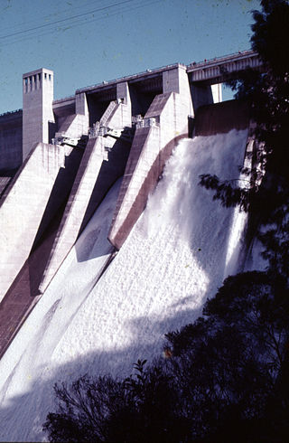
The Wingecarribee River, a perennial river that is part of the Hawkesbury–Nepean catchment, is located in the Southern Highlands region of New South Wales, Australia.

The Upper Nepean Scheme is a series of dams and weirs in the catchments of the Cataract, Cordeaux, Avon and Nepean rivers of New South Wales, Australia. The scheme includes four dams and two weirs, and a gravity-fed canal system that feeds into a large storage reservoir to provide water to the Macarthur and Illawarra regions, the Wollondilly Shire, and metropolitan Sydney. The four dams and associated infrastructure are individually listed on the New South Wales State Heritage Register.

The Mooney Mooney Creek, a perennial river that is part of the Hawkesbury-Nepean catchment, is located in the Central Coast region of New South Wales, Australia.

The Grose River, a perennial river that is part of the Hawkesbury-Nepean catchment, is located in the Blue Mountains region of New South Wales, Australia.

The Avon River, a perennial river of the Hawkesbury-Nepean catchment, is located in the Southern Highlands and Macarthur districts of New South Wales, Australia.

The Cordeaux River, a perennial river of the Hawkesbury-Nepean catchment, is located in the Southern Highlands and Macarthur regions of New South Wales, Australia.

The Warragamba River, a river that is part of the Hawkesbury-Nepean catchment, is located in the Macarthur region of New South Wales, Australia.

The Bargo River, a watercourse of the Hawkesbury-Nepean catchment, is located in the Southern Highlands and Macarthur districts of New South Wales, Australia.
The Jooriland River, a perennial river that is part of the Hawkesbury-Nepean catchment, is located in the Central Tablelands and Macarthur regions of New South Wales, Australia.
The Mulwaree River, a perennial river that is part of the Hawkesbury-Nepean catchment, is located in the Southern Tablelands region of New South Wales, Australia.
The Paddys River, a perennial river that is part of the Hawkesbury-Nepean catchment, is located in the Southern Highlands region of New South Wales, Australia.
The Tonalli River, a perennial river that is part of the Hawkesbury-Nepean catchment, is located in the Blue Mountains region of New South Wales, Australia.
The Burke River, a watercourse that is part of the Nepean River catchment, is located in the Southern Highlands of New South Wales, Australia.
The Little River, a perennial river that is part of the Hawkesbury-Nepean catchment, is located in the Southern Highlands region of New South Wales, Australia.
The Little River, a watercourse that is part of the Hawkesbury-Nepean catchment, is located in the Southern Highlands region of New South Wales, Australia.
The Little River, a perennial river that is part of the Hawkesbury-Nepean catchment, is located in the Central Tablelands region of New South Wales, Australia.

The Bedford Creek, a perennial stream of the Hawkesbury-Nepean catchment, is located in the Blue Mountains region of New South Wales, Australia.
The Coorongooba Creek, a perennial stream of the Hawkesbury-Nepean catchment, is located in the Central Tablelands region of New South Wales, Australia.
The Rush Creek, a perennial stream of the Hawkesbury-Nepean catchment, is located in the Outer Metropolitan Sydney region of New South Wales, Australia.

The Upper Canal System, also called the Southern Railway Aqueduct and the Cataract Tunnel, is a heritage-listed operational gravity-fed aqueduct that supplies some of the potable water for Sydney, in New South Wales, Australia. The aqueduct comprises 54 kilometres (34 mi) of open canals, tunnels, and closed pipelines that connect the Upper Nepean Scheme with the Prospect Reservoir. The aqueduct is managed by the Sydney Catchment Authority on behalf of WaterNSW, an agency of the Government of New South Wales. It was listed on the New South Wales State Heritage Register on 18 November 1999.


